


Babb, Montana
Babb, Montana | |
|---|---|
 The mountains of Glacier National Park rising to the west over Babb | |
 Babb  Babb | |
| Coordinates: 48°52′20″N 113°26′27″W / 48.87222°N 113.44083°W | |
| Country | United States |
| State | Montana |
| County | Glacier |
| Established | 1905 |
| Area | |
• Total | 9.56 sq mi (24.76 km2) |
| • Land | 9.49 sq mi (24.57 km2) |
| • Water | 0.073 sq mi (0.19 km2) |
| Elevation | 4,580 ft (1,400 m) |
| Population (2020) | |
• Total | 130 |
| • Density | 13.7/sq mi (5.29/km2) |
| Time zone | UTC-7 (MST) |
| • Summer (DST) | UTC-6 (MDT) |
| ZIP code | 59411 |
| FIPS code | 30-03250 |
| GNIS feature ID | 2583786[2] |
Babb is an unincorporated farming and ranching community in Glacier County, Montana, United States, on the Blackfeet Indian Reservation. The community experiences a large influx of tourists in the summer months as it is the gateway to the Many Glacier area of Glacier National Park. For statistical purposes, the United States Census Bureau has defined Babb as a census-designated place (CDP). As of the 2020 census, Babb had a population of 130.[3]
Community infrastructure includes one school (Babb Elementary School), a U.S. Post Office, a fire station that houses the Babb/St. Mary Volunteer Fire Department, Thronson's General Store and Motel, several restaurants, two churches, and a gas station. Alcohol is not sold in Babb.
History
Established in 1905 as a post office, the town of Babb was named for Cyrus C. Babb, the engineer in charge of surveying the U.S. Reclamation Service's St. Mary Irrigation Canal.[4] The canal siphoned water from the St. Mary River into the Milk River and was one of the first Bureau of Reclamation projects in the nation.[5]
Geography
Babb is located in northwestern Glacier County in the valley of the St. Mary River. U.S. Route 89 passes through the community, leading north 10 miles (16 km) to the Canadian border at Piegan and south 9 miles (14 km) to St. Mary. Many Glacier Road leads west from Babb 5 miles (8 km) to the border of Glacier National Park at the east end of Lake Sherburne and continues west 7 miles (11 km) to the Many Glacier Hotel.
According to the U.S. Census Bureau, the Babb CDP has a total area of 9.6 square miles (24.8 km2), of which 9.5 square miles (24.6 km2) is land and 0.1 square miles (0.2 km2), or 0.78%, is water.[6]
Climate
| Climate data for Babb, Montana (Elevation: 4,524ft/1,379m) | |||||||||||||
|---|---|---|---|---|---|---|---|---|---|---|---|---|---|
| Month | Jan | Feb | Mar | Apr | May | Jun | Jul | Aug | Sep | Oct | Nov | Dec | Year |
| Record high °F (°C) | 62 (17) |
70 (21) |
69 (21) |
85 (29) |
88 (31) |
92 (33) |
96 (36) |
99 (37) |
94 (34) |
84 (29) |
77 (25) |
70 (21) |
99 (37) |
| Mean daily maximum °F (°C) | 29.8 (−1.2) |
34.4 (1.3) |
40.1 (4.5) |
50.8 (10.4) |
60.6 (15.9) |
67.7 (19.8) |
76.2 (24.6) |
75.4 (24.1) |
65.3 (18.5) |
55.8 (13.2) |
41.9 (5.5) |
33.5 (0.8) |
52.6 (11.4) |
| Mean daily minimum °F (°C) | 6.7 (−14.1) |
10.6 (−11.9) |
16.7 (−8.5) |
26.3 (−3.2) |
34.4 (1.3) |
40.7 (4.8) |
44.2 (6.8) |
42.9 (6.1) |
36.3 (2.4) |
30.1 (−1.1) |
20.0 (−6.7) |
11.2 (−11.6) |
26.7 (−2.9) |
| Record low °F (°C) | −54 (−48) |
−53 (−47) |
−39 (−39) |
−18 (−28) |
2 (−17) |
20 (−7) |
27 (−3) |
21 (−6) |
−3 (−19) |
−20 (−29) |
−31 (−35) |
−48 (−44) |
−54 (−48) |
| Average precipitation inches (mm) | 0.83 (21) |
0.74 (19) |
0.99 (25) |
1.50 (38) |
2.65 (67) |
3.52 (89) |
1.79 (45) |
1.87 (47) |
1.93 (49) |
1.05 (27) |
0.83 (21) |
0.82 (21) |
18.53 (471) |
| Average snowfall inches (cm) | 10.3 (26) |
9.0 (23) |
10.5 (27) |
7.5 (19) |
2.4 (6.1) |
0.1 (0.25) |
0 (0) |
0 (0) |
2.9 (7.4) |
4.9 (12) |
7.7 (20) |
9.0 (23) |
64.5 (164) |
| Source: The Western Regional Climate Center[7] | |||||||||||||
Demographics
| Census | Pop. | Note | %± |
|---|---|---|---|
| 2020 | 130 | — | |
| U.S. Decennial Census[8] | |||
References
- ^ "ArcGIS REST Services Directory". United States Census Bureau. Retrieved September 5, 2022.
- ^ a b U.S. Geological Survey Geographic Names Information System: Babb, Montana
- ^ "2020 Decennial Census Redistricting Data (Public Law 94-171)". United States Census Bureau. 2021. Retrieved March 11, 2026.
- ^ Carkeek Cheney, Roberta (1983). Names on the Face of Montana. Missoula, Montana: Mountain Press Publishing Company. p. 5. ISBN 0-87842-150-5.
- ^ Montana Placenames: From Alzada to Zortman, p. 11. Montana Placenames Companion Website
- ^ "Geographic Identifiers: 2010 Demographic Profile Data (G001): Babb CDP, Montana". American Factfinder. U.S. Census Bureau. Retrieved December 22, 2016.[dead link]
- ^ "Seasonal Temperature and Precipitation Information". Western Regional Climate Center. Retrieved April 13, 2013.
- ^ "Census of Population and Housing". Census.gov. Retrieved June 4, 2016.
External links
![]() Babb travel guide from Wikivoyage
Babb travel guide from Wikivoyage
Municipalities and communities of Glacier County, Montana, United States | ||
|---|---|---|
| City | 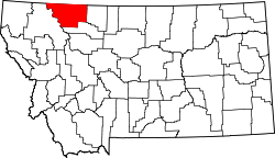 | |
| CDPs | ||
| Indian reservation | ||
| Footnotes | ‡This populated place also has portions in an adjacent county or counties | |
| International | |
|---|---|
| National | |
| Other | |