


File:Map of Medieval Universities.jpg

Size of this preview: 685 × 599 pixels. Other resolutions: 274 × 240 pixels | 549 × 480 pixels | 878 × 768 pixels | 1,127 × 986 pixels.
Original file (1,127 × 986 pixels, file size: 574 KB, MIME type: image/jpeg)
| Description |
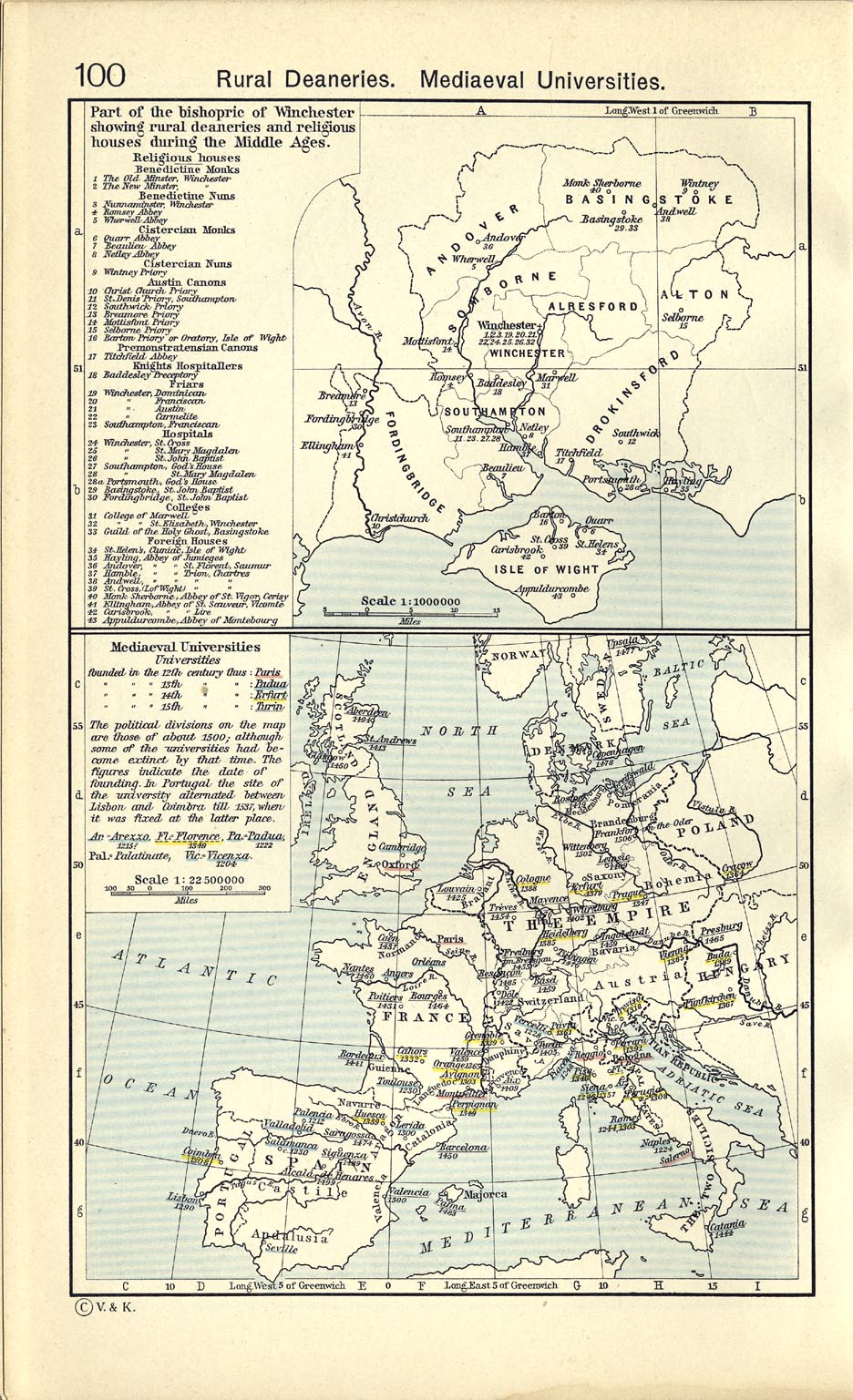
Deutsch: Karte der mittelalterlichen Universitäten
English: Map of medieval universities |
| Date | |
| Source | William R. Shepherd: Historical Atlas, New York, Henry Holt and Company, 1923, in the Public Domain (also to be found in the 1911 edition, p. 100) |
| Author | William Robert Shepherd |
|
This work is in the public domain in its country of origin and other countries and areas where the copyright term is the author's life plus 70 years or fewer. | |
| This file has been identified as being free of known restrictions under copyright law, including all related and neighboring rights. | |
File history
Click on a date/time to view the file as it appeared at that time.
| Date/Time | Thumbnail | Dimensions | User | Comment | |
|---|---|---|---|---|---|
| current | 18:23, 8 July 2022 | | 1,127 × 986 (574 KB) | Longsars | Better Quality |
| 21:33, 17 June 2005 |  | 1,087 × 971 (370 KB) | Tomisti | Map oif Medieval Universities From English Wikipedia: http://en.wikipedia.org/wiki/Image:Map_of_Medieval_Universities.JPG |
File usage
The following 6 pages use this file:
Global file usage
The following other wikis use this file:
- Usage on ar.wikipedia.org
- Usage on ast.wikipedia.org
- Usage on bn.wikipedia.org
- Usage on ca.wikipedia.org
- Usage on da.wikipedia.org
- Usage on de.wikipedia.org
- Usage on el.wikipedia.org
- Usage on eo.wikipedia.org
- Usage on es.wikipedia.org
- Usage on fa.wikipedia.org
- Usage on fi.wikipedia.org
- Usage on fr.wikipedia.org
- Usage on gl.wikipedia.org
- Usage on hu.wikipedia.org
- Usage on ia.wikipedia.org
- Usage on id.wikipedia.org
- Usage on it.wikipedia.org
- Usage on ja.wikipedia.org
- Usage on kn.wikipedia.org
- Usage on ko.wikipedia.org
- Usage on mk.wikipedia.org
- Usage on ms.wikipedia.org
- Usage on nl.wikipedia.org
- Usage on pl.wikipedia.org
View more global usage of this file.