


Bayou Blue, Louisiana
Bayou Blue, Louisiana | |
|---|---|
 Bayou Blue  Bayou Blue | |
| Coordinates: 29°38′03″N 90°40′23″W / 29.63417°N 90.67306°W | |
| Country | United States |
| State | Louisiana |
| Parish | Lafourche, Terrebonne |
| Area | |
• Total | 23.53 sq mi (60.94 km2) |
| • Land | 23.27 sq mi (60.28 km2) |
| • Water | 0.26 sq mi (0.67 km2) |
| Elevation | 7 ft (2.1 m) |
| Population (2020) | |
• Total | 13,352 |
| • Density | 573.7/sq mi (221.51/km2) |
| Time zone | UTC-6 (Central (CST)) |
| • Summer (DST) | UTC-5 (CDT) |
| Area code | 985 |
| GNIS feature ID | 2583527[2] |
Bayou Blue is an unincorporated community and census-designated place in Lafourche and Terrebonne parishes, Louisiana, United States. As of the 2020 census, Bayou Blue had a population of 13,352.[3]
In June 1981, an arson attack on a local nightclub killed five people.[4]
Geography
According to the U.S. Census Bureau, the community has an area of 23.520 square miles (60.92 km2); 23.263 square miles (60.25 km2) of its area is land, and 0.257 square miles (0.67 km2) is water.[5]
Demographics
| Census | Pop. | Note | %± |
|---|---|---|---|
| 2010 | 12,352 | — | |
| 2020 | 13,352 | 8.1% | |
| U.S. Decennial Census[6] 1950[7] 1960[8] 1970[9] 1980[10] 1990[11] 2000[12] 2010[13] | |||
Bayou Blue was first listed as a census designated place in the 2010 U.S. census.[13]
| Race | Number | Percentage |
|---|---|---|
| White (non-Hispanic) | 9,625 | 72.09% |
| Black or African American (non-Hispanic) | 1,087 | 8.14% |
| Native American | 620 | 4.64% |
| Asian | 57 | 0.43% |
| Pacific Islander | 4 | 0.03% |
| Other/Mixed | 661 | 4.95% |
| Hispanic or Latino | 1,298 | 9.72% |
As of the 2020 United States census, there were 13,352 people, 3,891 households, and 3,049 families residing in the CDP.
Education
The Lafourche Parish portion is in the Lafourche Parish School District.[15] Schools in the Lafourche Parish part of the CDP include:[16] Bayou Blue Elementary School,[17] and Bayou Blue Middle School.[18]
Areas in Terrebonne Parish are assigned to Terrebonne Parish School District.[19]
Lafourche Parish Library operates the Bayou Blue Library.[20]
Both Lafourche and Terrebonne parishes are in the service area of Fletcher Technical Community College.[21] Additionally, a Delgado Community College document stated that both Lafourche and Terrebonne parishes were in the college's service area.[22]
References
- ^ "2020 U.S. Gazetteer Files". United States Census Bureau. Retrieved March 20, 2022.
- ^ "Bayou Blue". Geographic Names Information System. United States Geological Survey, United States Department of the Interior.
- ^ "2020 Decennial Census Redistricting Data (Public Law 94-171)". United States Census Bureau. 2021. Retrieved March 11, 2026.
- ^ "Suspect Held in Fatal Fire". The New York Times. United Press. September 1, 1981. Retrieved November 21, 2020.
- ^ "2010 Census Gazetteer Files - Places: Louisiana". U.S. Census Bureau. Retrieved January 16, 2017.
- ^ "Decennial Census by Decade". United States Census Bureau.
- ^ "1950 Census of Population - Louisiana - Table 7 - Population of all incorporated places and of unincorporated places of 1,000 or more: 1950 and 1940" (PDF). United States Census Bureau. 1950.
- ^ "1960 Census of Population - Number of Inhabitants - Louisiana - Table 8 - Population of All Incorporated Places and Unincorporated Places of 1,000 or More: 1940 to 1960" (PDF). United States Census Bureau. 1960.
- ^ "1970 Census of Population - Louisiana - Characteristics of the Population - Table 6. Population of Places: 1970 and 1960" (PDF). United States Census Bureau. 1970.
- ^ "1980 Census of Population - Louisiana - Table 14 - Summary of General Characteristics" (PDF). United States Census Bureau. 1980.
- ^ "1990 Census of Population - Louisiana - Table 1. Summary of General Characteristics of Persons: 1990" (PDF). United States Census Bureau. 1990.
- ^ "2000 Census of Population - Population and Housing Unit Counts - Louisiana" (PDF). United States Census Bureau. 2000.
- ^ a b "2010 Census of Population - Population and Housing Unit Counts - Louisiana" (PDF). United States Census Bureau. Archived from the original (PDF) on April 2, 2024.
- ^ "Explore Census Data". data.census.gov. Retrieved December 28, 2021.
- ^ "2020 CENSUS - SCHOOL DISTRICT REFERENCE MAP: Lafourche Parish, LA" (PDF). U.S. Census Bureau. Retrieved March 9, 2024. - Text list
- ^ "2020 CENSUS - CENSUS BLOCK MAP (INDEX): Bayou Blue CDP, LA" (PDF). U.S. Census Bureau. Retrieved February 17, 2024. - Compare to addresses of schools.
- ^ "Home". Bayou Blue Elementary School. Retrieved February 17, 2024.
1916 Bayou Blue Road Houma, LA 70364
- ^ "Home". Bayou Blue Middle School. Retrieved February 17, 2024.
196 Mazerac Street Houma, LA 70364
- ^ "2020 CENSUS - SCHOOL DISTRICT REFERENCE MAP: Terrebonne Parish, LA" (PDF). U.S. Census Bureau. Archived (PDF) from the original on July 31, 2022. Retrieved March 9, 2024. - Text list
- ^ "LOCATIONS & CONTACT". Lafourche Parish Library. Archived from the original on January 17, 2024. Retrieved February 17, 2024.
Bayou Blue Branch 198 Mazerac Street Houma, LA 70364
- ^ "Our Colleges". Louisiana's Technical and Community Colleges. Retrieved June 3, 2021. - See the outlines of the parishes in the maps.
- ^ "The Economic Value of Delgado Community College" (PDF). Delgado Community College. Retrieved March 9, 2024.
For the purposes of this analysis, the Delgado Service Area is comprised of [...] Lafourche, [...] and Terrebonne[...]
Municipalities and communities of Lafourche Parish, Louisiana, United States | ||
|---|---|---|
| City | 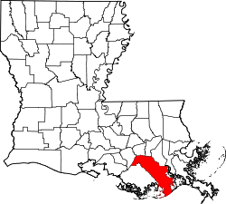 | |
| Towns | ||
| CDPs | ||
| Other communities | ||
| Footnotes | ‡This populated place also has portions in an adjacent parish or parishes | |
Municipalities and communities of Terrebonne Parish, Louisiana, United States | ||
|---|---|---|
| City | 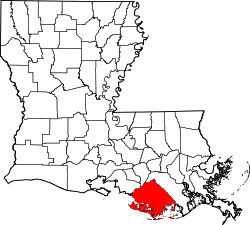 | |
| CDPs | ||
| Other unincorporated communities | ||
| Footnotes | ‡This populated place also has portions in an adjacent parish or parishes | |