


Ketchuptown, South Carolina
Ketchuptown, South Carolina | |
|---|---|
 Country store at the crossroads | |
 Ketchuptown  Ketchuptown | |
| Coordinates: 34°07′05″N 79°09′25″W / 34.11806°N 79.15694°W[1] | |
| Country | United States |
| State | South Carolina |
| County | Horry |
| Established | 1920s |
| Area | |
• Total | 2.71 sq mi (7.02 km2) |
| • Land | 2.71 sq mi (7.02 km2) |
| • Water | 0 sq mi (0.00 km2) |
| Elevation | 72 ft (22 m) |
| Population | |
• Total | 84 |
| • Density | 31.0/sq mi (11.97/km2) |
| Time zone | UTC-5 (Eastern (EST)) |
| • Summer (DST) | UTC-4 (EDT) |
| ZIP Code | 29581 (Nichols) |
| Area code | 843 |
| FIPS code | 45-38110 |
| GNIS feature ID | 2812961[1] |
Ketchuptown is a historic unincorporated community and census-designated place (CDP) located in Horry County, South Carolina, United States. Ketchuptown is at the intersection of Highways 23 and 99, about 9 miles (14 km) north of Aynor. As of the 2020 census, it had a population of 84.[4][5]
Demographics
| Census | Pop. | Note | %± |
|---|---|---|---|
| 2020 | 84 | — | |
| U.S. Decennial Census[6] 2020[7][3] | |||
2020 census
| Race / Ethnicity | Pop 2020[7] | % 2020 |
|---|---|---|
| White alone (NH) | 63 | 75.00% |
| Black or African American alone (NH) | 0 | 0.00% |
| Native American or Alaska Native alone (NH) | 3 | 3.57% |
| Asian alone (NH) | 0 | 0.00% |
| Pacific Islander alone (NH) | 0 | 0.00% |
| Some Other Race alone (NH) | 0 | 0.00% |
| Mixed Race/Multi-Racial (NH) | 0 | 0.00% |
| Hispanic or Latino (any race) | 18 | 21.43% |
| Total | 84 | 100.00% |
Note: the US Census treats Hispanic/Latino as an ethnic category. This table excludes Latinos from the racial categories and assigns them to a separate category. Hispanics/Latinos can be of any race.
References
- ^ a b c U.S. Geological Survey Geographic Names Information System: Ketchuptown, South Carolina
- ^ "ArcGIS REST Services Directory". United States Census Bureau. Retrieved October 15, 2022.
- ^ a b "Census Population API". United States Census Bureau. Retrieved October 15, 2022.
- ^ "Ketchuptown CDP, South Carolina 2020 DEC Redistricting Data (PL 94-171)". U.S. Census Bureau. Retrieved January 24, 2022.
- ^ "Ketchuptown CDP, South Carolina". United States Census Bureau. Retrieved April 7, 2022.
- ^ "Decennial Census of Population and Housing by Decades". US Census Bureau.
- ^ a b "P2 HISPANIC OR LATINO, AND NOT HISPANIC OR LATINO BY RACE – 2020: DEC Redistricting Data (PL 94-171) – Ketchuptown CDP, South Carolina". United States Census Bureau.
External links
- Ketchuptown (Horry County Board of Architectural Review)
- "Ketchuptown, 1927-1994; The Place To Catch Up On The News," by Ruth Ham (Horry County Historical Society)
Municipalities and communities of Horry County, South Carolina, United States | ||
|---|---|---|
| Cities | 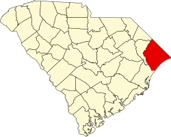 | |
| Towns | ||
| CDPs | ||
| Other communities | ||