


File:Mauk School (NRHP) Mauk, GA.JPG
Size of this preview: 800 × 597 pixels. Other resolutions: 320 × 239 pixels | 640 × 477 pixels | 1,024 × 764 pixels | 1,280 × 955 pixels | 1,416 × 1,056 pixels.
Original file (1,416 × 1,056 pixels, file size: 788 KB, MIME type: image/jpeg)
|
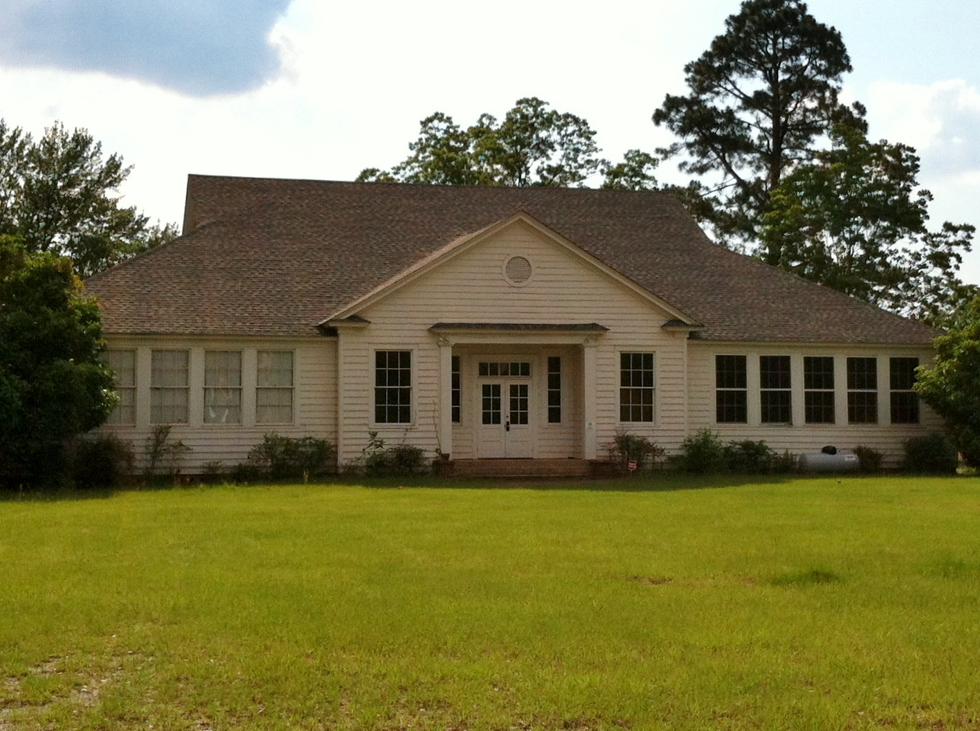
This is an image of a place or building that is listed on the National Register of Historic Places in the United States of America. Its reference number is 08001248 (Wikidata). |
Summary
| Camera location | | View this and other nearby images on: OpenStreetMap |
|---|
_Mauk,_GA.JPG¶ms=032.499800_N_-084.423000_E_globe:Earth_type:camera_heading:280.00&language=en)
| Description |
English: This is a photograph of the Mauk Schoolhouse building in Mauk, GA. The Mauk School started out as a one room schoolhouse when it was built in 1909. In 1955, the school was consolidated with a neighboring one in Butler, and the old schoolhouse became a community center for the Mauk, Charing and Norwich communities. |
| Date | |
| Source | Own work |
| Author | SaveRivers |
Licensing
I, the copyright holder of this work, hereby publish it under the following license:
This file is licensed under the Creative Commons Attribution-Share Alike 3.0 Unported license.
- You are free:
- to share – to copy, distribute and transmit the work
- to remix – to adapt the work
- Under the following conditions:
- attribution – You must give appropriate credit, provide a link to the license, and indicate if changes were made. You may do so in any reasonable manner, but not in any way that suggests the licensor endorses you or your use.
- share alike – If you remix, transform, or build upon the material, you must distribute your contributions under the same or compatible license as the original.
File history
Click on a date/time to view the file as it appeared at that time.
| Date/Time | Thumbnail | Dimensions | User | Comment | |
|---|---|---|---|---|---|
| current | 04:45, 16 May 2012 | | 1,416 × 1,056 (788 KB) | SaveRivers |
File usage
The following 2 pages use this file:
Global file usage
The following other wikis use this file:
- Usage on www.wikidata.org
_Mauk,_GA.JPG)