


Size of this preview: 800 × 514 pixels. Other resolutions: 320 × 206 pixels | 640 × 411 pixels | 1,024 × 658 pixels | 1,280 × 822 pixels | 2,560 × 1,645 pixels | 4,179 × 2,685 pixels.
Original file (4,179 × 2,685 pixels, file size: 1.05 MB, MIME type: image/jpeg)
Summary
| Description |
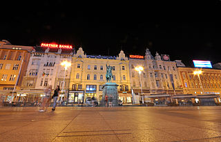
Ban Jelačić Square is the central square of the city of Zagreb, Croatia, named after ban Josip Jelačić. The official name is Trg bana Jelačića. It is colloquially referred to as Jelačić plac (derived from Platz, the German word for square or plaza) or simply Trg ("the square"). It is located below Zagreb's old city cores Gradec and Kaptol and directly south of the Dolac Market on the intersection of Ilica from the west, Radićeva Street from the northwest, the small streets Splavnica and Harmica from the north, Bakačeva Street from the northeast, Jurišićeva Street from the east, Praška Street from the southeast and Gajeva Street from the southwest. It is the center of the Zagreb Downtown pedestrian zone [Wikipedia.org] |
| Date | |
| Source | Ban Jelačić Square at night |
| Author | Jorge Láscar from Australia |
| Camera location | | View this and other nearby images on: OpenStreetMap |
|---|
.jpg¶ms=045.813019_N_0015.977367_E_globe:Earth_type:camera_source:Flickr_&language=en)
Licensing
This file is licensed under the Creative Commons Attribution 2.0 Generic license.
- You are free:
- to share – to copy, distribute and transmit the work
- to remix – to adapt the work
- Under the following conditions:
- attribution – You must give appropriate credit, provide a link to the license, and indicate if changes were made. You may do so in any reasonable manner, but not in any way that suggests the licensor endorses you or your use.
| This image was originally posted to Flickr by Jorge Lascar at https://www.flickr.com/photos/8721758@N06/13023889593. It was reviewed on 2 April 2014 by FlickreviewR and was confirmed to be licensed under the terms of the cc-by-2.0. |
File history
Click on a date/time to view the file as it appeared at that time.
| Date/Time | Thumbnail | Dimensions | User | Comment | |
|---|---|---|---|---|---|
| current | 06:27, 2 April 2014 | | 4,179 × 2,685 (1.05 MB) | Russavia | Transferred from Flickr |
File usage
The following page uses this file:
.jpg)
You must be logged in to post a comment.