


McBride, Oklahoma
McBride, Oklahoma | |
|---|---|
 McBride  McBride | |
| Coordinates: 33°56′07″N 96°38′15″W / 33.93528°N 96.63750°W | |
| Country | United States |
| State | Oklahoma |
| County | Marshall |
| Area | |
• Total | 0.47 sq mi (1.22 km2) |
| • Land | 0.43 sq mi (1.12 km2) |
| • Water | 0.039 sq mi (0.10 km2) |
| Population | |
• Total | 128 |
| • Density | 295.6/sq mi (114.1/km2) |
| Time zone | UTC-6 (Central (CST)) |
| • Summer (DST) | UTC-5 (CDT) |
| ZIP Code | 73439 (Kingston) |
| Area code | 580 |
| FIPS code | 40-44900 |
McBride is an unincorporated community and census-designated place (CDP) in Marshall County, Oklahoma, United States. It is located about 7 miles (11 km) southeast of Kingston along Oklahoma State Highway 70A.[3] The population was 128 as of the 2020 census.[4]
Demographics
| Census | Pop. | Note | %± |
|---|---|---|---|
| 2020 | 128 | — | |
| U.S. Decennial Census[5] | |||
2020 census
As of the 2020 census, McBride had a population of 128. The median age was 60.4 years. 13.3% of residents were under the age of 18 and 36.7% of residents were 65 years of age or older. For every 100 females there were 85.5 males, and for every 100 females age 18 and over there were 82.0 males age 18 and over.[6][7]
0.0% of residents lived in urban areas, while 100.0% lived in rural areas.[8]
There were 70 households in McBride, of which 28.6% had children under the age of 18 living in them. Of all households, 52.9% were married-couple households, 2.9% were households with a male householder and no spouse or partner present, and 31.4% were households with a female householder and no spouse or partner present. About 17.1% of all households were made up of individuals and 7.1% had someone living alone who was 65 years of age or older.[6]
There were 75 housing units, of which 6.7% were vacant. The homeowner vacancy rate was 0.0% and the rental vacancy rate was 0.0%.[6]
| Race | Number | Percent |
|---|---|---|
| White | 99 | 77.3% |
| Black or African American | 2 | 1.6% |
| American Indian and Alaska Native | 2 | 1.6% |
| Asian | 0 | 0.0% |
| Native Hawaiian and Other Pacific Islander | 0 | 0.0% |
| Some other race | 2 | 1.6% |
| Two or more races | 23 | 18.0% |
| Hispanic or Latino (of any race) | 4 | 3.1% |
References
- ^ "2024 U.S. Gazetteer Files: Oklahoma". United States Census Bureau. Retrieved May 8, 2025.
- ^ "P1. Race – McBride CDP, Oklahoma: 2020 DEC Redistricting Data (PL 94-171)". U.S. Census Bureau. Retrieved May 8, 2025.
- ^ "Kingston, Oklahoma to McBride, Oklahoma Oklahoma". Google Maps. Retrieved July 14, 2024.
- ^ "McBride (CDP), Oklahoma". U.S. Census Bureau. Retrieved July 14, 2024.
- ^ "Census of Population and Housing". Census.gov. Retrieved June 4, 2016.
- ^ a b c "2020 Decennial Census Demographic Profile (DP1)". United States Census Bureau. 2021. Retrieved January 31, 2026.
- ^ a b "2020 Decennial Census Redistricting Data (Public Law 94-171)". United States Census Bureau. 2021. Retrieved January 31, 2026.
- ^ "2020 Decennial Census Demographic and Housing Characteristics (DHC)". United States Census Bureau. 2023. Retrieved January 31, 2026.
Municipalities and communities of Marshall County, Oklahoma, United States | ||
|---|---|---|
| City | 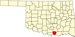 | |
| Towns | ||
| CDPs | ||
| Other communities | ||
| Indian reservation | ||
| Footnotes | ‡This populated place also has portions in an adjacent county or counties | |