


File:Colonial SC.png

Size of this preview: 600 × 600 pixels. Other resolutions: 240 × 240 pixels | 480 × 480 pixels | 1,000 × 1,000 pixels.
Original file (1,000 × 1,000 pixels, file size: 220 KB, MIME type: image/png)
Summary
| Description |
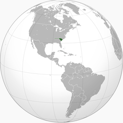
English: Locator map for Province of South Carolina |
| Date | |
| Source | Own work |
| Author | VoodooIsland (talk) (Uploads) |
Licensing
| |
This work has been released into the public domain by its author, VoodooIsland, at the English Wikipedia project. This applies worldwide. In case this is not legally possible: |
Original upload log
The original description page was here. All following user names refer to en.wikipedia.
| Date/Time | Dimensions | User | Comment |
|---|---|---|---|
| 2010-07-11 20:58 | 1000×1000× (224886 bytes) | VoodooIsland |
File history
Click on a date/time to view the file as it appeared at that time.
| Date/Time | Thumbnail | Dimensions | User | Comment | |
|---|---|---|---|---|---|
| current | 13:15, 20 August 2021 | | 1,000 × 1,000 (220 KB) | Explicit | Transferred from en.wikipedia via #commonshelper |
File usage
The following 2 pages use this file:
Global file usage
The following other wikis use this file:
- Usage on ar.wikipedia.org
- Usage on es.wikipedia.org
- Usage on ja.wikipedia.org
- Usage on zh.wikipedia.org