


No higher resolution available.
Google_Maps_Beta.png (335 × 219 pixels, file size: 102 KB, MIME type: image/png)
Summary
| Description |
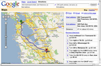
Screenshot of Google Maps in beta (2005) |
|---|---|
| Source | |
| Article | |
| Portion used |
Cropped top and bottom |
| Low resolution? |
Yes |
| Purpose of use |
Identification and critical commentary in the Google Maps article, a subject of public interest. |
| Replaceable? |
No |
| Fair useFair use of copyrighted material in the context of Google Maps//en.wikipedia.org/wiki/File:Google_Maps_Beta.pngtrue | |
Licensing
File history
Click on a date/time to view the file as it appeared at that time.
| Date/Time | Thumbnail | Dimensions | User | Comment | |
|---|---|---|---|---|---|
| current | 14:55, 29 January 2019 | | 335 × 219 (102 KB) | Tim42 (talk | contribs) | {{Non-free use rationale |Article = Google Maps |Description = Screenshot of Google Maps in beta (2005) |Source = http://digital-archaeology.org/plotting-the-past/ |Portion = Cropped top and bottom |Low_resolution = Yes |Purpose = Identification and critical commentary in the Google Maps article, a subject of public interest. |Replaceability = No |other_information = }} |
You cannot overwrite this file.
File usage
The following page uses this file:
You must be logged in to post a comment.