


Fail:The Ancient Roads of Italy and Sicily nopng.svg

Lühikirjeldus
| Kirjeldus |
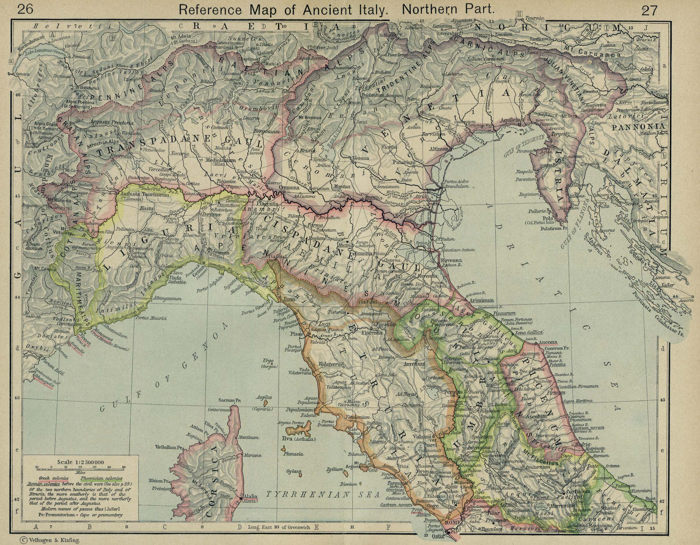
English: The major roads of Italy (going from Rome) are as follows, going clockwise from the left:
Corrections and additions are welcome! |
||
| Kuupäev | |||
| Allikas | Üleslaadija oma töö | ||
| Looja | |||
| Georeferencing | If inappropriate please set warp_status = skip to hide. | ||
| Teised versioonid |
|

Litsents
| Selle teose autoriõiguste valdajana annan selle teose avalikku omandisse. See kehtib üleilmselt. Kui see pole mõnes riigis õiguslikult võimalik: Annan kõigile õiguse seda teost kasutada ükskõik mille jaoks, ilma ühegi tingimuseta, kui seadus neid just ei sea. |
Faili ajalugu
Klõpsa kuupäeva ja kellaaega, et näha sel ajahetkel kasutusel olnud failiversiooni.
| Kuupäev/kellaaeg | Pisipilt | Mõõtmed | Kasutaja | Kommentaar | |
|---|---|---|---|---|---|
| viimane | 24. aprill 2020, kell 03:24 | | 1201 × 1340 (245 KB) | Ciaurlec | Changed alpha channel values to make it lighter |
| 20. veebruar 2010, kell 10:07 |  | 1201 × 1340 (245 KB) | Agamemnus | Bringing back a road that went missing. | |
| 13. veebruar 2010, kell 06:25 |  | 1201 × 1340 (239 KB) | Agamemnus | One more color change. | |
| 13. veebruar 2010, kell 06:19 |  | 1201 × 1340 (239 KB) | Agamemnus | Color change.. | |
| 13. veebruar 2010, kell 06:14 |  | 1201 × 1340 (239 KB) | Agamemnus | Minor road edit. | |
| 13. veebruar 2010, kell 06:04 |  | 1201 × 1340 (238 KB) | Agamemnus | Added a little compass showing north. Added a scale strip next to the compass. Changed Via Tiburtina color to dark purple. | |
| 9. veebruar 2010, kell 20:05 |  | 1201 × 1340 (230 KB) | Agamemnus | Moved the italy/sicily svg down so the roads could be seen again... | |
| 9. veebruar 2010, kell 10:18 |  | 1201 × 1340 (230 KB) | Agamemnus | Teh Sicily portion of the SVG is now more detailed. | |
| 9. veebruar 2010, kell 07:16 |  | 1201 × 1340 (220 KB) | Agamemnus | {{Information |Description={{en|1=The major roads of Italy (going from Rome) are as follows, going clockwise from the left: Green: Via Aurelia -> Via Aumelia Scaura -> Via Julia Augusta Bright green: Via Clodia Yellow: Via Cassia Blue: Via Flaminia Grey: |
Faili kasutus
Seda faili kasutab järgmine lehekülg:
Globaalne failikasutus
Järgmised muud vikid kasutavad seda faili:
- Faili kasutus vikis ca.wikipedia.org
- Faili kasutus vikis en.wikipedia.org
- Faili kasutus vikis fr.wikipedia.org
- Faili kasutus vikis la.wikipedia.org
- Faili kasutus vikis lt.wikipedia.org
- Faili kasutus vikis sq.wikipedia.org
- Faili kasutus vikis uk.wikipedia.org
- Faili kasutus vikis zh.wikipedia.org