


The Capital Region (Spanish: Región Capital) is one of the nine administrative regions in which Venezuela is divided. It includes the states Miranda and Vargas, as well as the Capital District. In 2011, the population of the region was reported to be more than 5 million people.

History
Throughout the country, after the beginning of the democratic era, a policy of rationalisation was developed. By 1969, thanks to a presidential decree, the first legal element was established, from which the rationalisation process would begin across the country. This decree created the Central Region as well as 8 other regions in the country, in addition to laying the foundation for the creation of various regional organisations.
In 1969, the region called the Coastal North-Central Region was created, which consisted of the Federal District and the States of Miranda, Carabobo, and Aragua, excluding the then District of Urdaneta (now a Municipality) from the latter. Later, in 1979, following a legal reform, the Federal District and the State of Miranda were separated to form the Capital Region, and the District of Urdaneta from the State of Aragua and the State of Cojedes were incorporated into it; these last two territories had until then been part of the Central Llanos Region"[citation needed]
Physical aspects
Relief
The region is dominated by mountainous forms, belonging to the central section of the Coastal Range.
Climate
The regional climate is like this:
- Coastal zone; semi-arid tropical climate.
- Windward depression; tropical monsoon climate.
- Caracas Valley; tropical climate of altitude.
- Mountainous zone; tropical climate of altitude.
Hydrography
The most important river in the region is the Tuy River (239 km), which originates from the Codazzi Peak and the Guaire River
Economy
Its economy is based on industry and commerce, it has an important port such as La Guaira, which allows commercialization with other countries. This brings as consequence the increase of the population in this region due to the opportunity for the commercialization of products and the offer of jobs.
Despite the fact that the capital of the country is located in this region, a part of the primary sector that has survived is predominant, such as cocoa planting in the areas of Barlovento in the state of Miranda.
The state of Miranda is the area of greatest agricultural activity in the region, highlighting the cultivation of cocoa, sugar cane, poultry and raising cattle and pigs.
It is one of the 9 regions in which Venezuela is divided, has a large economy that allows industries to continue growing and has some very important centers, both financial and industrial.
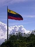
Gallery
-
-
 Vargas State Beach
 -
 Los Teques Miranda State
 -
 Tacarigua Lagoon National Park
 -
 Naiguatá, Vargas State


| Capital District | ||
|---|---|---|
| States | ||
| Federal Dependencies | ||
| Regions | ||
| Disputed state | ||
| Related topics |
| |