


Milfay, Oklahoma
Milfay, Oklahoma | |
|---|---|
 Milfay Location within the state of Oklahoma  Milfay Milfay (the United States) | |
| Coordinates: 35°45′06″N 96°33′33″W / 35.75167°N 96.55917°W | |
| Country | United States |
| State | Oklahoma |
| County | Creek |
| Area | |
• Total | 0.64 sq mi (1.66 km2) |
| • Land | 0.63 sq mi (1.64 km2) |
| • Water | 0.0039 sq mi (0.01 km2) |
| Elevation | 837 ft (255 m) |
| Population (2020) | |
• Total | 74 |
| • Density | 116.8/sq mi (45.11/km2) |
| Time zone | UTC-6 (Central (CST)) |
| • Summer (DST) | UTC-5 (CDT) |
| FIPS code | 40-48450 |
| GNIS feature ID | 2805341[2] |
Milfay is a small unincorporated community in Creek County, Oklahoma, United States, about five and a half miles east of Stroud.[3] As of the 2020 census, Milfay had a population of 74.[4] The post office was established December 14, 1911. The community was named after Charles Mills and Edward Fay, two railroad officials.[5]
Demographics
| Census | Pop. | Note | %± |
|---|---|---|---|
| 2020 | 74 | — | |
| U.S. Decennial Census[6] | |||
2020 census
As of the 2020 census, Milfay had a population of 74. The median age was 48.0 years. 18.9% of residents were under the age of 18 and 12.2% of residents were 65 years of age or older. For every 100 females there were 131.2 males, and for every 100 females age 18 and over there were 114.3 males age 18 and over.[7][8]
0.0% of residents lived in urban areas, while 100.0% lived in rural areas.[9]
There were 30 households in Milfay, of which 26.7% had children under the age of 18 living in them. Of all households, 40.0% were married-couple households, 30.0% were households with a male householder and no spouse or partner present, and 26.7% were households with a female householder and no spouse or partner present. About 46.6% of all households were made up of individuals and 3.3% had someone living alone who was 65 years of age or older.[7]
There were 38 housing units, of which 21.1% were vacant. The homeowner vacancy rate was 0.0% and the rental vacancy rate was 0.0%.[7]
| Race | Number | Percent |
|---|---|---|
| White | 51 | 68.9% |
| Black or African American | 2 | 2.7% |
| American Indian and Alaska Native | 2 | 2.7% |
| Asian | 0 | 0.0% |
| Native Hawaiian and Other Pacific Islander | 0 | 0.0% |
| Some other race | 3 | 4.1% |
| Two or more races | 16 | 21.6% |
| Hispanic or Latino (of any race) | 5 | 6.8% |
References
- ^ "ArcGIS REST Services Directory". United States Census Bureau. Retrieved September 20, 2022.
- ^ a b U.S. Geological Survey Geographic Names Information System: Milfay, Oklahoma
- ^ "Stroud, Oklahoma to Milfay, Oklahoma". Google Maps. Retrieved December 27, 2020.
- ^ "2020 Decennial Census Redistricting Data (Public Law 94-171)". United States Census Bureau. 2021. Retrieved February 1, 2026.
- ^ Shirk, George H (1987). Oklahoma Place Names. University of Oklahoma Press. ISBN 0-8061-2028-2.
- ^ "Census of Population and Housing". Census.gov. Retrieved June 4, 2016.
- ^ a b c "2020 Decennial Census Demographic Profile (DP1)". United States Census Bureau. 2021. Retrieved January 31, 2026.
- ^ a b "2020 Decennial Census Redistricting Data (Public Law 94-171)". United States Census Bureau. 2021. Retrieved January 31, 2026.
- ^ "2020 Decennial Census Demographic and Housing Characteristics (DHC)". United States Census Bureau. 2023. Retrieved January 31, 2026.
Municipalities and communities of Creek County, Oklahoma, United States | ||
|---|---|---|
| Cities | 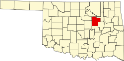 | |
| Towns | ||
| CDPs | ||
| Other communities | ||
| Ghost town | ||
| Indian reservation | ||
| Footnotes | ‡This populated place also has portions in an adjacent county or counties | |