


File:Royal Albert Hospital.jpg
Size of this preview: 450 × 600 pixels. Other resolutions: 180 × 240 pixels | 360 × 480 pixels | 576 × 768 pixels | 768 × 1,024 pixels | 2,448 × 3,264 pixels.
Original file (2,448 × 3,264 pixels, file size: 2.73 MB, MIME type: image/jpeg)
Summary
| Description |
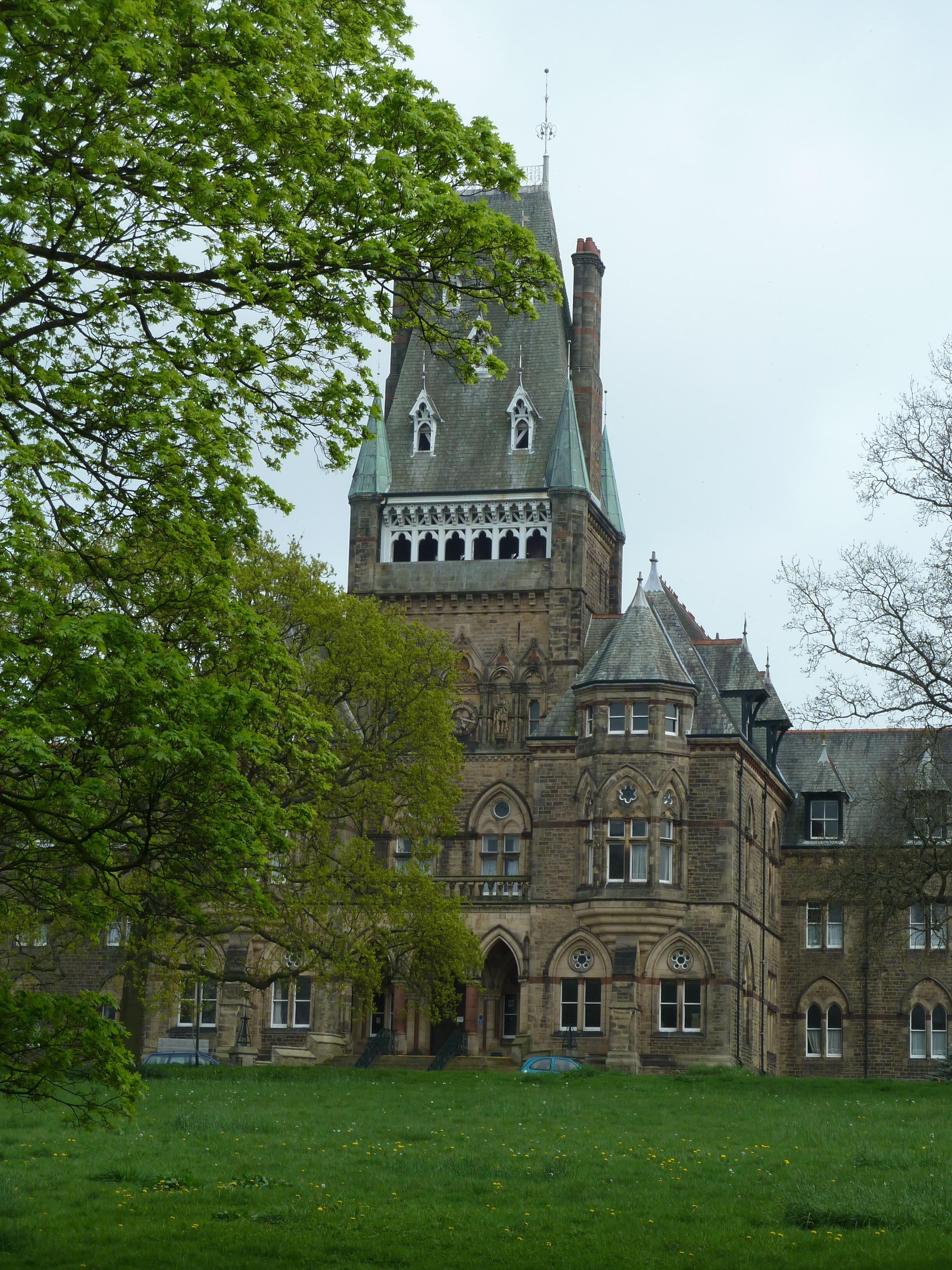
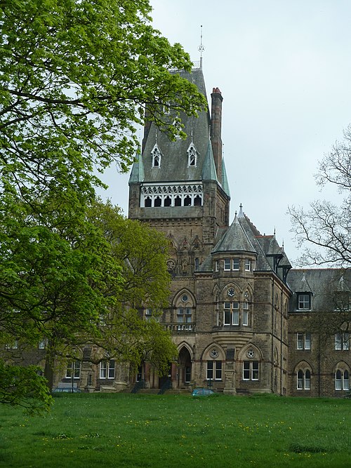
English: The former Royal Albert Hospital (now Jamea Al Kauthar College) seen from Ashton Road |
| Date | |
| Source | https://www.geograph.org.uk/photo/2373487 |
| Author | Peter Bond |
| Attribution (required by the license) | Peter Bond / Royal Albert Hospital seen from road / |
| Camera location | | View this and other nearby images on: OpenStreetMap |
|---|
_heading:67.00&language=en)
| Object location | | View this and other nearby images on: OpenStreetMap |
|---|
_heading:67.00&language=en)
Licensing

|
This image was taken from the Geograph project collection. See this photograph's page on the Geograph website for the photographer's contact details. The copyright on this image is owned by Peter Bond and is licensed for reuse under the Creative Commons Attribution-ShareAlike 2.0 license.
|
This file is licensed under the Creative Commons Attribution-Share Alike 2.0 Generic license.
Attribution:
Peter Bond
- You are free:
- to share – to copy, distribute and transmit the work
- to remix – to adapt the work
- Under the following conditions:
- attribution – You must give appropriate credit, provide a link to the license, and indicate if changes were made. You may do so in any reasonable manner, but not in any way that suggests the licensor endorses you or your use.
- share alike – If you remix, transform, or build upon the material, you must distribute your contributions under the same or compatible license as the original.
File history
Click on a date/time to view the file as it appeared at that time.
| Date/Time | Thumbnail | Dimensions | User | Comment | |
|---|---|---|---|---|---|
| current | 20:24, 12 September 2017 | | 2,448 × 3,264 (2.73 MB) | Geograph Update Bot | Higher-resolution version from Geograph. |
| 08:59, 5 September 2011 |  | 480 × 640 (105 KB) | Peter I. Vardy |
File usage
The following 8 pages use this file:
- Edward Denis de Vitre
- Edward Graham Paley
- Grade II* listed buildings in Lancashire
- List of non-ecclesiastical works by E. G. Paley
- List of non-ecclesiastical works by Paley and Austin
- List of works by Paley, Austin and Paley
- Listed buildings in Lancaster, Lancashire (outer areas)
- Royal Albert Hospital
Global file usage
The following other wikis use this file:
- Usage on az.wikipedia.org
- Usage on dag.wikipedia.org
- Usage on www.wikidata.org