


File:KernFrontOilFieldStructureMap.png
Size of this preview: 566 × 599 pixels. Other resolutions: 227 × 240 pixels | 577 × 611 pixels.
Original file (577 × 611 pixels, file size: 158 KB, MIME type: image/png)
Summary
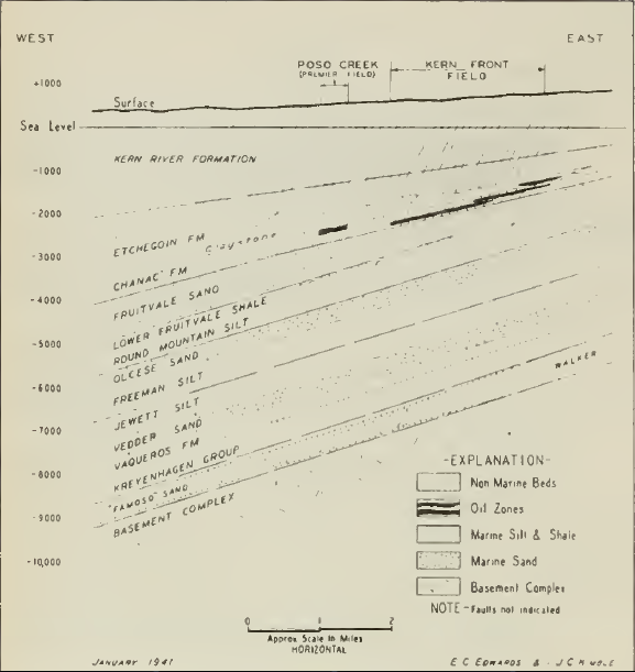
| Description |
English: Kern Front Oil Field Structure Map |
| Date | |
| Source | Geologic Formations and Economic Development of the Oil and Gas Fields of California |
| Author | State of California Dept. of Natural Resources Division of Mines Bulletin 118 |
Licensing
This work is in the public domain because it was published in the United States between 1931 and 1963, and although there may or may not have been a copyright notice, the copyright was not renewed. For further explanation, see Commons:Hirtle chart and the copyright renewal logs.
|
 |
File history
Click on a date/time to view the file as it appeared at that time.
| Date/Time | Thumbnail | Dimensions | User | Comment | |
|---|---|---|---|---|---|
| current | 18:18, 26 April 2018 | | 577 × 611 (158 KB) | Pi3.124 | User created page with UploadWizard |
File usage
The following page uses this file:
Global file usage
The following other wikis use this file:
- Usage on www.wikidata.org