


Čunovo
Čunovo | |
|---|---|
Borough | |
 Local baroque church, built in the 18th century | |
 Coat of arms | |
 Area of Čunovo in Bratislava | |
 Interactive map of Čunovo | |
 Čunovo Location of Čunovo in the Bratislava Region  Čunovo Location of Čunovo in Slovakia | |
| Coordinates: 48°01′47″N 17°11′56″E / 48.02972°N 17.19889°E | |
| Country | |
| Region | |
| District | Bratislava V |
| First mentioned | 1232 (Julian) |
| Government | |
| • Mayor | Gabriela Ferenčáková |
| Area | |
• Total | 18.62 km2 (7.19 sq mi) |
| Elevation | 130 m (430 ft) |
| Population | |
• Total | 1,811 |
| Time zone | UTC+1 (CET) |
| • Summer (DST) | UTC+2 (CEST) |
| Postal code | 851 10 |
| Area code | +421-2 |
| Vehicle registration plate (until 2022) | BA, BL, BT |
| Website | www |
Čunovo (Croatian: Čunovo, Hungarian: Dunacsún, Duna-Csún, German: Sandorf) is a small part of Bratislava, Slovakia, in the southern area near the Hungarian border. It is located close to the Gabčíkovo - Nagymaros Dams.
Geography
The municipality lies at an altitude of 130 metres (430 ft)[3] and covers an area of 18.62 km2 (7.19 sq mi) (2024).[4]
History
Čunovo was first mentioned as a village in 1232 under the name Chun. In the 16th century, Croats fleeing the Ottomans in the south settled in the village. Until 1947, Čunovo, along with Jarovce and Rusovce, was part of Hungary and was annexed that year, it was annexed to Czechoslovakia, to enable construction of the Port of Bratislava. It became an official part of Bratislava on January 1, 1972. Some of the inhabitants still speak the Croatian language and preserve folk traditions.
Tourism
In 2000, a new art museum called Danubiana was opened. Dunajské luhy Protected Landscape Area comprises some parts of the borough. It is home to Čunovo Water Sports Centre an artificial whitewater facility built in 1996 which attracts paddlers from around the world.
Transport
Čunovo is close to the international motorway E65/E75 and railway crossing to Hungary. The first town inside Hungary is Rajka.
Since 21 December 2007, all border controls have been lifted as Hungary and Slovakia became part of the Schengen Area.
Population
| Year | 1994 | 2004 | 2014 | 2024 |
|---|---|---|---|---|
| Count | 782 | 914 | 1248 | 1811 |
| Difference | +16.87% | +36.54% | +45.11% |
| Year | 2023 | 2024 |
|---|---|---|
| Count | 1770 | 1811 |
| Difference | +2.31% |
It has a population of 1811 people (31 December 2024).[6]
Ethnicity
| Ethnicity | Number | Fraction |
|---|---|---|
| Slovak | 1437 | 87.88% |
| Croatian | 158 | 9.66% |
| Hungarian | 73 | 4.46% |
| Czech | 30 | 1.83% |
| Not found out | 27 | 1.65% |
| Other | 21 | 1.28% |
| Total | 1635 |
In year 2021 was 1635 people by ethnicity 1437 as Slovak, 158 as Croatian, 73 as Hungarian, 30 as Czech, 27 as Not found out, 21 as Other, 14 as German, 10 as Austrian, 5 as Polish, 4 as Russian, 3 as Ukrainian, 2 as Jewish, 2 as Rusyn, 2 as Bulgarian, 1 as Irish, 1 as Silesian and 1 as French.
Note on population: The difference between the population numbers above and in the census (here and below) is that the population numbers above are mostly made up of permanent residents, etc.; and the census should indicate the place where people actually mainly live.
For example, a student is a citizen of a village because they have permanent residence there (they lived there as a child and has parents), but most of the time he studies at a university in the city.
Religion
| Religion | Number | Fraction |
|---|---|---|
| Roman Catholic Church | 951 | 58.17% |
| None | 556 | 34.01% |
| Not found out | 33 | 2.02% |
| Evangelical Church | 32 | 1.96% |
| Total | 1635 |
In year 2021 was 1635 people by religion 951 from Roman Catholic Church, 556 from None, 33 from Not found out, 32 from Evangelical Church, 9 from Ad hoc movements, 8 from Greek Catholic Church, 7 from Calvinist Church, 7 from Eastern Orthodox Church, 7 from Apostolic Church, 6 from Other, 5 from Christian Congregations in Slovakia, 5 from Islam, 3 from Buddhism, 2 from Jewish community, 1 from Paganism and natural spirituality, 1 from Jehovah's Witnesses, 1 from Hinduism and 1 from Czechoslovak Hussite Church.
Gallery
-
 The Danubian Meulensteen Art Museum, near Čunovo.
 -
 Tripoint with Austria-Hungary-Slovakia near Čunovo.
 -
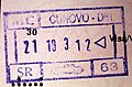 Passport enty stamp via road from Čunovo.


References
- ^ "Hustota obyvateľstva - obce [om7014rr_obc=AREAS_SK, v_om7014rr_ukaz=Rozloha (Štvorcový meter)]". Statistical Office of the Slovak Republic. 2025-03-31. Retrieved 2025-03-31.
- ^ "Počet obyvateľov podľa pohlavia - obce (ročne) [om7101rr_obce=AREAS_SK]". Statistical Office of the Slovak Republic. 2025-03-31. Retrieved 2025-03-31.
- ^ a b "Základná charakteristika". www.statistics.sk (in Slovak). Statistical Office of the Slovak Republic. 2015-04-17. Retrieved 2022-03-31.
- ^ "Hustota obyvateľstva - obce [om7014rr_obc=AREAS_SK, v_om7014rr_ukaz=Rozloha (Štvorcový meter)]". Statistical Office of the Slovak Republic. 2025-03-31. Retrieved 2025-03-31.
- ^ a b "Počet obyvateľov podľa pohlavia - obce (ročne) [om7101rr_obce=AREAS_SK]". Statistical Office of the Slovak Republic. 2025-03-31. Retrieved 2025-03-31.
- ^ "Počet obyvateľov podľa pohlavia - obce (ročne) [om7101rr_obce=AREAS_SK]". Statistical Office of the Slovak Republic. 2025-03-31. Retrieved 2025-03-31.
- ^ "Population - Basic results". www.scitanie.sk. Statistical Office of the Slovak republic. Retrieved 2025-11-03.
- ^ "Population - Basic results". www.scitanie.sk. Statistical Office of the Slovak republic. Retrieved 2025-11-03.
- ^ "Population - Basic results". www.scitanie.sk. Statistical Office of the Slovak republic. Retrieved 2025-11-03.
External links
| International | |
|---|---|
| National | |