


File:Map of Caucasus 1801.jpg

Size of this preview: 731 × 600 pixels. Other resolutions: 293 × 240 pixels | 585 × 480 pixels | 936 × 768 pixels | 1,248 × 1,024 pixels | 2,497 × 2,048 pixels | 4,936 × 4,049 pixels.
Original file (4,936 × 4,049 pixels, file size: 4.07 MB, MIME type: image/jpeg)
Summary
| Description |
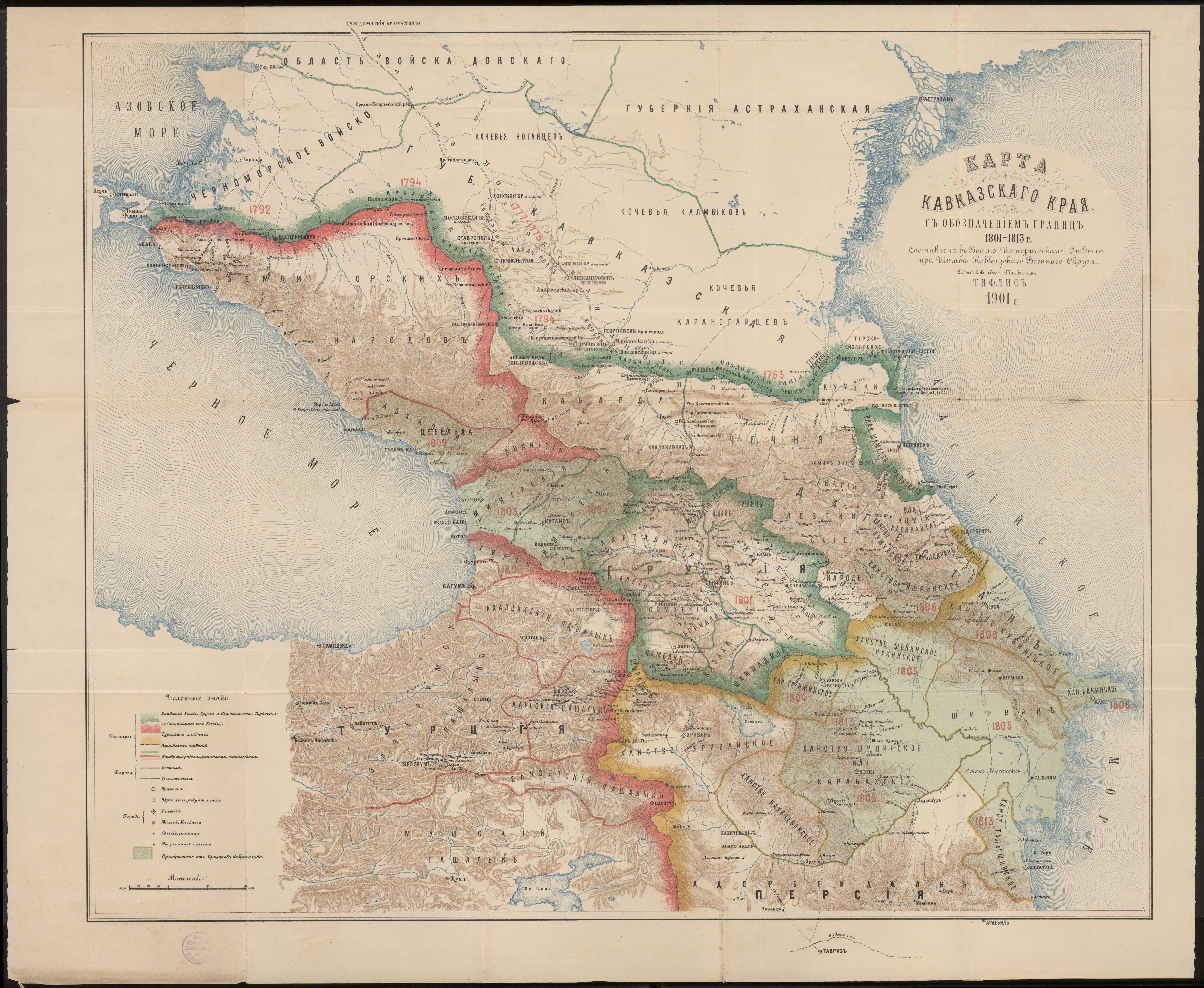
English: Map of states that existed in the Caucasus as of 1801. It was created by Department of History at the Caucasian Military Headquarters, Tiflis, Russian Empire, 1901. |
| Date | |
| Source | Department of History at the Caucasian Military Headquarters, Tiflis, Russian Empire, 1901. http://xn--b1aaibpv0aet4h1a.xn--p1ai/forums/uploads/gallery/album_19/gallery_4_19_4287845.jpg |
| Author | Lieutenant Colonel Tomkiev |
| Camera location | | View this and other nearby images on: OpenStreetMap |
|---|
Licensing
|
This is a faithful photographic reproduction of a two-dimensional, public domain work of art. The work of art itself is in the public domain for the following reason:
The official position taken by the Wikimedia Foundation is that "faithful reproductions of two-dimensional public domain works of art are public domain".
This photographic reproduction is therefore also considered to be in the public domain in the United States. In other jurisdictions, re-use of this content may be restricted; see Reuse of PD-Art photographs for details. | ||||
File history
Click on a date/time to view the file as it appeared at that time.
| Date/Time | Thumbnail | Dimensions | User | Comment | |
|---|---|---|---|---|---|
| current | 21:01, 1 December 2020 | | 4,936 × 4,049 (4.07 MB) | OrkhanScience | Uploaded a work by Lieutenant Colonel Tomkiev from Department of History at the Caucasian Military Headquarters, Tiflis, Russian Empire, 1901. with UploadWizard |
File usage
The following 7 pages use this file:
Global file usage
The following other wikis use this file:
- Usage on en.wiktionary.org
- Usage on es.wikipedia.org
- Usage on it.wikipedia.org
- Usage on ka.wikipedia.org
- Usage on pt.wikipedia.org
- Usage on ru.wikipedia.org
- Usage on sq.wikipedia.org
- Usage on tr.wikipedia.org