


File:ConnLakes.jpg
No higher resolution available.
ConnLakes.jpg (213 × 330 pixels, file size: 43 KB, MIME type: image/jpeg)
Summary
| Description |
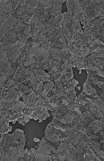
United States Geological Survey map of the Connecticut Lakes. Approx. 188 km E of Montreal, Quebec, Canada 01 July 1975. |
|---|---|
| Source |
Source: [http://msrmaps.com |
| Date | |
| Author | |
| Permission (Reusing this file) |
See below. |
| Additional information | 45°5′37″N 71°14′52″W / 45.09361°N 71.24778°W |
Licensing
File history
Click on a date/time to view the file as it appeared at that time.
| Date/Time | Thumbnail | Dimensions | User | Comment | |
|---|---|---|---|---|---|
| current | 23:40, 24 February 2012 | | 213 × 330 (43 KB) | Zfish118 (talk | contribs) | United States Geological Survey map of the Connecticut Lake. Approx. 188 km E of Montreal, Quebec, Canada 01 July 1975. Source: [http://msrmaps.com|MSR Research Maps] {{coord|45|5|37|N|71|14|52|W|type:waterbody_region:US}} |
You cannot overwrite this file.
File usage
The following 2 pages use this file: