


File:Hazard Reef at MdO, SLO.jpg
Size of this preview: 800 × 576 pixels. Other resolutions: 320 × 230 pixels | 640 × 461 pixels | 1,024 × 737 pixels | 1,280 × 921 pixels | 2,560 × 1,843 pixels | 3,069 × 2,209 pixels.
Original file (3,069 × 2,209 pixels, file size: 3.37 MB, MIME type: image/jpeg)
Summary
| Description |
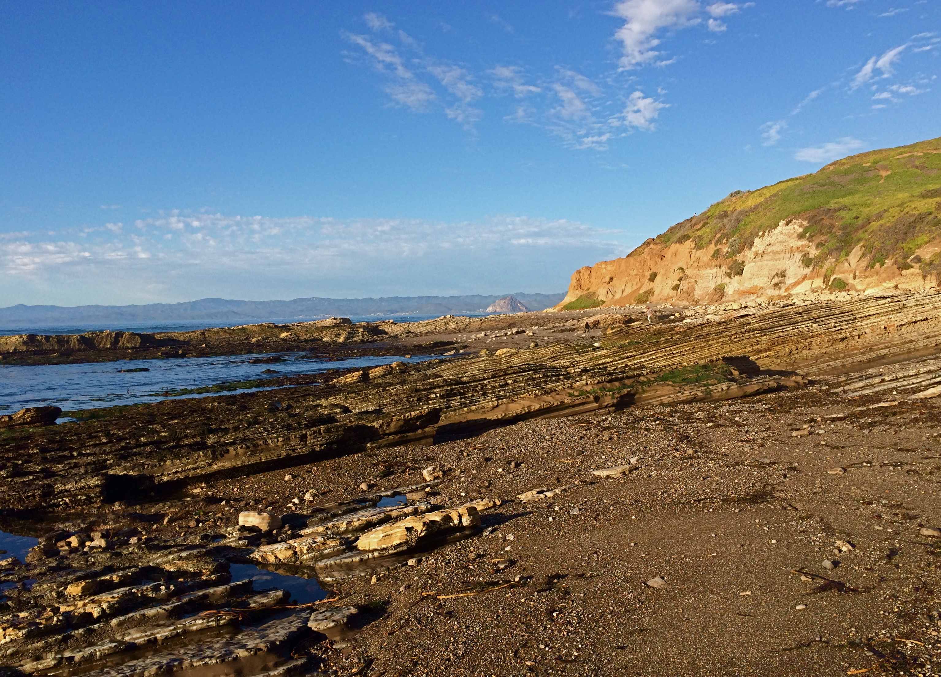
English: Hazard Reef, looking north to Morro Rock. The late Miocene marine sediments here are tilted 10 or 20 degrees to the northwest which makes for perfect "structural" tide pools as the tide goes out.
See en:Montery formation for general geology of these rocks. By memory these are the Miguelito member, marly siltstones with prominent dessicatin cracking on the bedding planes. |
| Date | |
| Source | Own work |
| Author | Peter D. Tillman |
| Camera location | | View this and other nearby images on: OpenStreetMap |
|---|
Licensing
I, the copyright holder of this work, hereby publish it under the following licenses:

|
Permission is granted to copy, distribute and/or modify this document under the terms of the GNU Free Documentation License, Version 1.2 or any later version published by the Free Software Foundation; with no Invariant Sections, no Front-Cover Texts, and no Back-Cover Texts. A copy of the license is included in the section entitled GNU Free Documentation License. |
This file is licensed under the Creative Commons Attribution 3.0 Unported license.
- You are free:
- to share – to copy, distribute and transmit the work
- to remix – to adapt the work
- Under the following conditions:
- attribution – You must give appropriate credit, provide a link to the license, and indicate if changes were made. You may do so in any reasonable manner, but not in any way that suggests the licensor endorses you or your use.
You may select the license of your choice.
File history
Click on a date/time to view the file as it appeared at that time.
| Date/Time | Thumbnail | Dimensions | User | Comment | |
|---|---|---|---|---|---|
| current | 01:44, 24 January 2015 | | 3,069 × 2,209 (3.37 MB) | Tillman | {{Information |Description ={{en|1=Hazard Reef, looking north to Morro Rock. The late Miocene marine sediments here are tilted 10 or 20 degrees to the northwest which makes for perfect "structural" tide pools as the tide goes out. See [[:en:Montery... |
File usage
The following page uses this file: