


Grabfeld, Thuringia
Grabfeld | |
|---|---|
 Coat of arms | |
Location of Grabfeld
within Schmalkalden-Meiningen district 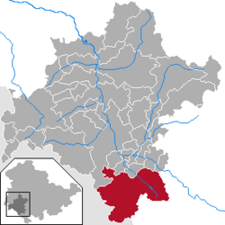 | |
 Location of Grabfeld | |
 Grabfeld  Grabfeld | |
| Coordinates: 50°27′N 10°26′E / 50.450°N 10.433°E | |
| Country | Germany |
| State | Thuringia |
| District | Schmalkalden-Meiningen |
| Subdivisions | 13 |
| Area | |
• Total | 121.08 km2 (46.75 sq mi) |
| Elevation | 360 m (1,180 ft) |
| Population (2023-12-31)[1] | |
• Total | 5,513 |
| • Density | 45.53/km2 (117.9/sq mi) |
| Time zone | UTC+01:00 (CET) |
| • Summer (DST) | UTC+02:00 (CEST) |
| Postal codes | 98631 |
| Dialling codes | 036944, 036947 |
| Vehicle registration | SM |
| Website | www |

Grabfeld (German pronunciation: [ˈɡʁaːpˌfɛlt]) is a municipality in the district Schmalkalden-Meiningen, in Thuringia, Germany.
Grabfeld was established as a municipality on 1 December 2007 by combining the former municipalities of Behrungen, Berkach, Bibra, Exdorf, Jüchsen, Nordheim, Queienfeld, Rentwertshausen, Schwickershausen and Wolfmannshausen, replacing the former Verwaltungsgemeinschaft of the same name. It was joined by the former municipality Bauerbach in January 2012, and by Wölfershausen in January 2019.
History
Within the German Empire (1871–1918), the territory of the present-day municipality of Grabfeld was part of the Duchy of Saxe-Meiningen.
References
- ^ "Alle politisch selbständigen Gemeinden mit ausgewählten Merkmalen am 31.12.2023" (in German). Federal Statistical Office of Germany. 28 October 2024. Retrieved 16 November 2024.
| International | |
|---|---|
| National | |
| Geographic | |