


File:Swannington 1850.png
Size of this preview: 723 × 599 pixels. Other resolutions: 290 × 240 pixels | 579 × 480 pixels | 927 × 768 pixels | 1,235 × 1,024 pixels | 1,298 × 1,076 pixels.
Original file (1,298 × 1,076 pixels, file size: 82 KB, MIME type: image/png)
Summary
| Description |
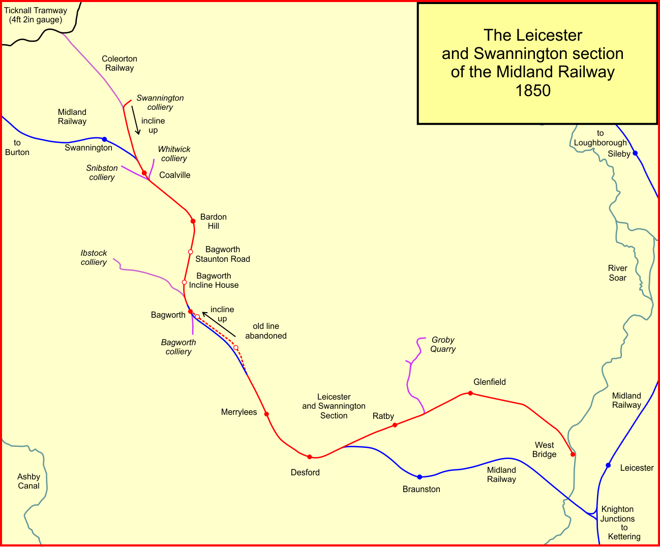
English: System map of the Leicester and Swannington Railway, England, in 1850, after takevoer by teh Midland Railway and improvements to alignment |
| Date | |
| Source | Own work |
| Author | Afterbrunel |
Licensing
I, the copyright holder of this work, hereby publish it under the following license:
This file is licensed under the Creative Commons Attribution-Share Alike 4.0 International license.
- You are free:
- to share – to copy, distribute and transmit the work
- to remix – to adapt the work
- Under the following conditions:
- attribution – You must give appropriate credit, provide a link to the license, and indicate if changes were made. You may do so in any reasonable manner, but not in any way that suggests the licensor endorses you or your use.
- share alike – If you remix, transform, or build upon the material, you must distribute your contributions under the same or compatible license as the original.
File history
Click on a date/time to view the file as it appeared at that time.
| Date/Time | Thumbnail | Dimensions | User | Comment | |
|---|---|---|---|---|---|
| current | 06:27, 7 July 2022 | | 1,298 × 1,076 (82 KB) | Afterbrunel | Uploaded own work with UploadWizard |
File usage
The following 2 pages use this file: