


File:6DayWarEnglish.png
Size of this preview: 347 × 599 pixels. Other resolutions: 139 × 240 pixels | 278 × 480 pixels | 445 × 768 pixels | 593 × 1,024 pixels | 1,187 × 2,048 pixels | 4,000 × 6,900 pixels.
Original file (4,000 × 6,900 pixels, file size: 477 KB, MIME type: image/png)

|
This military map image could be re-created using vector graphics as an SVG file. This has several advantages; see Commons:Media for cleanup for more information. If an SVG form of this image is available, please upload it and afterwards replace this template with
{{vector version available|new image name}}.It is recommended to name the SVG file “6DayWarEnglish.svg”—then the template Vector version available (or Vva) does not need the new image name parameter. |
Summary
| Description |
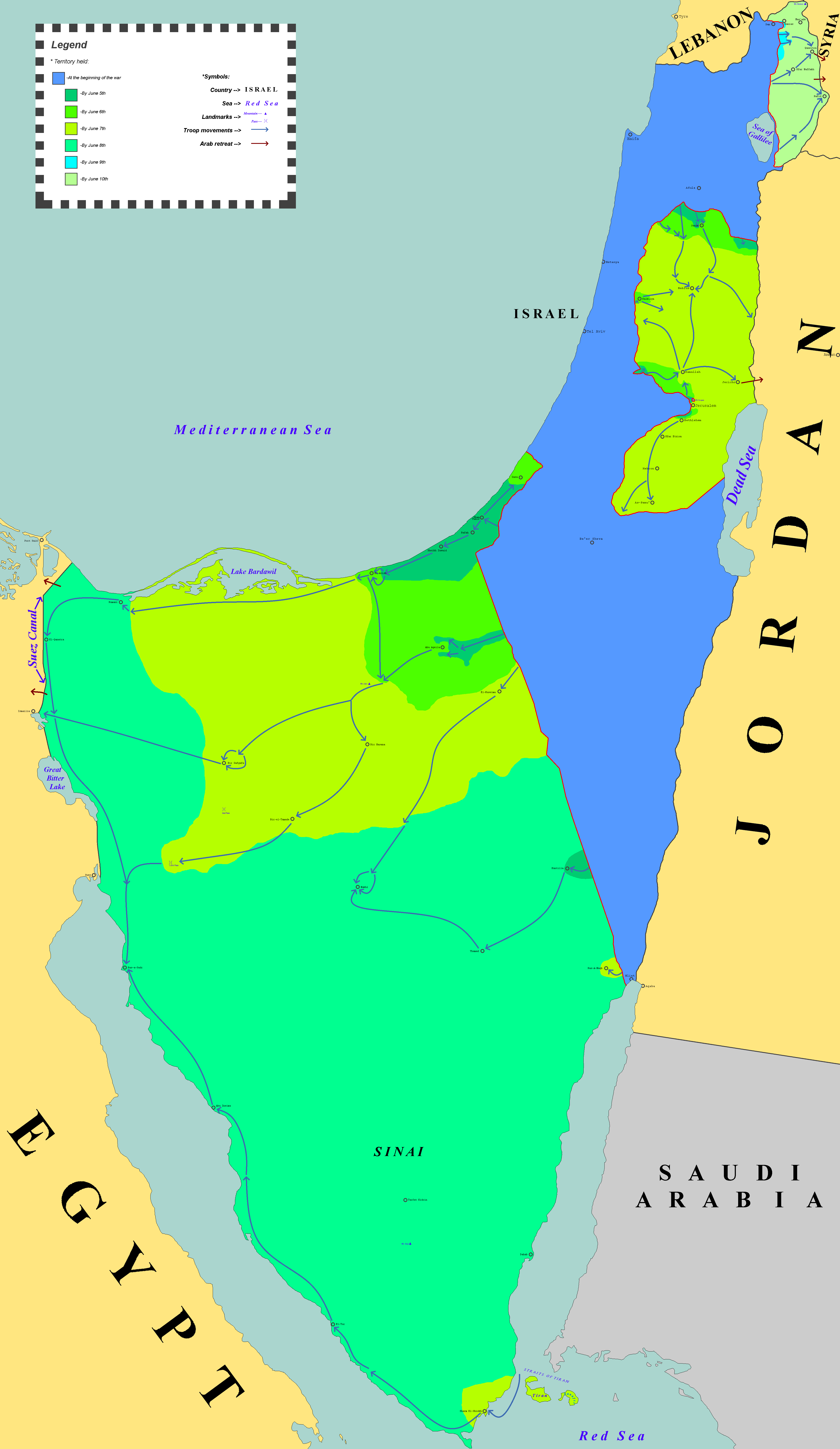
English: Arab territories gained by Israel in the aftermath of the Six-Day War. |
| Date | |
| Source | Own work |
| Author | Zvikorn |
Licensing
This file is licensed under the Creative Commons Attribution-Share Alike 4.0 International license.
- You are free:
- to share – to copy, distribute and transmit the work
- to remix – to adapt the work
- Under the following conditions:
- attribution – You must give appropriate credit, provide a link to the license, and indicate if changes were made. You may do so in any reasonable manner, but not in any way that suggests the licensor endorses you or your use.
- share alike – If you remix, transform, or build upon the material, you must distribute your contributions under the same or compatible license as the original.
File history
Click on a date/time to view the file as it appeared at that time.
| Date/Time | Thumbnail | Dimensions | User | Comment | |
|---|---|---|---|---|---|
| current | 00:03, 31 January 2025 | | 4,000 × 6,900 (477 KB) | Hohum | Cartographic colours |
| 22:28, 28 December 2019 |  | 4,000 × 6,900 (482 KB) | Zvikorn | User created page with UploadWizard |
File usage
The following 8 pages use this file:
- Arab–Israeli relations
- Israeli Military Governorate
- Israeli occupation of the Sinai Peninsula
- Israeli–Palestinian conflict
- Six-Day War
- United Nations Security Council Resolution 242
- User:Falcaorib/Israel, Palestine and Jordan
- User:Kazkaskazkasako/Books/History/History of regions, empires, ethnicities, (nation) states, countries of the world
Global file usage
The following other wikis use this file:
- Usage on ca.wikipedia.org
- Usage on ckb.wikipedia.org
- Usage on es.wikipedia.org
- Usage on fa.wikipedia.org
- Usage on hi.wiktionary.org
- Usage on iba.wikipedia.org
- Usage on id.wikipedia.org
- Usage on it.wikibooks.org
- Usage on ja.wikipedia.org
- Usage on ka.wikipedia.org
- Usage on ko.wikipedia.org
- Usage on ku.wikipedia.org
- Usage on lmo.wikipedia.org
- Usage on pt.wikipedia.org
- Usage on simple.wikipedia.org
- Usage on th.wikipedia.org
- Usage on tr.wikipedia.org
- Usage on uk.wikipedia.org
- Usage on zh-yue.wikipedia.org
- Usage on zh.wikipedia.org