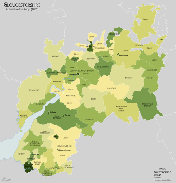
Size of this preview: 578 × 600 pixels. Other resolutions: 231 × 240 pixels | 462 × 480 pixels | 740 × 768 pixels | 986 × 1,024 pixels | 1,999 × 2,075 pixels.
Original file (1,999 × 2,075 pixels, file size: 731 KB, MIME type: image/png)
File history
Click on a date/time to view the file as it appeared at that time.
| Date/Time | Thumbnail | Dimensions | User | Comment | |
|---|---|---|---|---|---|
| current | 21:23, 14 December 2012 |  | 1,999 × 2,075 (731 KB) | XrysD | Changed Bristol and Gloucester to "County of Itself". Increased line width. Fixed extraneous white strip. |
| 19:43, 29 November 2012 |  | 2,000 × 2,056 (693 KB) | XrysD | Added other extant boroughs (Berkeley, Chipping Sodbury, Dursley, Wickwar, Winchcomcbe). Extant status as defined by The National Gazetteer of Great Britain and Ireland (1868) | |
| 23:02, 28 November 2012 |  | 2,000 × 2,056 (675 KB) | XrysD | User created page with UploadWizard |
File usage
The following 11 pages use this file:
Global file usage
The following other wikis use this file:
- Usage on ca.wikipedia.org


You must be logged in to post a comment.