


The BR-116 is part of the Brazilian Highway System.[2] With at total length of 4,542 km (2,822 mi) it is the longest highway in the country.[3][1] It is also the longest highway in the country to be completely paved.
The highway connects Fortaleza, Ceará, one of the largest Northeast Brazil metropolises, to the southern city of Jaguarão, Rio Grande do Sul, on the border with Uruguay.
It is considered one of the most important, and busiest, highways in the country, along with BR-101.[4]
Route description
The BR-116 runs in a north-south direction, parallel to, but not on Brazil's coastline. It connects major urban centers, including Fortaleza, São Paulo, Rio de Janeiro, Curitiba and Porto Alegre.
Numerous stretches of the BR-116 highway have other official names.
The highway is especially busy along the section connecting Curitiba—São Paulo—Rio de Janeiro (via Teresópolis). The Curitiba–São Paulo section–officially known as the Régis Bittencourt Highway (Rodovia Régis Bittencourt)–is nicknamed the "Highway of Death" ("Rodovia da Morte") due to its many weather-related accidents. The São Paulo—Rio de Janeiro section is officially named President Dutra Highway (Rodovia Presidente Dutra) and is the busiest section of the BR-116, running into or close to 15 cities with over 200,000 inhabitants. The section between Novo Hamburgo and Porto Alegre is also heavily used, and there is a strong movement of cargo between Porto Alegre and the Port of Rio Grande, in Pelotas.[5][6]
Major cities directly served by the BR-116 are: Fortaleza, Chorozinho, Russas, Tucano, Itaobim, Governador Valadares, Realeza, Teresópolis, Rio de Janeiro, Barra Mansa, São Paulo, Juquiá, Curitiba, Mafra, Lages, Caxias do Sul, Pelotas, and Jaguarão.
Dual carriageway
In the Southeast Region of the country, the highway is a dual carriageway for 850 km between Curitiba in the south and Guapimirim in the north. This dual carriageway begins south of São Paulo and ends north of Rio de Janeiro thus connecting the two largest cities in Brazil. Between Curitiba and São Paulo its official name is Rodovia Régis Bittencourt. Between São Paulo and Rio de Janeiro its official name is Rodovia Presidente Dutra.
The highway is a dual carriageway for the 70 km between Guaíba and Novo Hamburgo.
In November 2022, 148 km, of the planned 211 km between Guaíba and Pelotas had been converted to a dual carriageway, with work continuing on the remaining portion.
Between Curitiba and Mandirituba, in the state of Santa Catarina, it is a dual carriageway.[7]
In the Northeast Region of the country, the highway is a dual carriageway for the 76 km between Feira de Santana and Argoim.
There is some dual carriageway near Fortaleza, Ceará.[8][9]
Privatization
On 1 March 1996, the stretch of highway between the cities of São Paulo and Rio de Janeiro, known as the Rodovia Presidente Dutra, was granted to private companies, with the CCR Nova Dutra company being the current administrator. On the same day, a 144 kilometer section between the cities of Duque de Caxias and Sapucaia was granted to a company named CRT.
Gallery
-
 BR-116 in São José dos Campos, São Paulo
 -
 Rodovia Presidente Dutra in São Paulo
 -

-

-
 BR-116 in Miradouro, Minas Gerais
 -
 BR-116 in Guapimirim, Rio de Janeiro
 -

-

-
 BR-116 in Santa Catarina
 -
 BR-116 in Vacaria, Rio Grande do Sul
 -
 BR-116 in Morro Reuter, Rio Grande do Sul
 -
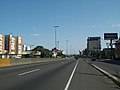 BR-116 in Canoas, Rio Grande do Sul


See also
References
- ^ a b "BR-116" (in Brazilian Portuguese). Banco de Informações e Mapas de Transportes/Ministry of Transport (Brazil). 2018. Archived from the original on 2013-01-27. Retrieved 22 November 2022.
- ^ "BR-116". Ministry of Transport. Archived from the original on 26 April 2011. Retrieved 7 June 2011.
- ^ "Qual é a maior rodovia do Brasil?" (in Brazilian Portuguese). O Estado de S.Paulo. 9 March 2022. Retrieved 22 November 2022.
- ^ Rodovias Longitudinais
- ^ Postal discute com bancada gaúcha alternativas à BR-116
- ^ DNIT libera mais 11,3 km de trecho duplicado na BR-116/RS
- ^ Duplicação da BR-116, no Paraná, resulta em uma rodovia mais segura
- ^ Obras de duplicação da BR-116/BA e do rodoanel da Feira de Santana (BA) são vistoriados pelo MInfra
- ^ Duplicação de trecho da BR-116 já dura 10 anos
| Radial highways (originating from Brasília) | |
|---|---|
| North-south highways | |
| East-west highways | |
| Diagonal highways | |
| Link highways |
|
| Authority control databases: National |
|---|
You must be logged in to post a comment.