


m →Mayors |
2003:55:c25:f01:ad72:9a5f:544c:7c9a (talk) No edit summary |
||
| Line 1: | Line 1: | ||
{{Infobox German location |
{{Infobox German location |
||
|Art = Stadt |
|Art = Stadt |
||
|image_photo = |
|image_photo = Wernigerode Stadtblick.JPG |
||
|image_caption = View |
|image_caption = View over Wernigerode |
||
|Wappen = Wernigerode Wappen.svg |
|Wappen = Wernigerode Wappen.svg |
||
|Wappengröße = 113 |
|Wappengröße = 113 |
||
| Line 37: | Line 37: | ||
The borough measures 9.5 km from west to east and 6 km from north to south. Its highest point is the [[Brocken]], at 1,141 metres above NN, and its lowest is at 215 metres. |
The borough measures 9.5 km from west to east and 6 km from north to south. Its highest point is the [[Brocken]], at 1,141 metres above NN, and its lowest is at 215 metres. |
||
| ⚫ | The town lies on the German-Dutch holiday road known as the [[Orange Route]]. The [[Northern Harz Boundary Fault]] crosses the borough along which the watershed between the Weser and Elbe runs. To the north precipitation flows into the Weser, to the southeast, later northeast, waters flow into the Elbe. This fault line runs through the quarter of Hasserode. It can be made out in the east of the town at the Schloßberg. |
||
The town lies on the German-Dutch holiday road known as the [[Orange Route]]. |
|||
| ⚫ | The [[Northern Harz Boundary Fault]] crosses the borough along which the watershed between the Weser and Elbe runs. To the north precipitation flows into the Weser, to the southeast, later northeast, waters flow into the Elbe. This fault line runs through the quarter of Hasserode. It can be made out in the east of the town at the Schloßberg. |
||
The North Harz Fault cuts through the borough along which the watershed between Weser and Elbe rivers runs. To the north of the fault line, the precipitation flows into the Weser; to the southeast, later northeast, waters flow into the Elbe. This fault runs through the suburb of Hasserode. To the east it is manifested in the town's castle hill. |
The North Harz Fault cuts through the borough along which the watershed between Weser and Elbe rivers runs. To the north of the fault line, the precipitation flows into the Weser; to the southeast, later northeast, waters flow into the Elbe. This fault runs through the suburb of Hasserode. To the east it is manifested in the town's castle hill. |
||
[[File: |
[[File:WenigerodeWinterViewFromCastle.jpg|thumb|right|Wernigerode and the [[Brocken]] in winter]] |
||
=== Town divisions === |
=== Town divisions === |
||
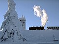
[[File:Lok 99 222 im Bahnhof Wernigerode.jpg|thumb|right|320px| Lok 99 222 at Central Station in Wernigerode, Germany]] |
|||
The borough of Wernigrode is divided into the town itself, including the villages of [[Hasserode]] and [[Nöschenrode]] incorporated before 1994 and five villages with their own parish councils that were integrated in 1994: [[Benzingerode]], [[Minsleben]], [[Reddeber]], [[Schierke]] and [[Silstedt]].<ref>[http://www.wernigerode.de/media/dokumente/ortsrechtsatzungen/0_verwaltung/hauptsatzung.pdf Hauptsatzung Stadt Wernigerode] (PDF; 88 KB); accessed on 30 March 2011</ref> |
The borough of Wernigrode is divided into the town itself, including the villages of [[Hasserode]] and [[Nöschenrode]] incorporated before 1994 and five villages with their own parish councils that were integrated in 1994: [[Benzingerode]], [[Minsleben]], [[Reddeber]], [[Schierke]] and [[Silstedt]].<ref>[http://www.wernigerode.de/media/dokumente/ortsrechtsatzungen/0_verwaltung/hauptsatzung.pdf Hauptsatzung Stadt Wernigerode] (PDF; 88 KB); accessed on 30 March 2011</ref> |
||
| Line 155: | Line 152: | ||
== History == |
== History == |
||
| ⚫ | |||
[[File:Fotothek df roe-neg 0006140 011 Blick aus der Altstadt zum Schloss.jpg|thumb|right|Wernigerode in 1951]] |
|||
Wernigerode was the capital of the medieval [[County of Wernigerode]] and [[Stolberg-Wernigerode]]. In 1815, after the [[Napoleonic Wars]], it became part of the [[Prussia]]n [[Province of Saxony]]. The [[Hasseröder]] brewery was founded in Wernigerode in 1872. |
Wernigerode was the capital of the medieval [[County of Wernigerode]] and [[Stolberg-Wernigerode]]. In 1815, after the [[Napoleonic Wars]], it became part of the [[Prussia]]n [[Province of Saxony]]. The [[Hasseröder]] brewery was founded in Wernigerode in 1872. |
||
| Line 160: | Line 159: | ||
=== Emergence of the town === |
=== Emergence of the town === |
||
| ⚫ | |||
There are no written sources confirming exactly when the town was established. According to the latest research – for example, by Eduard Jacobs and Walther Grosse – there were no early relations with the Abbey at [[Corvey]] ([[Weser]]) and the abbot there, [[Warin I of Corvey|Warin]], instead the town name suggests it was a protected clearance settlement. |
There are no written sources confirming exactly when the town was established. According to the latest research – for example, by Eduard Jacobs and Walther Grosse – there were no early relations with the Abbey at [[Corvey]] ([[Weser]]) and the abbot there, [[Warin I of Corvey|Warin]], instead the town name suggests it was a protected clearance settlement. |
||
| Line 168: | Line 166: | ||
As a result of the immigration of new townsfolk from the surrounding villages a new settlement, later called ''Neustadt'', grew up on the northeastern edge of the old town. It was a farming settlement that lay outside the walls of the old town. [[St. John's Church, Wernigerode|St. John's Church]] was built as the parish church of Wernigerode's Neustadt in the last third of the 13th century in the [[Romanesque architecture|Romanesque]] style. |
As a result of the immigration of new townsfolk from the surrounding villages a new settlement, later called ''Neustadt'', grew up on the northeastern edge of the old town. It was a farming settlement that lay outside the walls of the old town. [[St. John's Church, Wernigerode|St. John's Church]] was built as the parish church of Wernigerode's Neustadt in the last third of the 13th century in the [[Romanesque architecture|Romanesque]] style. |
||
<!-- |
|||
=== Vom Spätmittelalter zur Neuzeit === |
|||
Nach dem Aussterben der [[Grafschaft Wernigerode|Grafen von Wernigerode]] in männlicher Linie durch den Tod des Grafen [[Heinrich von Wernigerode|Heinrich]] 1429 wurde Wernigerode Sitz der [[Grafen zu Stolberg]], die über Jahrhunderte hier die Oberherrschaft ausübten. Im [[Bauernkrieg]] 1525 wurden mehrere umliegende Klöster geplündert und teilweise zerstört, so insbesondere das [[Kloster Himmelpforten (Harz)|Kloster Himmelpforten]] im heutigen Stadtteil Hasserode. Plünderungen im [[Dreißigjähriger Krieg|Dreißigjährigen Krieg]] und Zerstörungen durch Brände brachten großes Leid über die hier ansässige Bevölkerung. |
|||
Von 1658 bis 1931 bestand in der Stadt ein [[Konsistorium#Gliedkirchen der Evangelischen Kirche in Deutschland|Konsistorium]] für die Leitung der lutherischen Kirche in der [[Grafschaft Wernigerode]]. Die evangelischen Kirchengemeinden im Gebiet der Grafschaft gehörten nach der Gründung der [[Unierte Kirchen (evangelisch)|unierten]] [[Evangelische Kirche in Preußen|Evangelischen Kirche in Preußen]] 1821 zu deren [[Evangelische Kirche der Kirchenprovinz Sachsen|Kirchenprovinz Sachsen]]. Das Konsistorium jedoch bestand mit regionaler Zuständigkeit für diese Kirchengemeinden noch bis zur Auflösung 1921 fort. |
|||
1714 musste Graf [[Christian Ernst zu Stolberg-Wernigerode]] in einem [[Rezess]] die Oberhoheit [[Brandenburg-Preußen]]s über die Grafschaft Wernigerode anerkennen. |
|||
[[Datei:Wernigerode1900.jpg|thumb|Wernigerode um 1900]] |
|||
Von 1807 bis 1813 war Wernigerode in den [[Stadtkanton Wernigerode]] des [[Königreich Westphalen]] integriert, bevor die Stadt dem neugebildeten preußischen [[Kreis Osterwieck]] der preußischen [[Provinz Sachsen]] zugeordnet wurde. Erst nach Einspruch des Grafen [[Henrich zu Stolberg-Wernigerode]] wurde Wernigerode 1825 wieder Sitz eines eigenen Landkreises innerhalb des [[Regierungsbezirk Magdeburg|Regierungsbezirks Magdeburg]]. |
|||
Am 29. März 1847 fiel ein Teil der Stadt, vor allem das Heideviertel, einem großen Brand zum Opfer. |
|||
In der zweiten Hälfte des 19. Jahrhunderts setzte in Wernigerode neben dem Tourismus die industrielle Entwicklung (unter anderem Maschinen- und Werkzeugbau, Elektromotoren, pharmazeutische Produkte, Schokolade, Schreibwaren, Baustoffe) ein, die zu einem wesentlichen Aufschwung der Stadt als Tourismuszentrum und Wirtschaftsstandort führten. |
|||
=== 20. Jahrhundert === |
|||
[[Datei:Wernigerode Sehenswürdigkeiten Handwerk und Fackwerkhäuser in der Altstadt Foto 2005 Wolfgang Pehlemann PICT0012.jpg|thumb|right|Blick in die Wernigeröder Altstadt]] |
|||
Während des [[Zweiter Weltkrieg|Zweiten Weltkrieges]] wurden in den ''Rautalwerken GmbH'' (auch ''Wernigwerke AG'' genannt), die 1938 zu einer modernen Leichtmetallgießerei ausgebaut worden waren, Zulieferteile für die Rüstungsindustrie gefertigt, vornehmlich durch [[Zwangsarbeiter]] und [[Konzentrationslager|KZ-Häftlinge]]. Diese lebten in einem Barackenlager am ''Ziegenberg''. 1942 wurde ein weiteres Barackenlager am ''Veckenstedter Weg 23'' errichtet, das 1943 zu einem [[Liste der Außenlager des KZ Buchenwald|Außenlager]] (Tarnbezeichnung „Richard“) des [[KZ Buchenwald]] umfunktioniert wurde. Von anfänglich 95 Häftlingen steigerte sich die Belegung bis auf 800 Personen, die vor allem beim Bau von Luftschutzstollen am ''Galgenberg'' eingesetzt wurden. Die Häftlinge vom Veckenstedter Weg wurden im Dezember 1944 in das Lager „Steinerne Renne“ verlegt, das im Stadtteil [[Hasserode]] als Außenstelle der ''Wernig-Werke'' genutzt wurde. Hier führten sie die Produktion von Zulieferteilen für Raketen fort, die zuvor von 200 Zwangsarbeitern geleistet worden war. Die 500 Häftlinge wurden kurz vor Eintreffen der US-Truppen in Richtung [[KZ Theresienstadt]] in Marsch gesetzt, wo nur noch 57 lebend ankamen. |
|||
Am Brockenweg 1 befand sich vom 1. September 1937 bis zum 13. Mai 1945 das [[Lebensborn]]heim ''Harz'', das von der SS-Organisation Lebensborn e.V. betrieben wurde.<ref >[http://www.lebensspuren-deutschland.eu/unten6.html Lebensbornheime in Deutschland]</ref><ref>[http://www.fr-online.de/politik/doku---debatte/ungeliebte-deutschenkinder/-/1472608/3043420/-/index.html Ungeliebte Deutschenkinder], in [[Frankfurter Rundschau]] am 27. Juni 2008, Seite 12.</ref><ref >[http://www.faz.net/s/Rub02DBAA63F9EB43CEB421272A670A685C/Doc~EE992EABD7A244511A4827145713F9B7F~ATpl~Ecommon~Scontent.html Die Patenkinder der SS], in [[FAZ]].NET am 20. September 2010.</ref> |
|||
Am 24. Februar 1944 erlebte Wernigerode einen [[Luftangriff]]. Das repräsentative Brau- und Bürgerhaus Breite Straße 78 wurde zerstört, die Ruine später abgetragen. Der Westteil der Orangerie wurde schwer beschädigt.<ref>Renate Kroll in „Schicksale deutscher Baudenkmale im Zweiten Weltkrieg“. Hrsg. Götz Eckardt, Henschel-Verlag, Berlin 1978. Band 1, S. 273-274</ref> |
|||
--> |
|||
<!-- === Religionen === --> |
|||
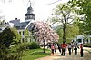
=== Mayors === |
=== Mayors === |
||
| Line 240: | Line 212: | ||
==Architecture== |
==Architecture== |
||
[[Image: |
[[Image:Wernigerode (2013-06-03), by Klugschnacker in Wikipedia (14).JPG|thumb|right|Town hall and Marketplace]] |
||
Wernigerode contains several interesting [[Gothic architecture|Gothic]] buildings, including a fine town hall with a timber facade from 1498. Some of the quaint old houses which have escaped the numerous fires through the years are elaborately adorned with wood-carving.{{sfn|Chisholm|1911}} The [[Gerhart-Hauptmann]] [[gymnasium (school)|Gymnasium]],<ref>http://www.gerhart-hauptmann-gymnasium.de</ref> occupying a modern Gothic building, is the successor to an ancient grammar school in existence until 1825. [[Brandy]], Hasseröder lager, [[cigar]]s and [[dye]]s are among the products manufactured in Wernigerode. The castle (Schloß Wernigerode) of the princes of [[Stolberg-Wernigerode]] rises above the town.{{sfn|Chisholm|1911}} The original was built in the 12th century but the present castle was built between 1862 and 1893 by [[Karl Frühling]] and includes parts of the medieval building. |
Wernigerode contains several interesting [[Gothic architecture|Gothic]] buildings, including a fine town hall with a timber facade from 1498. Some of the quaint old houses which have escaped the numerous fires through the years are elaborately adorned with wood-carving.{{sfn|Chisholm|1911}} The [[Gerhart-Hauptmann]] [[gymnasium (school)|Gymnasium]],<ref>http://www.gerhart-hauptmann-gymnasium.de</ref> occupying a modern Gothic building, is the successor to an ancient grammar school in existence until 1825. [[Brandy]], Hasseröder lager, [[cigar]]s and [[dye]]s are among the products manufactured in Wernigerode. The castle (Schloß Wernigerode) of the princes of [[Stolberg-Wernigerode]] rises above the town.{{sfn|Chisholm|1911}} The original was built in the 12th century but the present castle was built between 1862 and 1893 by [[Karl Frühling]] and includes parts of the medieval building. |
||
==Sights== |
==Sights== |
||
| ⚫ | |||
* [[Harzer Schmalspurbahnen|Harzer Schmalspurbahn]] - a [[narrow gauge railways|narrow gauge railway]] that leads from Wernigerode to the [[Brocken]] (1141 m), the highest peak in the [[Harz Mountains]], and then goes to [[Nordhausen]] to the south of the Harz mountains. The second highest peak, [[Wurmberg (Harz)|Wurmberg]] (971 m), is accessible by [[Wurmberg cable car|cable car]] from [[Braunlage]] which is connected by bus to Wernigerode. Wernigerode has numerous museums, galleries, libraries, monuments and parks.{{Specify|date=January 2010}} |
* [[Harzer Schmalspurbahnen|Harzer Schmalspurbahn]] - a [[narrow gauge railways|narrow gauge railway]] that leads from Wernigerode to the [[Brocken]] (1141 m), the highest peak in the [[Harz Mountains]], and then goes to [[Nordhausen]] to the south of the Harz mountains. The second highest peak, [[Wurmberg (Harz)|Wurmberg]] (971 m), is accessible by [[Wurmberg cable car|cable car]] from [[Braunlage]] which is connected by bus to Wernigerode. Wernigerode has numerous museums, galleries, libraries, monuments and parks.{{Specify|date=January 2010}} |
||
* [[Armeleuteberg]] - hill with an [[Emperor Tower]] and forest inn. |
* [[Armeleuteberg]] - hill with an [[Emperor Tower]] and forest inn. |
||
<gallery widths="100px" heights="100px"> |
|||
| ⚫ | |||
File:Wernigerode Blick vom Schloss by Stepro 05.jpg|View over the old town of Wernigerode |
|||
File:Wernigerode-Rathaus-2010-Nacht-Pano.JPG|Town hall at night |
|||
File:CampusWernigerode.jpg|The Campus Wernigerode is part of the [[Hochschule Harz]] |
|||
File:HasseroederBrauerei.jpg|The [[Hasseröder]] brewery in Wernigerode |
|||
</gallery> |
|||
==Culture== |
==Culture== |
||
Revision as of 12:48, 16 August 2014
Wernigerode (Template:IPA-de) is a town in the district of Harz, Saxony-Anhalt, Germany. Until 2007, it was the capital of the district of Wernigerode.[citation needed] Its population was 35,500 in 1999.
Wernigerode is located southwest of Halberstadt, and is picturesquely situated on the Holtemme river, on the north slopes of the Harz Mountains. Wernigerode is located on the German Timber-Frame Road.[2]
Geography
Location

The town lies at about 250 metres above sea level (NN) on the northeastern flank of the Harz Mountains in central Germany, at the foot of their highest peak, the Brocken, on the B 6 and B 244 federal highways and on the railway line from Halberstadt to Vienenburg that links the cities of Halle (Saale) and Hanover.
The River Holtemme flows through the town and, not far from its western gate, it is joined by the Zillierbach stream, which is also known as the Flutrenne near its mouth. North of the town the Barrenbach flows through several ponds and empties into the Holtemme in the village of Minsleben. The historic town centre consists of an old town and a new town (Altstadt and Neustadt). The town's borough includes Hasserode, Nöschenrode, the residential estates of Stadtfeld, Burgbreite and Harzblick as well as the villages of Benzingerode, Minsleben, Silstedt, Schierke and Reddeber.
The borough measures 9.5 km from west to east and 6 km from north to south. Its highest point is the Brocken, at 1,141 metres above NN, and its lowest is at 215 metres.
The town lies on the German-Dutch holiday road known as the Orange Route. The Northern Harz Boundary Fault crosses the borough along which the watershed between the Weser and Elbe runs. To the north precipitation flows into the Weser, to the southeast, later northeast, waters flow into the Elbe. This fault line runs through the quarter of Hasserode. It can be made out in the east of the town at the Schloßberg.
The North Harz Fault cuts through the borough along which the watershed between Weser and Elbe rivers runs. To the north of the fault line, the precipitation flows into the Weser; to the southeast, later northeast, waters flow into the Elbe. This fault runs through the suburb of Hasserode. To the east it is manifested in the town's castle hill.

Town divisions
The borough of Wernigrode is divided into the town itself, including the villages of Hasserode and Nöschenrode incorporated before 1994 and five villages with their own parish councils that were integrated in 1994: Benzingerode, Minsleben, Reddeber, Schierke and Silstedt.[3]
Climate

Wernigerode is located in the Central European transition subzone of the temperate climatic zone.[4] Its average annual temperature is 9.5 ºC; its average annual precipitation is 500 millimetres.
The warmest months are June to August with average temperatures of 16.0 to 18.3 ºC and the coldest are December to February at 1.1 to 2.1 ºC.
The most rain falls in July, on average 54 millimetres, the least in February, with 30 millimetres on average.
The climate, more precisely the amounts of precipitation and temperatures, are influenced by the orographic rainfall caused by the Harz Mountains. Because the town lies in the rain shadow (leeward side) of the Harz, less precipitation falls here than in similar temperate regions without the protection of a mountain range. In addition the occasional föhn winds that occur result in an increase in temperatures.
| Climate data for Wernigerode | |||||||||||||
|---|---|---|---|---|---|---|---|---|---|---|---|---|---|
| Month | Jan | Feb | Mar | Apr | May | Jun | Jul | Aug | Sep | Oct | Nov | Dec | Year |
| Mean daily maximum °F | 39 | 41 | 46 | 57 | 64 | 70 | 75 | 75 | 66 | 57 | 46 | 39 | 56 |
| Mean daily minimum °F | 28 | 30 | 34 | 39 | 46 | 52 | 55 | 55 | 50 | 43 | 37 | 32 | 42 |
| Average precipitation inches | 1.5 | 1.2 | 1.8 | 1.4 | 1.8 | 1.9 | 2.1 | 1.7 | 1.4 | 1.3 | 1.9 | 1.7 | 19.7 |
| Mean daily maximum °C | 4 | 5 | 8 | 14 | 18 | 21 | 24 | 24 | 19 | 14 | 8 | 4 | 14 |
| Mean daily minimum °C | −2 | −1 | 1 | 4 | 8 | 11 | 13 | 13 | 10 | 6 | 3 | 0 | 6 |
| Average precipitation mm | 37 | 30 | 46 | 35 | 46 | 47 | 54 | 43 | 36 | 34 | 49 | 43 | 500 |
| Average rainy days | 14 | 14 | 16 | 13 | 13 | 13 | 15 | 13 | 12 | 13 | 16 | 17 | 169 |
| Mean monthly sunshine hours | 56.5 | 84.75 | 113 | 141.25 | 169.5 | 197.75 | 197.75 | 169.5 | 141.25 | 113 | 56.5 | 56.5 | 1,497.25 |
| Source: [5] | |||||||||||||
Wernigerode has a snow load class of 3 according to the German industrial standard, DIN 1055.
History


Wernigerode was the capital of the medieval County of Wernigerode and Stolberg-Wernigerode. In 1815, after the Napoleonic Wars, it became part of the Prussian Province of Saxony. The Hasseröder brewery was founded in Wernigerode in 1872.
After World War II, Wernigerode was included in the new state Saxony-Anhalt. During the time of Communist East Germany, the town was very close to the inner German border. Wernigerode became part of the restored state of Saxony-Anhalt in 1990 after German reunification.
Emergence of the town
There are no written sources confirming exactly when the town was established. According to the latest research – for example, by Eduard Jacobs and Walther Grosse – there were no early relations with the Abbey at Corvey (Weser) and the abbot there, Warin, instead the town name suggests it was a protected clearance settlement.
The first area to be settle was the Klint, where there was a lowland castle, the so-called Schnakenburg. In 1805 the ruins of this castle site were demolished. The only part remaining is Haus Gadenstedt at Oberpfarrkirchhof 12 which dates to the year 1582. At the time of the first settlelement there was still ancient forest, typical of the Harz, on the heights of the Klint, which had first to be cleared, hence the suffix -rode in the town name which means "clearing".
The town was first mentioned in the records in 1121 in connexion with Count Adalbert of Haimar who had moved here from the region near Hildesheim and henceforth was titled the Count of Wernigerode. On 17 April 1229 the settlement was granted town rights along the lines of that for Goslar. In 2004 Wernigerode celebrated the 775th anniversary of that occasion.
As a result of the immigration of new townsfolk from the surrounding villages a new settlement, later called Neustadt, grew up on the northeastern edge of the old town. It was a farming settlement that lay outside the walls of the old town. St. John's Church was built as the parish church of Wernigerode's Neustadt in the last third of the 13th century in the Romanesque style.
Mayors
- Runden, circa 1640[6]
- Ludwig Gepel, 7 January 1921 to 6 January 1933
- Ulrich von Fresenius (1 September 1888; died 12 November 1962), 10 January 1933 to 20 April 1945
- Max Otto (1889-1969), SPD/SED, 20 April 1945 to 1951
- Gustav Strahl, 1951 to 1962
- Martin Kilian, SED, 24 October 1962 to 1990
- Herbert Teubner, CDU, 1990 to 1991
- Horst-Dieter Weyrauch, CDU, 1991 to 1994
- Ludwig Hoffmann, SPD, 1994 to 31 July 2008
- Peter Gaffert, independent, since 1 August 2008
Population statistics
|
|
|
Architecture

Wernigerode contains several interesting Gothic buildings, including a fine town hall with a timber facade from 1498. Some of the quaint old houses which have escaped the numerous fires through the years are elaborately adorned with wood-carving.[2] The Gerhart-Hauptmann Gymnasium,[7] occupying a modern Gothic building, is the successor to an ancient grammar school in existence until 1825. Brandy, Hasseröder lager, cigars and dyes are among the products manufactured in Wernigerode. The castle (Schloß Wernigerode) of the princes of Stolberg-Wernigerode rises above the town.[2] The original was built in the 12th century but the present castle was built between 1862 and 1893 by Karl Frühling and includes parts of the medieval building.
Sights
- Harzer Schmalspurbahn - a narrow gauge railway that leads from Wernigerode to the Brocken (1141 m), the highest peak in the Harz Mountains, and then goes to Nordhausen to the south of the Harz mountains. The second highest peak, Wurmberg (971 m), is accessible by cable car from Braunlage which is connected by bus to Wernigerode. Wernigerode has numerous museums, galleries, libraries, monuments and parks.[specify]
- Armeleuteberg - hill with an Emperor Tower and forest inn.
-
 Top of the Brocken with the Brockenbahn, which starts in Wernigerode
 -
 View over the old town of Wernigerode
 -
 Town hall at night
 -
 The Campus Wernigerode is part of the Hochschule Harz
 -
 The Hasseröder brewery in Wernigerode


Culture
Wernigerode is the home of the choir Rundfunk-Jugendchor Wernigerode.
Natural monuments
- Steinerne and Kleine Renne, and the nearby well of Wernigeröder Bürgerbrunnen
- Ottofels, rock formation with extensive views over the Harz
- Mönchsbuche, a protected beech on the old monk's way
Sport
Wernigerode hosts the Brocken Marathon each October. Wernigerode also has had an American Football club, The Mountain Tigers, since 1993. During the last 19 years this team has played in Germany's Oberliga 4 and Regionaliga 3. Since its inception, it has been a mainstay for American football in the Harz region.
International relations
Wernigerode is twinned with:
 Carpi, Emilia-Romagna, Italy, since 1964
 Cisnădie, Romania, since 2002
 Neustadt an der Weinstraße, Germany, since 1998
Notes
- ^ "Bevölkerung der Gemeinden – Stand: 31. Dezember 2022" (PDF) (in German). Statistisches Landesamt Sachsen-Anhalt. June 2023.
- ^ a b c Chisholm 1911.
- ^ Hauptsatzung Stadt Wernigerode (PDF; 88 KB); accessed on 30 March 2011
- ^ Klimaklassifikation nach E. Neef. Siehe m-forkel.de: Klimazonen
- ^ Klimatabelle auf Grundlage der Daten des Klimarechners von wetteronline.de mit Daten für Wernigerode für den Zeitraum von Jan. 1990 bis Dez. 2006
- ^ http://www.myheritage.dk/person-1000257_176701832_176701832/ukendt-runden
- ^ http://www.gerhart-hauptmann-gymnasium.de
References
- Attribution
- This article incorporates text from a publication now in the public domain: Chisholm, Hugh, ed. (1911). "Wernigerode". Encyclopædia Britannica (11th ed.). Cambridge University Press.
External links
Towns and municipalities in the district of Harz | ||
|---|---|---|
Town of Wernigerode | ||
|---|---|---|
You must be logged in to post a comment.