


Size of this preview: 276 × 598 pixels. Other resolutions: 110 × 240 pixels | 329 × 713 pixels.
Original file (329 × 713 pixels, file size: 27 KB, MIME type: image/png)
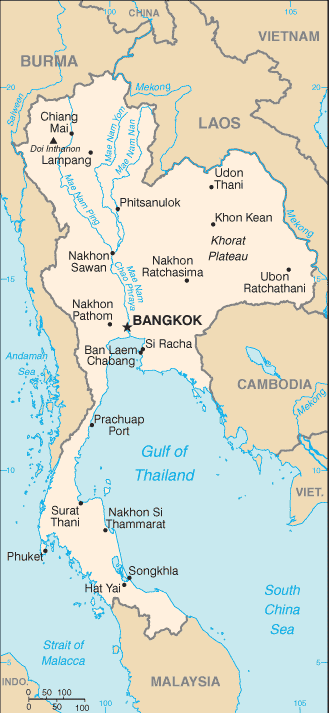
This image is in the public domain because it contains materials that originally came from the United States Central Intelligence Agency's World Factbook.
|
 |
File history
Click on a date/time to view the file as it appeared at that time.
| Date/Time | Thumbnail | Dimensions | User | Comment | |
|---|---|---|---|---|---|
| current | 02:20, 18 February 2006 | | 329 × 713 (27 KB) | Hoshie | Updated map of Thailand from the CIA World Factbook, 10 Jan 06 rev.: http://www.cia.gov/cia/publications/factbook/maps/th-map.gif |
| 09:18, 27 March 2005 |  | 331 × 708 (20 KB) | Wolfman~commonswiki | {{CIA-map}} |
File usage
The following 3 pages use this file:
Global file usage
The following other wikis use this file:
- Usage on ca.wikipedia.org
- Usage on en.wikisource.org
- Usage on en.wiktionary.org
- Usage on fa.wikipedia.org
- Usage on fo.wikipedia.org
- Usage on hi.wikipedia.org
- Usage on ilo.wikipedia.org
- Usage on ja.wikipedia.org
- Usage on ka.wikipedia.org
- Usage on kn.wikipedia.org
- Usage on ml.wikipedia.org
- Usage on ne.wikipedia.org
- Usage on nl.wikipedia.org
- Usage on or.wikipedia.org
- Usage on pl.wikipedia.org
- Usage on pt.wikipedia.org
- Usage on shn.wikipedia.org
- Usage on simple.wikipedia.org
- Usage on si.wikipedia.org
- Usage on sl.wikipedia.org
- Usage on th.wikipedia.org
- Usage on uz.wikipedia.org
You must be logged in to post a comment.