


Size of this PNG preview of this SVG file: 198 × 296 pixels. Other resolutions: 160 × 240 pixels | 321 × 480 pixels | 514 × 768 pixels | 685 × 1,024 pixels | 1,370 × 2,048 pixels.
Original file (SVG file, nominally 198 × 296 pixels, file size: 67 KB)
Summary
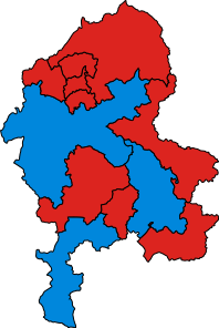
| Description | Map of Parliamentary constituencies in Staffordshire, showing the results by party in the general election of 2005. |
| Date | 4 May 2010 (original upload date) |
| Source | No machine-readable source provided. Own work assumed (based on copyright claims). |
| Author | No machine-readable author provided. Wereon assumed (based on copyright claims). |
Licensing
| I, the copyright holder of this work, release this work into the public domain. This applies worldwide. In some countries this may not be legally possible; if so: I grant anyone the right to use this work for any purpose, without any conditions, unless such conditions are required by law. |
File history
Click on a date/time to view the file as it appeared at that time.
| Date/Time | Thumbnail | Dimensions | User | Comment | |
|---|---|---|---|---|---|
| current | 14:00, 18 December 2019 | | 198 × 296 (67 KB) | The- | Cropped |
| 21:49, 27 January 2019 |  | 200 × 298 (75 KB) | The- | Fixed colours. | |
| 00:45, 4 May 2010 |  | 200 × 298 (75 KB) | Wereon | == {{int:filedesc}} == Map of Parliamentary constituencies in Staffordshire, showing the results by party in the general election of 2005. == {{int:license}} == {{PD-self}} Category:Locator maps of parliamentary constituencies of Staffordshire [[Cat |
File usage
The following 2 pages use this file:
Global file usage
The following other wikis use this file:
- Usage on fr.wikipedia.org
You must be logged in to post a comment.