


Size of this preview: 663 × 599 pixels. Other resolutions: 266 × 240 pixels | 531 × 480 pixels | 850 × 768 pixels | 1,060 × 958 pixels.
Original file (1,060 × 958 pixels, file size: 167 KB, MIME type: image/jpeg)
| Description |
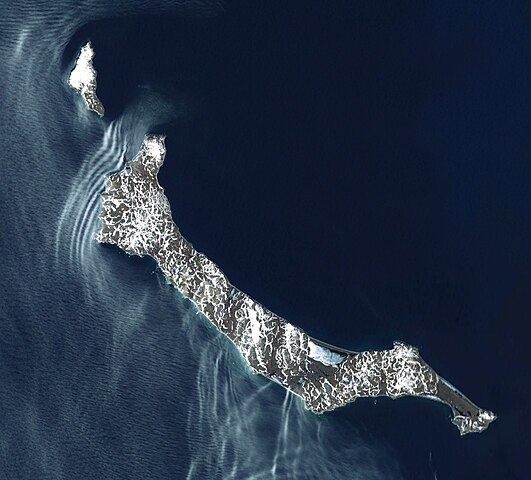
Deutsch: Satellitenbild der St.-Matthew-Insel (Alaska)
English: Satellite view of St. Matthew Island (Alaska) |
|||
| Date | ||||
| Source | NASA World Wind | |||
| Author | NASA World Wind, Screenshot by Carport | |||
| Permission (Reusing this file) |
|

File history
Click on a date/time to view the file as it appeared at that time.
| Date/Time | Thumbnail | Dimensions | User | Comment | |
|---|---|---|---|---|---|
| current | 18:42, 24 May 2010 | | 1,060 × 958 (167 KB) | Carport | {{Information |Description={{de|Satellitenbild der {{w|St.-Matthew-Insel|3=de}} (Alaska)}} {{en|Satellite view of {{w|St. Matthew Island}} (Alaska)}} |Source=NASA World Wind |Date=2010-05-24 |Author=NASA World Wind, Screenshot by {{u|Carport}} |Permission |
File usage
The following 2 pages use this file:
Global file usage
The following other wikis use this file:
- Usage on arz.wikipedia.org
- Usage on ca.wikipedia.org
- Usage on ceb.wikipedia.org
- Usage on de.wikipedia.org
- Usage on hy.wikipedia.org
- Usage on it.wikipedia.org
- Usage on ja.wikipedia.org
- Usage on pl.wikipedia.org
- Usage on ru.wikipedia.org
- Usage on sr.wikipedia.org
- Usage on www.wikidata.org
You must be logged in to post a comment.