


Size of this preview: 457 × 599 pixels. Other resolutions: 183 × 240 pixels | 366 × 480 pixels | 586 × 768 pixels | 781 × 1,024 pixels | 1,562 × 2,048 pixels | 4,500 × 5,900 pixels.
Original file (4,500 × 5,900 pixels, file size: 25.82 MB, MIME type: image/jpeg)
Summary
| Description |
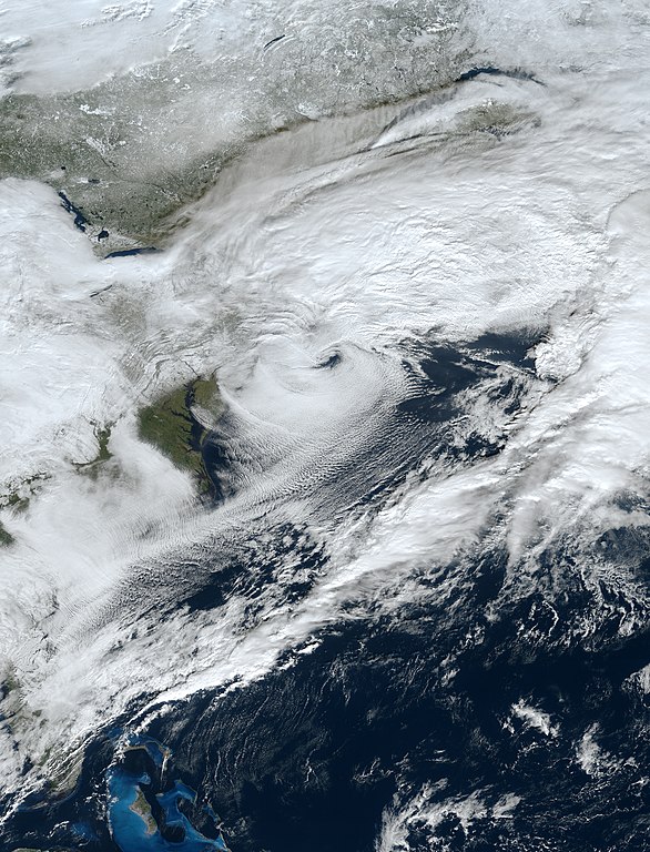
English: Visible satellite imagery of nor'easter impacting New England on Dec 16-17, 2020 |
| Date | |
| Source | https://www.star.nesdis.noaa.gov/GOES/sector.php?sat=G16§or=ne |
| Author | NOAA |
Licensing
This image is in the public domain because it contains materials that originally came from the U.S. National Oceanic and Atmospheric Administration, taken or made as part of an employee's official duties.
|
File history
Click on a date/time to view the file as it appeared at that time.
| Date/Time | Thumbnail | Dimensions | User | Comment | |
|---|---|---|---|---|---|
| current | 23:32, 17 December 2020 | | 4,500 × 5,900 (25.82 MB) | Supportstorm | Brighter image |
| 23:21, 17 December 2020 |  | 4,500 × 5,900 (22.29 MB) | Supportstorm | Image showing more of the system | |
| 16:15, 17 December 2020 |  | 2,400 × 2,400 (3.65 MB) | Wikicanada1127 | Uploaded a work by NOAA from https://www.star.nesdis.noaa.gov/GOES/sector.php?sat=G16§or=ne with UploadWizard |
File usage
The following 4 pages use this file:
Global file usage
The following other wikis use this file:
- Usage on ru.wikipedia.org
- Usage on vi.wikipedia.org
- Usage on www.wikidata.org
You must be logged in to post a comment.