


Size of this preview: 800 × 506 pixels. Other resolutions: 320 × 203 pixels | 640 × 405 pixels | 1,024 × 648 pixels | 1,280 × 810 pixels | 2,560 × 1,620 pixels | 8,500 × 5,379 pixels.
Original file (8,500 × 5,379 pixels, file size: 4.79 MB, MIME type: image/jpeg)
Summary
| Description |
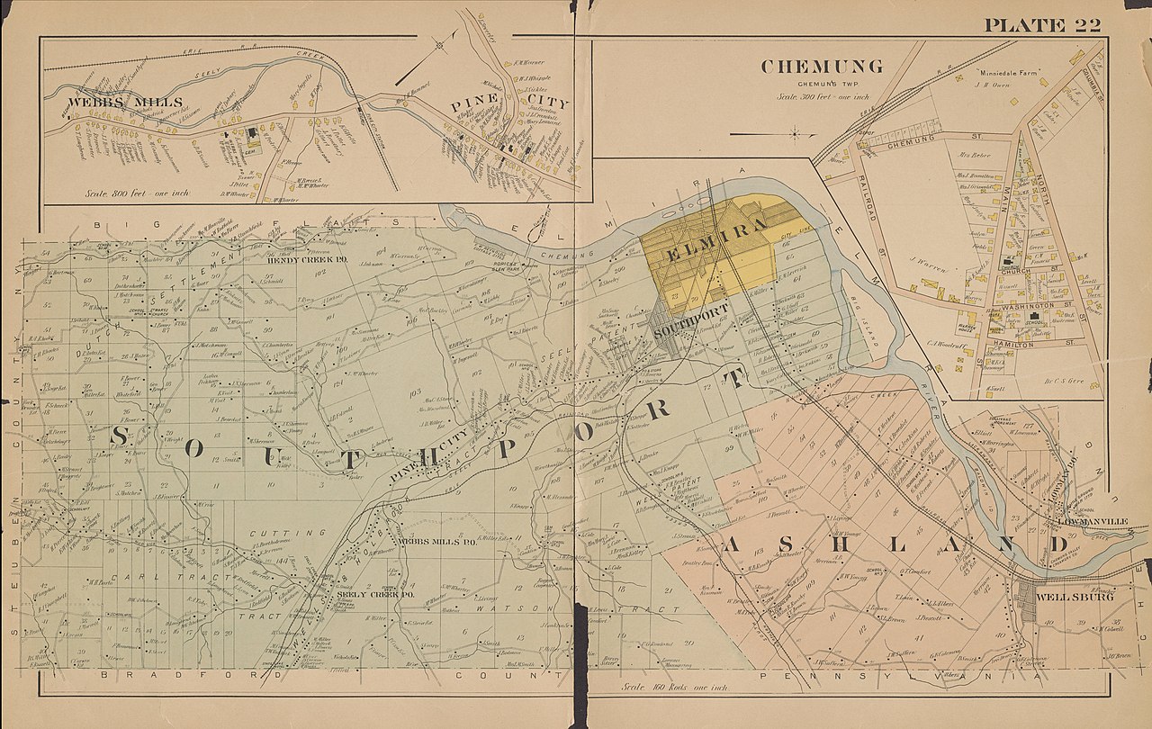
English: Plate 22 of the Atlas of Chemung County, New York : embracing detailed plans of the city of Elmira. From official records, private plans and surveys / under the direction and personal supervision of D. L. Miller, assisted by E. B. Foote, Thos. Flynn and A. R. Whipple from 1904. Includes Webbs Mills, Southport, Ashland, and Chemung. |
||
| Date | |||
| Source |
Chemung County Library District Collection on NYheritage.org https://cdm16694.contentdm.oclc.org/digital/collection/p15085coll7/id/122/rec/1 |
||
| Author | D. L. Miller & Co. | ||
| Permission (Reusing this file) |
|
File history
Click on a date/time to view the file as it appeared at that time.
| Date/Time | Thumbnail | Dimensions | User | Comment | |
|---|---|---|---|---|---|
| current | 21:00, 30 July 2021 | | 8,500 × 5,379 (4.79 MB) | Remitamine | Higher resolution version |
| 18:27, 18 March 2021 |  | 1,000 × 632 (94 KB) | Quailpop | Plate 22 of the Atlas of Chemung County, New York : embracing detailed plans of the city of Elmira. From official records, private plans and surveys / under the direction and personal supervision of D. L. Miller, assisted by E. B. Foote, Thos. Flynn and A. R. Whipple from 1904. Includes Webbs Mills, Southport, Ashland, and Chemung. <ref>https://cdm16694.contentdm.oclc.org/digital/collection/p15085coll7/id/122/rec/1</ref> <ref>Chemung County Library District Collection on NYheritage.org</ref> |
File usage
The following page uses this file:
You must be logged in to post a comment.