


Size of this preview: 800 × 533 pixels. Other resolutions: 320 × 213 pixels | 640 × 427 pixels | 1,024 × 682 pixels | 1,280 × 853 pixels | 2,560 × 1,706 pixels | 3,262 × 2,174 pixels.
Original file (3,262 × 2,174 pixels, file size: 2.46 MB, MIME type: image/jpeg)
Summary
| Description |
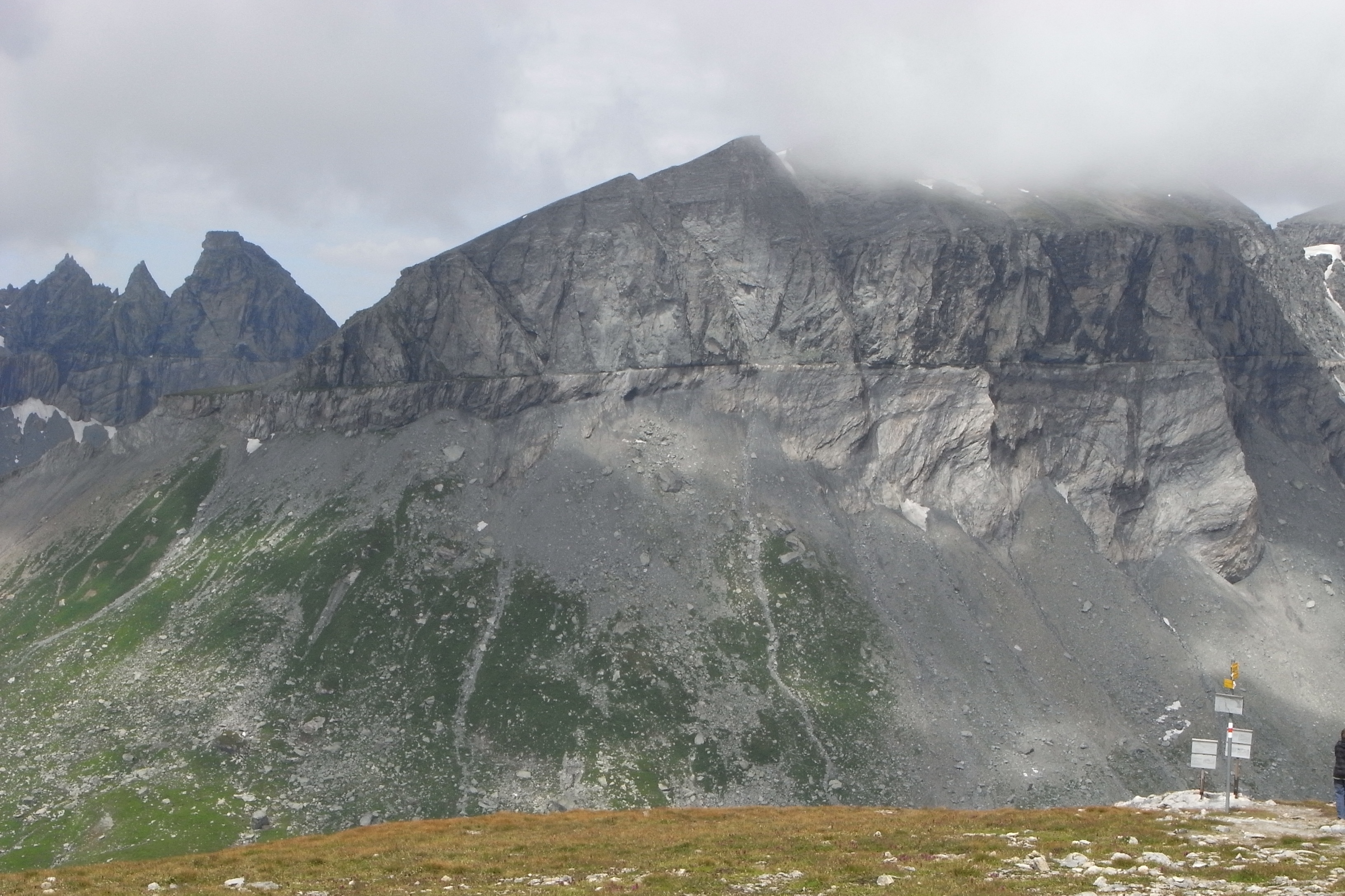
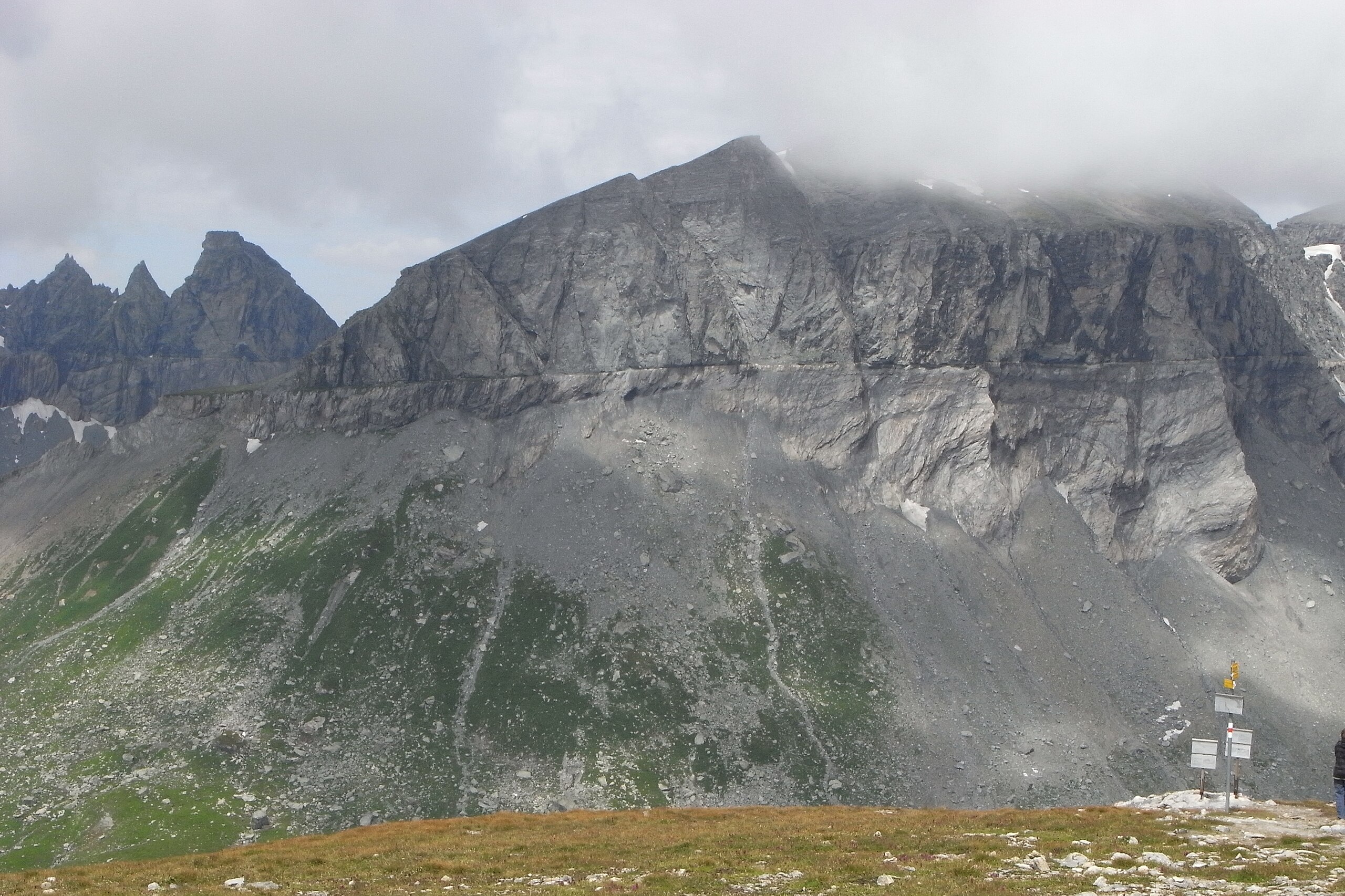
English: Glarus thrust fault at Tschingelhorn (left) and southern promontory of Piz Segnes (Atlas, center and right) seen from Fil de Cassons
Deutsch: Glarner Überschiebung an den Tschingelhörnern (links) und dem Südausläufer des Piz Segnas (Atlas, Mitte und rechts) von Fil de Cassons aus gesehen
|
| Original file name | STOLSOR |
| Date | |
| Source | Own work |
| Author | Hans G. Oberlack |
| Camera location | | View this and other nearby images on: OpenStreetMap |
|---|
Licensing
I, the copyright holder of this work, hereby publish it under the following licenses:
This file is licensed under the Creative Commons Attribution-Share Alike 3.0 Unported license.
- You are free:
- to share – to copy, distribute and transmit the work
- to remix – to adapt the work
- Under the following conditions:
- attribution – You must give appropriate credit, provide a link to the license, and indicate if changes were made. You may do so in any reasonable manner, but not in any way that suggests the licensor endorses you or your use.
- share alike – If you remix, transform, or build upon the material, you must distribute your contributions under the same or compatible license as the original.

|
Permission is granted to copy, distribute and/or modify this document under the terms of the GNU Free Documentation License, Version 1.2 or any later version published by the Free Software Foundation; with no Invariant Sections, no Front-Cover Texts, and no Back-Cover Texts. A copy of the license is included in the section entitled GNU Free Documentation License. |
You may select the license of your choice.
File history
Click on a date/time to view the file as it appeared at that time.
| Date/Time | Thumbnail | Dimensions | User | Comment | |
|---|---|---|---|---|---|
| current | 00:12, 28 June 2009 | | 3,262 × 2,174 (2.46 MB) | Hans G. Oberlack | {{Information |Description={{en|1=Glarus thrust fault between Tschingelhorn (left) and Piz Segnes (right)}} |Source=Own work by uploader |Author=Hans G. Oberlack |Date=2008-07-29 |Permission= |other_versions= }} <!--{{ImageUploa |
File usage
The following page uses this file:
Global file usage
The following other wikis use this file:
- Usage on cs.wikipedia.org
- Usage on de.wikipedia.org
- Usage on es.wikipedia.org
- Usage on he.wikipedia.org
- Usage on ko.wikipedia.org
- Usage on lt.wikipedia.org
- Usage on sl.wikipedia.org
- Usage on sv.wikipedia.org
- Usage on uk.wikipedia.org
You must be logged in to post a comment.