


Size of this PNG preview of this SVG file: 469 × 600 pixels. Other resolutions: 187 × 240 pixels | 375 × 480 pixels | 600 × 768 pixels | 800 × 1,024 pixels | 1,601 × 2,048 pixels | 512 × 655 pixels.
Original file (SVG file, nominally 512 × 655 pixels, file size: 31 KB)
Summary
| Description |
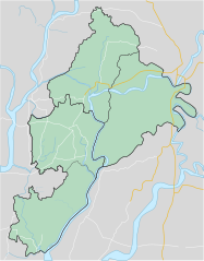
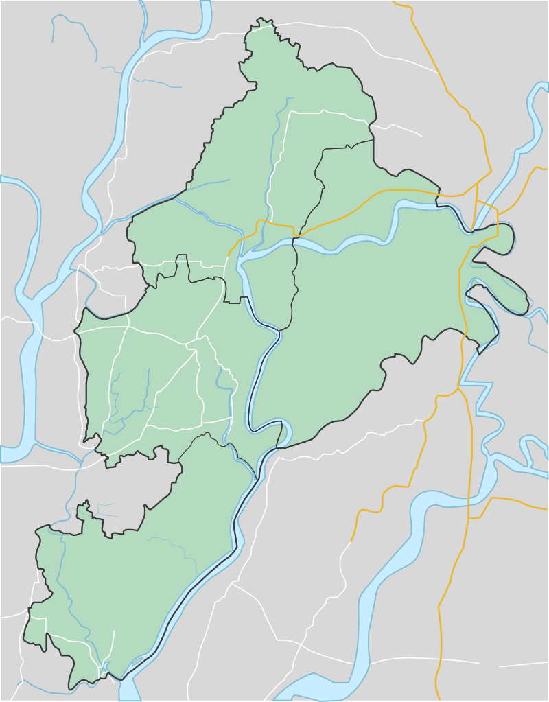
English: Jhalokati District in Barisal Division
বাংলা: বরিশাল বিভাগে ঝালকাঠী জেলার অবস্থান। |
| Date | |
| Source | Own work |
| Author | Syfur007 |
Licensing
I, the copyright holder of this work, hereby publish it under the following license:
This file is licensed under the Creative Commons Attribution-Share Alike 4.0 International license.
- You are free:
- to share – to copy, distribute and transmit the work
- to remix – to adapt the work
- Under the following conditions:
- attribution – You must give appropriate credit, provide a link to the license, and indicate if changes were made. You may do so in any reasonable manner, but not in any way that suggests the licensor endorses you or your use.
- share alike – If you remix, transform, or build upon the material, you must distribute your contributions under the same or compatible license as the original.
File history
Click on a date/time to view the file as it appeared at that time.
| Date/Time | Thumbnail | Dimensions | User | Comment | |
|---|---|---|---|---|---|
| current | 01:45, 6 September 2020 | | 512 × 655 (31 KB) | Syfur007 | New version!! |
| 20:47, 2 September 2020 |  | 512 × 564 (43 KB) | Syfur007 | Uploaded own work with UploadWizard |
File usage
The following 2 pages use this file:
Global file usage
The following other wikis use this file:
- Usage on bn.wikipedia.org
- Usage on si.wikipedia.org
- Usage on uz.wikipedia.org
You must be logged in to post a comment.