


Size of this PNG preview of this SVG file: 667 × 599 pixels. Other resolutions: 267 × 240 pixels | 534 × 480 pixels | 855 × 768 pixels | 1,140 × 1,024 pixels | 2,280 × 2,048 pixels | 2,569 × 2,308 pixels.
Original file (SVG file, nominally 2,569 × 2,308 pixels, file size: 350 KB)
Summary
| Description |
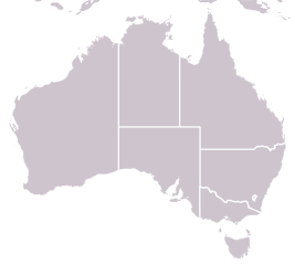
English: Equirectangular projection, N/S stretching 110 %. Geographic limits of the map:
Deutsch: Quadratische Plattkarte, N-S-Streckung 110 %. Geographische Begrenzung der Karte:
|
| Date | |
| Source | File:Australia_location_map.svg |
| Author | NordNordWest |
Licensing
This file is licensed under the Creative Commons Attribution-Share Alike 3.0 Unported license.
- You are free:
- to share – to copy, distribute and transmit the work
- to remix – to adapt the work
- Under the following conditions:
- attribution – You must give appropriate credit, provide a link to the license, and indicate if changes were made. You may do so in any reasonable manner, but not in any way that suggests the licensor endorses you or your use.
- share alike – If you remix, transform, or build upon the material, you must distribute your contributions under the same or compatible license as the original.
File history
Click on a date/time to view the file as it appeared at that time.
| Date/Time | Thumbnail | Dimensions | User | Comment | |
|---|---|---|---|---|---|
| current | 21:16, 30 March 2014 | | 2,569 × 2,308 (350 KB) | Ham105 | Increased state borders to 10pt |
| 13:23, 30 March 2014 |  | 2,569 × 2,308 (349 KB) | Ham105 | User created page with UploadWizard |
File usage
The following 23 pages use this file:
- 1997–98 Australian Baseball League season
- 1998–99 Australian Baseball League season
- 2010 Claxton Shield
- 2010–11 Australian Baseball League season
- 2011–12 Australian Baseball League season
- 2012–13 Australian Baseball League season
- 2013–14 Australian Baseball League season
- 2014–15 Australian Baseball League season
- 2015–16 Australian Baseball League season
- 2016–17 Australian Baseball League season
- 2017–18 Australian Baseball League season
- 2020–21 Australian Baseball League season
- 2021–22 Australian Baseball League season
- 2023–24 Australian Baseball League season
- 2024–25 Australian Baseball League season
- Otway Basin
- User:Afaber012/Sandbox
- User:Ham105/sandbox/p9
- User talk:Gaff/Map request
- Template:Australia locator map
- Template:Australia locator map/doc
- Module:Location map/data/Australia
- Module:Location map/data/Australia/doc
Global file usage
The following other wikis use this file:
- Usage on ab.wikipedia.org
- Usage on ast.wikipedia.org
- Usage on bh.wikipedia.org
- Usage on bn.wikipedia.org
- Usage on bs.wikipedia.org
- Usage on ca.wikipedia.org
- Usage on ceb.wikipedia.org
- Usage on ckb.wikipedia.org
- Usage on dty.wikipedia.org
- Usage on fo.wikipedia.org
- Usage on hi.wikipedia.org
- Usage on hr.wikipedia.org
- Usage on id.wikipedia.org
- Usage on ilo.wikipedia.org
- Usage on ja.wikipedia.org
- Usage on kn.wikipedia.org
- Usage on ku.wikipedia.org
- Usage on min.wikipedia.org
- Usage on ml.wikipedia.org
- Usage on ms.wikipedia.org
- Usage on my.wikipedia.org
- Usage on ne.wikipedia.org
- Usage on or.wikipedia.org
- Usage on pa.wikipedia.org
- Usage on sat.wikipedia.org
- Usage on sd.wikipedia.org
- Usage on simple.wikipedia.org
View more global usage of this file.
You must be logged in to post a comment.