


No higher resolution available.
Astley_Bridge_Mill_-_geograph.org.uk_-_964370.jpg (640 × 425 pixels, file size: 73 KB, MIME type: image/jpeg)
Summary
| Description |
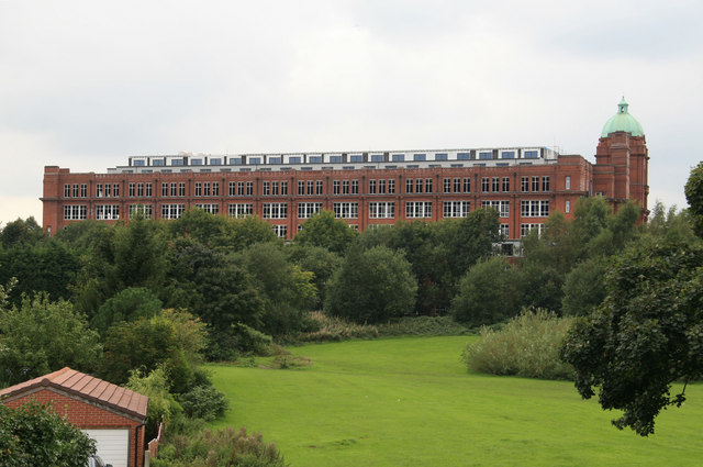
English: Astley Bridge Mill Another view of this mill also known as Sir John Holden's Mill and the last cotton spinning mill to be built in Bolton. The trees obscure the lower levels and the new penthouses are perhaps a little obtrusive. As stated before, this mill used grid electricity and it never possessed a typical mill chimney, although I've noticed a little brick stack in front of the water tower that might have serviced a central heating boiler. |
| Date | |
| Source | From geograph.org.uk |
| Author | Chris Allen |
| Attribution (required by the license) | Chris Allen / Astley Bridge Mill / |
| Camera location | | View this and other nearby images on: OpenStreetMap |
|---|
_heading:270.00&language=en)
| Object location | | View this and other nearby images on: OpenStreetMap |
|---|
_heading:270.00&language=en)
Licensing

|
This image was taken from the Geograph project collection. See this photograph's page on the Geograph website for the photographer's contact details. The copyright on this image is owned by Chris Allen and is licensed for reuse under the Creative Commons Attribution-ShareAlike 2.0 license.
|
This file is licensed under the Creative Commons Attribution-Share Alike 2.0 Generic license.
Attribution: Chris Allen
- You are free:
- to share – to copy, distribute and transmit the work
- to remix – to adapt the work
- Under the following conditions:
- attribution – You must give appropriate credit, provide a link to the license, and indicate if changes were made. You may do so in any reasonable manner, but not in any way that suggests the licensor endorses you or your use.
- share alike – If you remix, transform, or build upon the material, you must distribute your contributions under the same or compatible license as the original.
File history
Click on a date/time to view the file as it appeared at that time.
| Date/Time | Thumbnail | Dimensions | User | Comment | |
|---|---|---|---|---|---|
| current | 16:05, 22 February 2011 | | 640 × 425 (73 KB) | GeographBot | == {{int:filedesc}} == {{Information |description={{en|1=Astley Bridge Mill Another view of this mill also known as Sir John Holden's Mill and the last cotton spinning mill to be built in Bolton. The trees obscure the lower levels and the new penthouses a |
File usage
The following 2 pages use this file:
You must be logged in to post a comment.