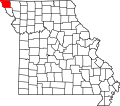
Phelps City is an unincorporated community in Atchison County, Missouri, United States. As of the 2020 census, its population was 0, down from 24 in 2010. [3] The community is 5 miles (8.0 km) west of Rock Port. It is the closest Missouri community to Brownville Bridge, a Missouri River crossing that is listed on the National Register of Historic Places.
History
Phelps City was platted in 1868.[4] The community was named for Willis Phelps, one of the owners of the town site.[5] A post office was established at Phelps City in 1868, and remained in operation until 1954.[6] The town was located along the main line of the Burlington Railroad. [7] The Missouri River floods of the 2010s, especially the 2019 flood, heavily affected this community and largely led to its diminution.
Demographics
| Census | Pop. | Note | %± |
|---|---|---|---|
| 2010 | 24 | — | |
| 2020 | 0 | −100.0% | |
| U.S. Decennial Census[8] | |||
Phelps City is no longer considered a census-designated place by the State of Missouri. [9]
Education
The school district is Rock Port R-II School District.[10] Rock Port High School is the zoned comprehensive high school.
References
- ^ "ArcGIS REST Services Directory". United States Census Bureau. Retrieved August 28, 2022.
- ^ a b "Phelps City". Geographic Names Information System. United States Geological Survey, United States Department of the Interior.
- ^ "Explore Census Data". data.census.gov. Retrieved December 16, 2021.
- ^ "Atchison County Place Names, 1928-1945 (archived)". The State Historical Society of Missouri. Archived from the original on June 24, 2016. Retrieved August 30, 2016.
{{cite web}}: CS1 maint: bot: original URL status unknown (link) - ^ Eaton, David Wolfe (1916). How Missouri Counties, Towns and Streams Were Named. The State Historical Society of Missouri. pp. 203.
- ^ "Post Offices". Jim Forte Postal History. Retrieved August 30, 2016.
- ^ Williams, Walter (1915). A History of Northwest Missouri Volume I. The Lewis Publishing Company. p. 334.
- ^ "Census of Population and Housing". Census.gov. Retrieved June 4, 2016.
- ^ https://www.sos.mo.gov/cmsimages/bluebook/2023-2024/8_Counties.pdf
- ^ "2020 CENSUS - SCHOOL DISTRICT REFERENCE MAP: Atchison County, MO" (PDF). U.S. Census Bureau. Retrieved December 15, 2024. - Text list


You must be logged in to post a comment.