


Mouth of the Pagee River
The Pagee River rises on the south eastern flank of Berry Hill (a 1,655 ft (504 m) summit) just below the 1,000 ft (300 m) contour at 18°17′42″N 76°55′41″W / 18.29488°N 76.92817°W near Crawle Pen in Saint Mary.[1] It reaches the sea 14 miles (23 km) later at Pagee Beach (18°22′06″N 76°52′46″W / 18.36845°N 76.87935°W) also in Saint Mary.[1][2]
Gallery
-
 Pagee Beach near Main St., Port Maria
 -
 Pagee Beach
 -
 D'Shore beach club
 -
 D'Shore beach club
 -
 Pagee Fishing Boats
 -
 Pagee Beach
 -
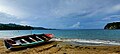
 Pagee Fishing Boats
 -
 Pagee Fishing Boats
 -
 Pagee Public Beach
 -
 PageePublicBeach sign


References
- ^ a b c d UK Directorate of Overseas Surveys 1:50,000 map of Jamaica sheet K, 1966.
- ^ "Pagee Beach". Wikimapia. Retrieved 13 December 2012.
You must be logged in to post a comment.