


No higher resolution available.
Wettonmill.jpg (640 × 480 pixels, file size: 145 KB, MIME type: image/jpeg)
| Description |
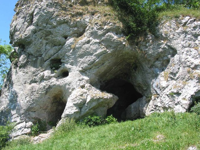
English: Caves at Wetton Mill, Staffordshire, England |
| Date | |
| Source | From geograph.org.uk |
| Author | Dennis Thorley |
| Permission (Reusing this file) |
Creative Commons Attribution Share-alike license 2.0 |
| Attribution (required by the license) | Dennis Thorley / Caves at Wetton Mill / |
| Camera location | | View this and other nearby images on: OpenStreetMap |
|---|

|
This image was taken from the Geograph project collection. See this photograph's page on the Geograph website for the photographer's contact details. The copyright on this image is owned by Dennis Thorley and is licensed for reuse under the Creative Commons Attribution-ShareAlike 2.0 license.
|
This file is licensed under the Creative Commons Attribution-Share Alike 2.0 Generic license.
Attribution: Dennis Thorley
- You are free:
- to share – to copy, distribute and transmit the work
- to remix – to adapt the work
- Under the following conditions:
- attribution – You must give appropriate credit, provide a link to the license, and indicate if changes were made. You may do so in any reasonable manner, but not in any way that suggests the licensor endorses you or your use.
- share alike – If you remix, transform, or build upon the material, you must distribute your contributions under the same or compatible license as the original.
Original upload log
The original description page was here. All following user names refer to en.wikipedia.
- 2008-10-22 08:09 Svejk74 640×480× (148184 bytes) {{Information |Description=Caves at Wetton Mill |Source=From [https://www.geograph.org.uk/photo/26675 geograph.org.uk] |Date=2005-06-27 |Author=[https://www.geograph.org.uk/profile/941 Dennis Thorley] |Permission=Creative Commons Attribution Share-alike lic
File history
Click on a date/time to view the file as it appeared at that time.
| Date/Time | Thumbnail | Dimensions | User | Comment | |
|---|---|---|---|---|---|
| current | 22:14, 30 October 2008 | | 640 × 480 (145 KB) | Angusmclellan | {{Information |Description={{en|Caves at Wetton Mill, Staffordshire, England}} |Source=From [http://www.geograph.org.uk/photo/26675 geograph.org.uk] |Date=2005-06-27 |Author=[http://www.geograph.org.uk/profile/941 Dennis Thorley] |Permission=Creative Comm |
File usage
The following page uses this file:
Global file usage
The following other wikis use this file:
- Usage on ca.wikipedia.org
- Usage on es.wikipedia.org
- Usage on it.wikipedia.org
You must be logged in to post a comment.