


Size of this preview: 800 × 533 pixels. Other resolutions: 320 × 213 pixels | 640 × 427 pixels | 1,024 × 683 pixels | 1,280 × 853 pixels | 3,000 × 2,000 pixels.
Original file (3,000 × 2,000 pixels, file size: 5.14 MB, MIME type: image/jpeg)
Summary
| Description |
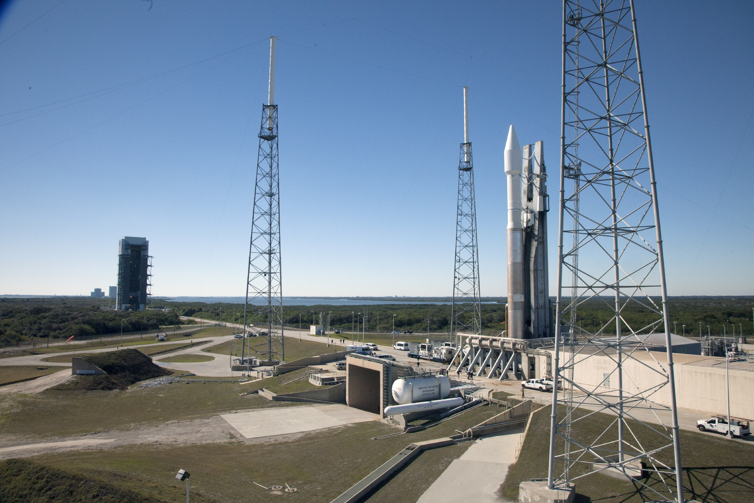
English: At Cape Canaveral Air Force Station's Launch Complex 41, a United Launch Alliance Atlas V with NASA's Tracking and Data Relay Satellite, or TDRS-L, spacecraft atop, arrives at the launch pad. The TDRS-L spacecraft is the second of three new satellites designed to ensure vital operational continuity for NASA by expanding the lifespan of the Tracking and Data Relay Satellite System TDRSS fleet, which consists of eight satellites in geosynchronous orbit. The spacecraft provide tracking, telemetry, command and high bandwidth data return services for numerous science and human exploration missions orbiting Earth. These include NASA's Hubble Space Telescope and the International Space Station. TDRS-L has a high-performance solar panel designed for more spacecraft power to meet the growing S-band communications requirements. TDRSS is one of NASA Space Communication and Navigation’s SCaN three networks providing space communications to NASA’s missions. |
| Date | |
| Source | |
| Author | NASA/Daniel Casper |
| Camera location | | View this and other nearby images on: OpenStreetMap |
|---|
This image or video was catalogued by Kennedy Space Center of the United States National Aeronautics and Space Administration (NASA) under Photo ID: KSC-2014-1152. This tag does not indicate the copyright status of the attached work. A normal copyright tag is still required. See Commons:Licensing. Other languages:
|
Licensing
| This file is in the public domain in the United States because it was solely created by NASA. NASA copyright policy states that "NASA material is not protected by copyright unless noted". (See Template:PD-USGov, NASA copyright policy page or JPL Image Use Policy.) | ||
 |
Warnings:
|
File history
Click on a date/time to view the file as it appeared at that time.
| Date/Time | Thumbnail | Dimensions | User | Comment | |
|---|---|---|---|---|---|
| current | 17:12, 10 February 2014 | | 3,000 × 2,000 (5.14 MB) | Pat Hawks | User created page with UploadWizard |
You must be logged in to post a comment.