


No higher resolution available.
Silbury_Hill_-_geograph.org.uk_-_776.jpg (640 × 484 pixels, file size: 124 KB, MIME type: image/jpeg)
Summary
| Description |
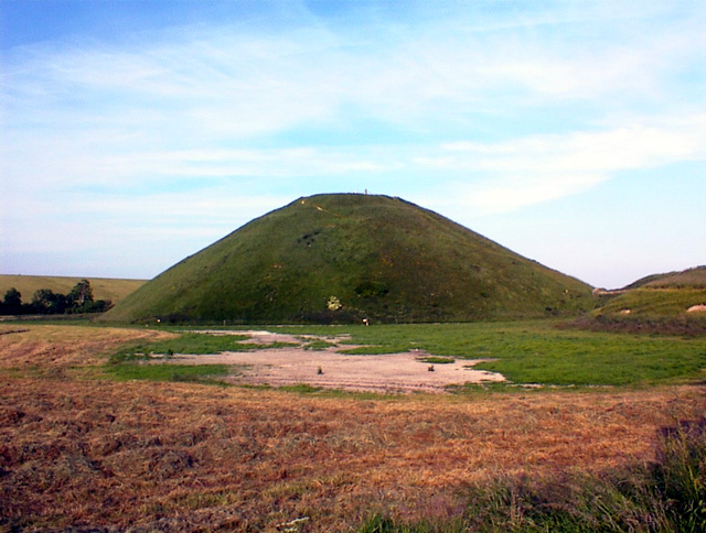
English: Silbury Hill. The largest man-made earthwork in Europe, and no-one knows what it was built for! Sadly dilapidated now, and sorely in need of attention - see http://www.heritageaction.org for details. |
| Date | |
| Source | From geograph.org.uk |
| Author | Alan Simkins |
| Attribution (required by the license) | Alan Simkins / Silbury Hill / |
| Object location | | View this and other nearby images on: OpenStreetMap |
|---|
_&language=en)
Licensing

|
This image was taken from the Geograph project collection. See this photograph's page on the Geograph website for the photographer's contact details. The copyright on this image is owned by Alan Simkins and is licensed for reuse under the Creative Commons Attribution-ShareAlike 2.0 license.
|
This file is licensed under the Creative Commons Attribution-Share Alike 2.0 Generic license.
Attribution: Alan Simkins
- You are free:
- to share – to copy, distribute and transmit the work
- to remix – to adapt the work
- Under the following conditions:
- attribution – You must give appropriate credit, provide a link to the license, and indicate if changes were made. You may do so in any reasonable manner, but not in any way that suggests the licensor endorses you or your use.
- share alike – If you remix, transform, or build upon the material, you must distribute your contributions under the same or compatible license as the original.
File history
Click on a date/time to view the file as it appeared at that time.
| Date/Time | Thumbnail | Dimensions | User | Comment | |
|---|---|---|---|---|---|
| current | 03:35, 30 January 2010 | | 640 × 484 (124 KB) | GeographBot | == {{int:filedesc}} == {{Information |description={{en|1=Silbury Hill. The largest man-made earthwork in Europe, and no-one knows what it was built for! Sadly dilapidated now, and sorely in need of attention - see http://www.heritageaction.org for details |
File usage
The following page uses this file:
You must be logged in to post a comment.