


Original file (1,456 × 1,524 pixels, file size: 779 KB, MIME type: image/jpeg)
| Description |
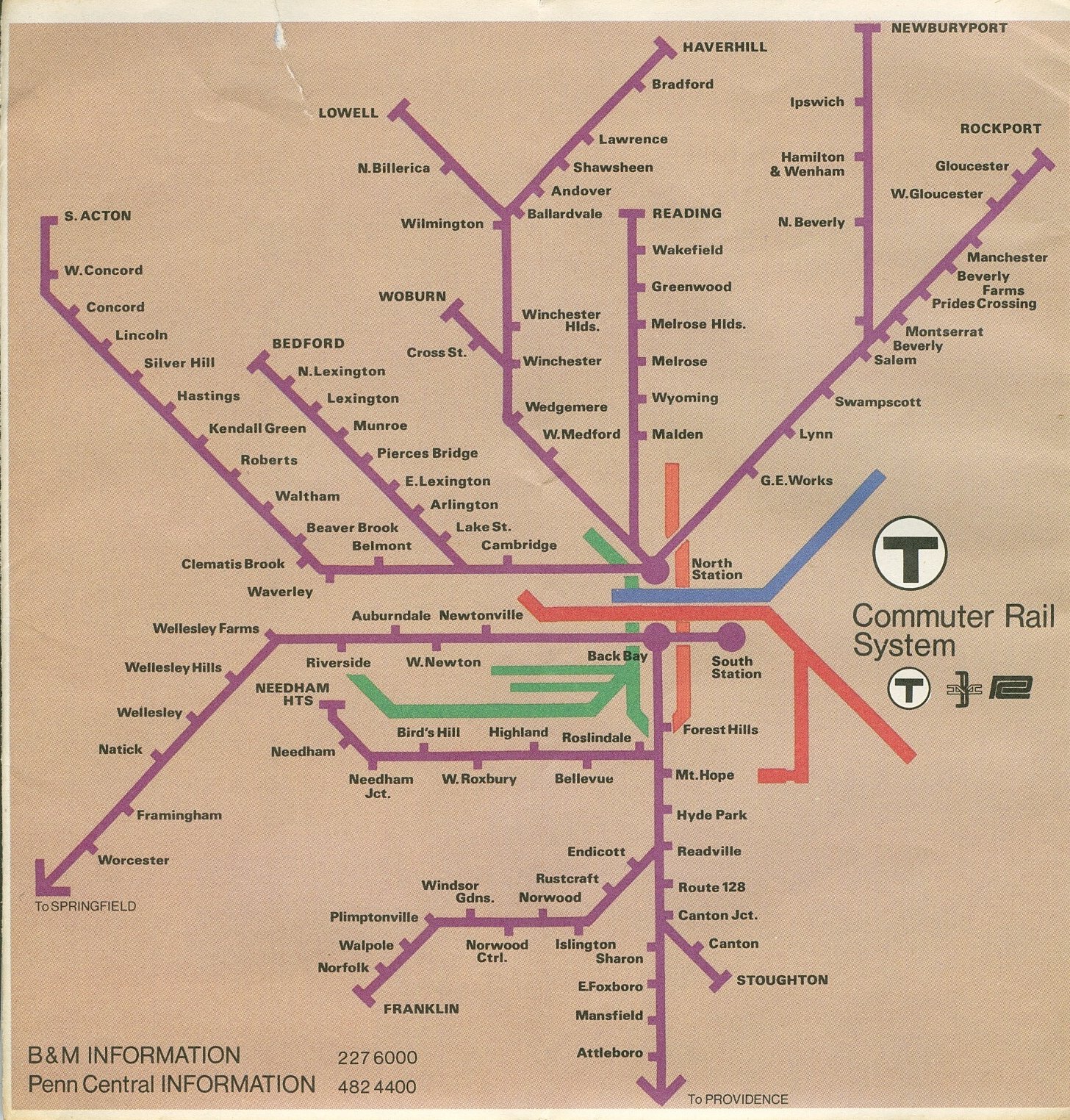
English: Map of MBTA Commuter Rail service in 1975. The map can be dated to between March 1 of that year (when South Acton to Ayer service was discontinued) andNovember (when Ballardvale, Andover, and Shawsheen stations closed). |
|||
| Date | ||||
| Source | Flickr (image direct link) | |||
| Author | Massachusetts Bay Transportation Authority | |||
| Permission (Reusing this file) |
|


File history
Click on a date/time to view the file as it appeared at that time.
| Date/Time | Thumbnail | Dimensions | User | Comment | |
|---|---|---|---|---|---|
| current | 19:41, 29 March 2012 | | 1,456 × 1,524 (779 KB) | Pi.1415926535 | {{Information |Description =Map of MBTA Commuter Rail service in 1975. The map can be dated to between March 1 of that year (when South Acton to Ayer service was discontinued) and October 27 (when Worcester to Framingham service was discontinued). |... |
File usage
The following page uses this file:
Global file usage
The following other wikis use this file:
- Usage on fr.wikipedia.org
You must be logged in to post a comment.