


Size of this preview: 800 × 528 pixels. Other resolutions: 320 × 211 pixels | 640 × 422 pixels | 1,024 × 676 pixels | 1,280 × 844 pixels | 2,560 × 1,689 pixels | 5,289 × 3,489 pixels.
Original file (5,289 × 3,489 pixels, file size: 3.41 MB, MIME type: image/jpeg)
Summary
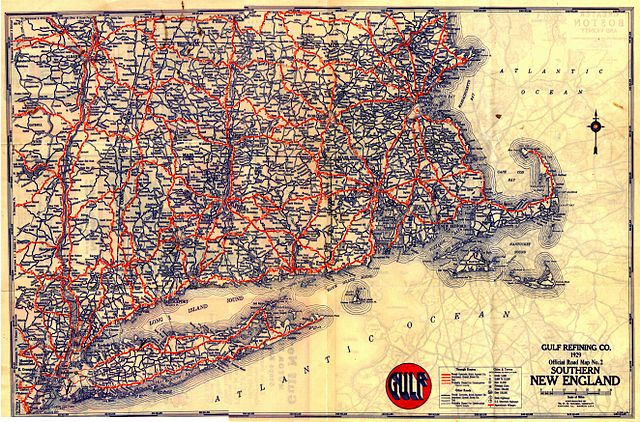
A 1929 road map of New England.
Scanned by Chris Mason, provided by John MacGregor.
Licensing
|
This work is in the public domain in its country of origin and other countries and areas where the copyright term is the author's life plus 70 years or fewer. | |
| This file has been identified as being free of known restrictions under copyright law, including all related and neighboring rights. | |
Anything published in the U.S. before 1964 had to have its copyright renewed; a search of copyright renewal records archive copy at the Wayback Machine for Gousha (the map company) gives nothing in New England.
File history
Click on a date/time to view the file as it appeared at that time.
| Date/Time | Thumbnail | Dimensions | User | Comment | |
|---|---|---|---|---|---|
| current | 04:41, 5 March 2005 | | 5,289 × 3,489 (3.41 MB) | SPUI~commonswiki | {{PD}}A 1929 map of New England. Anything published in the U.S. before 1964 had to be renewed; a search of [http://www.scils.rutgers.edu/~lesk/copyrenew.html] for Gousha (the map company) gives nothing in New England. Scanned by Chris Mason, provided by J |
File usage
The following page uses this file:
Global file usage
The following other wikis use this file:
- Usage on fr.wikipedia.org
- Usage on it.wikiquote.org
- Usage on nl.wikipedia.org
- Usage on pl.wikipedia.org
You must be logged in to post a comment.