


No higher resolution available.
The_Ship_and_Trades_-_geograph.org.uk_-_641952.jpg (640 × 471 pixels, file size: 122 KB, MIME type: image/jpeg)
Summary
| Description |
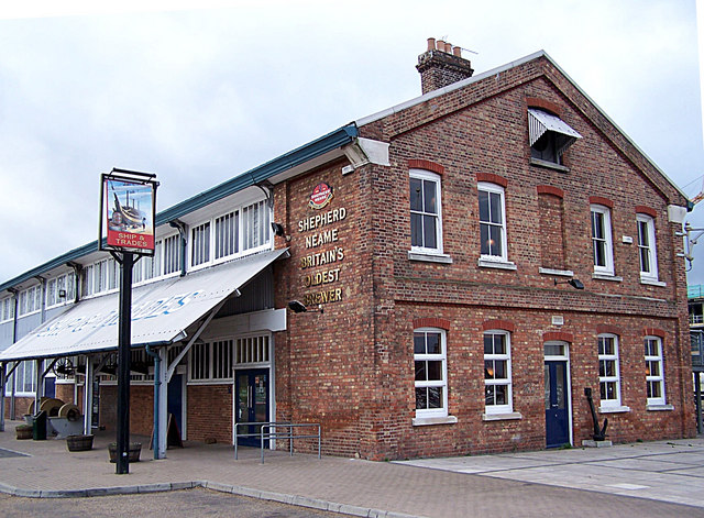
English: The Ship and Trades Dating from 1875, this building is a steel framed structure in Chatham Dockyard that housed dockyard offices and an engineering shop. This end of it has been restored and converted into a styling pub/restaurant. The building now also houses a Co-op convenience store and a Fish Bar. |
| Date | |
| Source | From geograph.org.uk |
| Author | Richard Dorrell |
| Attribution (required by the license) | Richard Dorrell / The Ship and Trades / |
| Camera location | | View this and other nearby images on: OpenStreetMap |
|---|
_heading:225.00&language=en)
| Object location | | View this and other nearby images on: OpenStreetMap |
|---|
_heading:225.00&language=en)
Licensing

|
This image was taken from the Geograph project collection. See this photograph's page on the Geograph website for the photographer's contact details. The copyright on this image is owned by Richard Dorrell and is licensed for reuse under the Creative Commons Attribution-ShareAlike 2.0 license.
|
This file is licensed under the Creative Commons Attribution-Share Alike 2.0 Generic license.
Attribution: Richard Dorrell
- You are free:
- to share – to copy, distribute and transmit the work
- to remix – to adapt the work
- Under the following conditions:
- attribution – You must give appropriate credit, provide a link to the license, and indicate if changes were made. You may do so in any reasonable manner, but not in any way that suggests the licensor endorses you or your use.
- share alike – If you remix, transform, or build upon the material, you must distribute your contributions under the same or compatible license as the original.
File history
Click on a date/time to view the file as it appeared at that time.
| Date/Time | Thumbnail | Dimensions | User | Comment | |
|---|---|---|---|---|---|
| current | 19:52, 11 March 2011 | | 640 × 471 (122 KB) | GeographBot | == {{int:filedesc}} == {{Information |description={{en|1=The Ship and Trades Dating from 1875, this building is a steel framed structure in Chatham Dockyard that housed dockyard offices and an engineering shop. This end of it has been restored and convert |
File usage
The following page uses this file:
Global file usage
The following other wikis use this file:
- Usage on www.wikidata.org
You must be logged in to post a comment.