


Size of this preview: 487 × 600 pixels. Other resolutions: 195 × 240 pixels | 390 × 480 pixels | 624 × 768 pixels | 832 × 1,024 pixels | 2,222 × 2,736 pixels.
Original file (2,222 × 2,736 pixels, file size: 2.36 MB, MIME type: image/jpeg)
Summary
| Description |
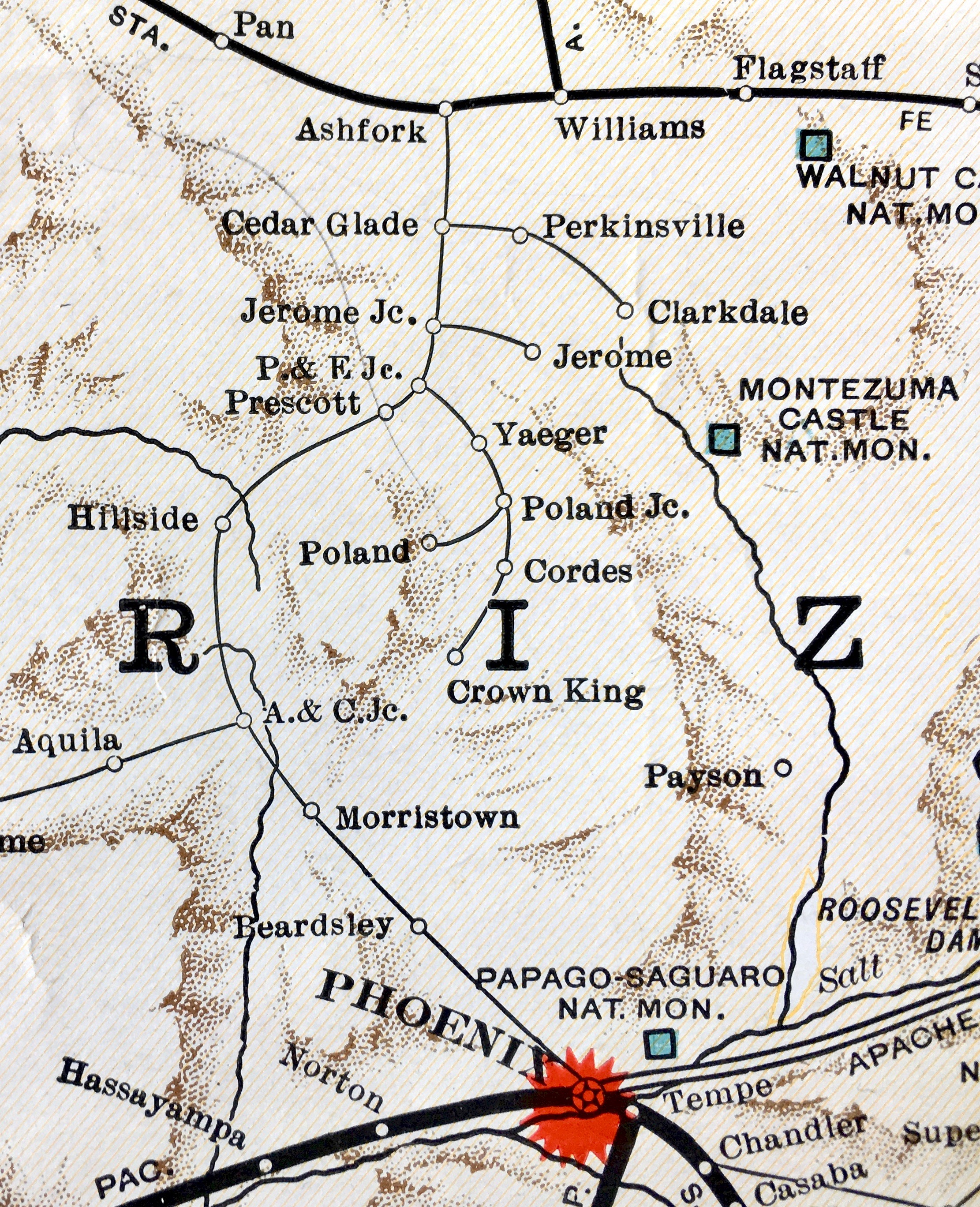
English: Crown King Branch route in 1930 |
| Date | |
| Source | Missouri Pacific Lines map |
| Author | Missouri Pacific Lines |
| Camera location | | View this and other nearby images on: OpenStreetMap |
|---|
Licensing
This work is in the public domain because it was published in the United States between 1930 and 1963, and although there may or may not have been a copyright notice, the copyright was not renewed. For further explanation, see Commons:Hirtle chart and the copyright renewal logs.
|
 |
– published in the United States between 1923 and 1963, with its copyright not renewed.
File history
Click on a date/time to view the file as it appeared at that time.
| Date/Time | Thumbnail | Dimensions | User | Comment | |
|---|---|---|---|---|---|
| current | 02:01, 12 June 2018 | | 2,222 × 2,736 (2.36 MB) | FAHansson | User created page with UploadWizard |
File usage
The following 6 pages use this file:
You must be logged in to post a comment.