


No higher resolution available.
Ga.-20Northern-Arc-routes.jpg (702 × 411 pixels, file size: 68 KB, MIME type: image/jpeg)
Summary
| Description |
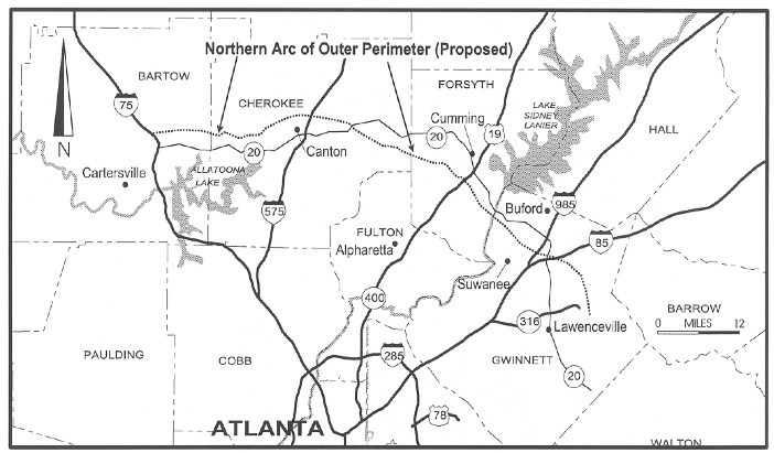
English: State transportation officials want to improve east-west access across the northern fringes of Atlanta. This map shows the proximity of the former Northern Arc to Ga. 20, which is now the subject of discussion for expansion. Credit: Truman Hartshorn study, GSU |
| Date | |
| Source | Own work |
| Author | Amyxagl |
Licensing
I, the copyright holder of this work, hereby publish it under the following license:
This file is licensed under the Creative Commons Attribution-Share Alike 4.0 International license.
- You are free:
- to share – to copy, distribute and transmit the work
- to remix – to adapt the work
- Under the following conditions:
- attribution – You must give appropriate credit, provide a link to the license, and indicate if changes were made. You may do so in any reasonable manner, but not in any way that suggests the licensor endorses you or your use.
- share alike – If you remix, transform, or build upon the material, you must distribute your contributions under the same or compatible license as the original.
File history
Click on a date/time to view the file as it appeared at that time.
| Date/Time | Thumbnail | Dimensions | User | Comment | |
|---|---|---|---|---|---|
| current | 18:08, 3 December 2015 | | 702 × 411 (68 KB) | Amyxagl | Cross-wiki upload from en.wikipedia.org |
File usage
The following page uses this file:
You must be logged in to post a comment.