


Size of this PNG preview of this SVG file: 419 × 599 pixels. Other resolutions: 168 × 240 pixels | 336 × 480 pixels | 537 × 768 pixels | 717 × 1,024 pixels | 1,433 × 2,048 pixels | 534 × 763 pixels.
Original file (SVG file, nominally 534 × 763 pixels, file size: 655 KB)
| Description |
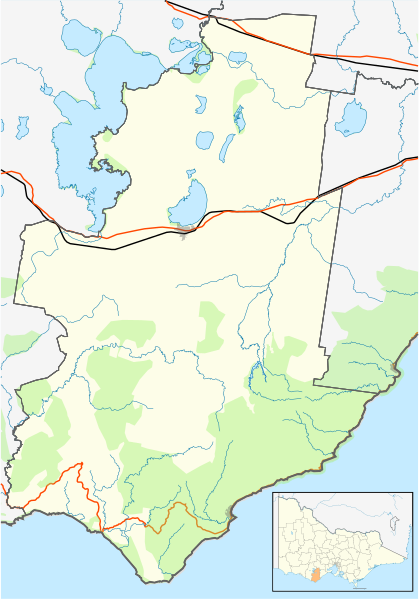
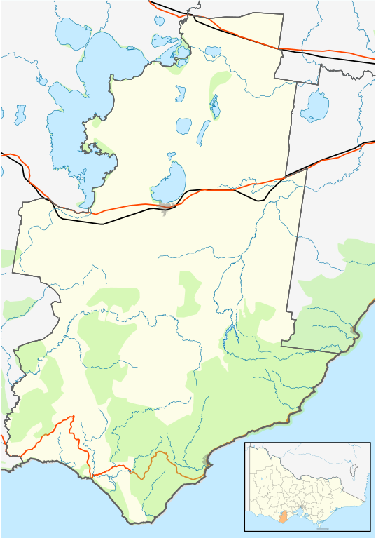
English: Blank map of w:Colac Otway Shire, Victoria, Australia, with the following information shown:
Geographic limits:
|
||
| Source | Own work | ||
| Author | Cassowary |

File history
Click on a date/time to view the file as it appeared at that time.
| Date/Time | Thumbnail | Dimensions | User | Comment | |
|---|---|---|---|---|---|
| current | 12:29, 17 February 2011 | | 534 × 763 (655 KB) | Cassowary | {{Information |Description ={{en|1=Blank map of w:Colac Otway Shire, Victoria, Australia, with the following information shown: * LGA boundaries * Coastline, lakes and rivers * Roads and railways * Urban areas * Parks Geographic limits: * North: |
File usage
The following 49 pages use this file:
- Aire Valley, Victoria
- Alvie, Victoria
- Apollo Bay
- Balintore, Victoria
- Barongarook, Victoria
- Barongarook West, Victoria
- Barwon Downs
- Beeac
- Beech Forest, Victoria
- Birregurra
- Cape Otway
- Colac, Victoria
- Cororooke, Victoria
- Cressy, Victoria
- Elliminyt, Victoria
- Ferguson, Victoria
- Forrest, Victoria
- Gellibrand, Victoria
- Grey River, Victoria
- Irrewarra, Victoria
- Irrewillipe
- Johanna, Victoria
- Kennett River, Victoria
- Larpent, Victoria
- Lavers Hill
- Marengo, Victoria
- Mount Sabine, Victoria
- Ombersley, Victoria
- Pennyroyal, Victoria
- Petticoat Creek, Victoria
- Pirron Yallock, Victoria
- Separation Creek, Victoria
- Shire of Colac Otway
- Simpson, Victoria
- Skenes Creek, Victoria
- Skenes Creek North, Victoria
- Sugarloaf, Victoria
- Swan Marsh
- Tanybryn, Victoria
- Warrion, Victoria
- Winchelsea, Victoria
- Wongarra, Victoria
- Wye River, Victoria
- User:Gerixau/temp2
- User:ThylacineHunter/LGA
- User:Viatori/sandbox
- Template:Towns in Colac Otway Shire
- Module:Location map/data/Australia Victoria Colac Otway Shire
- Module:Location map/data/Australia Victoria Colac Otway Shire/doc
Global file usage
The following other wikis use this file:
- Usage on ar.wikipedia.org
- Usage on ceb.wikipedia.org
- Usage on fa.wikipedia.org
- Usage on kn.wikipedia.org
- Usage on simple.wikipedia.org
- Usage on si.wikipedia.org
- Usage on tr.wikipedia.org
- Usage on uz.wikipedia.org
- Usage on war.wikipedia.org
- Usage on zh.wikipedia.org
You must be logged in to post a comment.