


Oberaurach
Oberaurach | |
|---|---|
 Tretzendorf Castle, today the town hall of Oberaurach | |
 Coat of arms | |
Location of Oberaurach
within Haßberge district 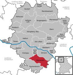 | |
 Location of Oberaurach | |
 Oberaurach  Oberaurach | |
| Coordinates: 49°55′N 10°37′E / 49.917°N 10.617°E | |
| Country | Germany |
| State | Bavaria |
| Admin. region | Unterfranken |
| District | Haßberge |
| Subdivisions | 11 Ortsteile |
| Government | |
| • Mayor (2020–26) | Thomas Sechser[1] (CSU) |
| Area | |
• Total | 45.14 km2 (17.43 sq mi) |
| Elevation | 350 m (1,150 ft) |
| Population (2023-12-31)[2] | |
• Total | 4,046 |
| • Density | 89.63/km2 (232.1/sq mi) |
| Time zone | UTC+01:00 (CET) |
| • Summer (DST) | UTC+02:00 (CEST) |
| Postal codes | 97514 |
| Dialling codes | 09529 |
| Vehicle registration | HAS |
| Website | www.oberaurach.de |
Oberaurach is a municipality in the district of Haßberge in Bavaria in Germany.
There are 11 quarters belonging to Oberaurach:[3]
- Dankenfeld
- Fatschenbrunn
- Kirchaich and Nützelsbach
- Neuschleichach
- Oberschleichach
- Tretzendorf
- Trossenfurt and Hummelmarter
- Unterschleichach
History
Some quarters have been mentioned as early as 741 and 753.
The municipality in its present form has been created in 1978, combining the then separate municipalities of Dankenfeld, Fatschenbrunn, Kirchaich, Neuschleichach, Oberschleichach, Tretzendorf, Trossenfurt and Unterschleichach. The name Oberaurach is an artificial word, describing the location of the municipality at the upper ("Ober") part of the river Aurach.
References
- ^ Liste der ersten Bürgermeister/Oberbürgermeister in kreisangehörigen Gemeinden, Bayerisches Landesamt für Statistik, 15 July 2021.
- ^ "Alle politisch selbständigen Gemeinden mit ausgewählten Merkmalen am 31.12.2023" (in German). Federal Statistical Office of Germany. 28 October 2024. Retrieved 16 November 2024.
- ^ "Gemeinde Oberaurach". BayernPortal des Bayerischen Staatsministerium für Digitales. Retrieved 2021-03-21.
Towns and municipalities in Haßberge (district) | ||
|---|---|---|
 | ||
| International | |
|---|---|
| Geographic | |