


Gloster, Louisiana
Gloster, Louisiana | |
|---|---|
_10.jpg) Rosneath house in Gloster. | |
 Location in De Soto Parish and the state of Louisiana. | |
| Coordinates: 32°11′31″N 93°48′41″W / 32.19194°N 93.81139°W[1] | |
| Country | |
| State | |
| Parish | DeSoto |
| Area | |
• Total | 1.27 sq mi (3.30 km2) |
| • Land | 1.26 sq mi (3.26 km2) |
| • Water | 0.012 sq mi (0.03 km2) |
| Elevation | 240 ft (73 m) |
| Population (2020) | |
• Total | 53 |
| • Density | 42.1/sq mi (16.24/km2) |
| Time zone | UTC-6 (Central (CST)) |
| • Summer (DST) | UTC-5 (CDT) |
| ZIP code | 71030 |
| FIPS code | 22-29395 |
| GNIS feature ID | 2586683[1] |
Gloster is an unincorporated community and census-designated place (CDP) in DeSoto Parish, Louisiana, United States. As of the 2020 census, Gloster had a population of 53.[3]
Gloster is located 1.5 miles (2.4 km) east of U.S. Route 171, 17 miles (27 km) north of Mansfield, the DeSoto Parish seat, and 30 miles (48 km) south of Shreveport.
It is the nearest community to three places listed on the U.S. National Register of Historic Places:
Demographics
| Census | Pop. | Note | %± |
|---|---|---|---|
| 2010 | 94 | — | |
| 2020 | 53 | −43.6% | |
| U.S. Decennial Census[4] | |||
Gloster was first listed as a census designated place in the 2010 U.S. census.[5]
References
- ^ a b c U.S. Geological Survey Geographic Names Information System: Gloster, Louisiana
- ^ "2020 U.S. Gazetteer Files". United States Census Bureau. Retrieved March 20, 2022.
- ^ "2020 Decennial Census Redistricting Data (Public Law 94-171)". United States Census Bureau. 2021. Retrieved March 11, 2026.
- ^ "Census of Population and Housing". Census.gov. Retrieved June 4, 2016.
- ^ "2010 Census of Population - Population and Housing Unit Counts - Louisiana" (PDF). United States Census Bureau. Archived from the original (PDF) on April 2, 2024.
Municipalities and communities of DeSoto Parish, Louisiana, United States | ||
|---|---|---|
| City | 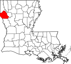 | |
| Towns | ||
| Villages | ||
| CDPs | ||
| Other unincorporated communities | ||