


Size of this preview: 450 × 600 pixels. Other resolutions: 180 × 240 pixels | 480 × 640 pixels.
Original file (480 × 640 pixels, file size: 150 KB, MIME type: image/jpeg)
Summary
| Description |
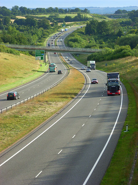
English: Showing the Newbury Bypass as it crosses the Lambourn valley. The nearer bridge carries a public footpath just east of Bagnor. The more distant one is at the A4 junction at Speen. |
| Date | |
| Source | From geograph.org.uk |
| Author | Andrew Smith |
| Attribution (required by the license) | Andrew Smith / The A34, Donnington / |
| Camera location | | View this and other nearby images on: OpenStreetMap |
|---|
Licensing

|
This image was taken from the Geograph project collection. See this photograph's page on the Geograph website for the photographer's contact details. The copyright on this image is owned by Andrew Smith and is licensed for reuse under the Creative Commons Attribution-ShareAlike 2.0 license.
|
This file is licensed under the Creative Commons Attribution-Share Alike 2.0 Generic license.
Attribution: Andrew Smith
- You are free:
- to share – to copy, distribute and transmit the work
- to remix – to adapt the work
- Under the following conditions:
- attribution – You must give appropriate credit, provide a link to the license, and indicate if changes were made. You may do so in any reasonable manner, but not in any way that suggests the licensor endorses you or your use.
- share alike – If you remix, transform, or build upon the material, you must distribute your contributions under the same or compatible license as the original.
File history
Click on a date/time to view the file as it appeared at that time.
| Date/Time | Thumbnail | Dimensions | User | Comment | |
|---|---|---|---|---|---|
| current | 03:36, 25 January 2011 | | 480 × 640 (150 KB) | BaldBoris | == {{int:filedesc}} == {{Information |description={{en|1=Showing the Newbury Bypass as it crosses the Lambourn valley. The nearer bridge carries a public footpath just east of Bagnor. The more distant one is at the A4 junction at Speen.}} |date=2008-08-21 |
File usage
The following 4 pages use this file:
Global file usage
The following other wikis use this file:
- Usage on de.wikipedia.org
- Usage on nl.wikipedia.org
- Usage on www.wikidata.org
You must be logged in to post a comment.