


Size of this preview: 800 × 533 pixels. Other resolutions: 320 × 213 pixels | 640 × 427 pixels | 1,024 × 683 pixels | 1,280 × 853 pixels | 2,560 × 1,707 pixels | 4,629 × 3,086 pixels.
Original file (4,629 × 3,086 pixels, file size: 10.8 MB, MIME type: image/jpeg)
Summary
| Description |
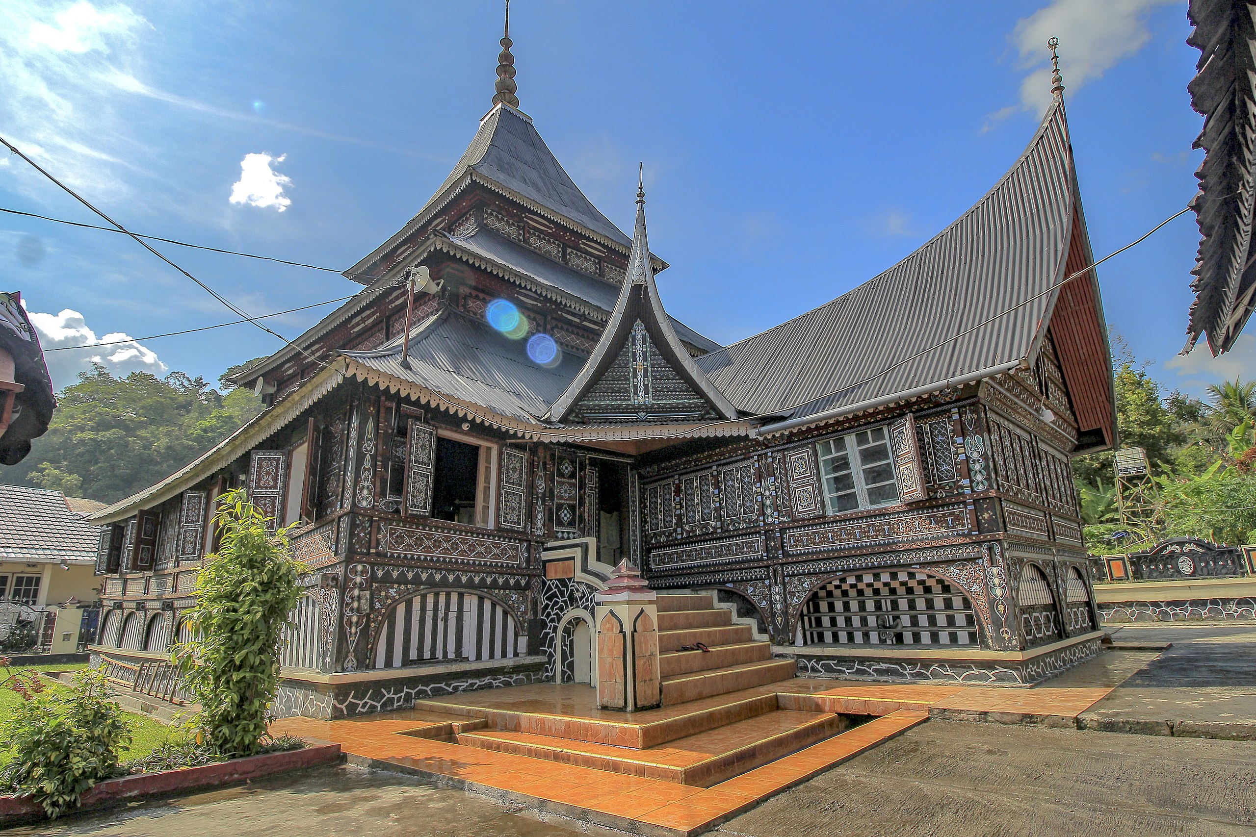
Bahasa Indonesia: Mesjid ini dibangun pada tahun 1702, yang di prakarsai oleh masyarakat dari 4 koto yaitu dari daerah Gunuang, Paninjauan, Jaho dan Tambangan. Masjid ini adalah mesjid tertua di Kota Padang Panjang, Arsitektur masjid ini menerapkan konsep arsitektur tradisional Minangkabau. yang terlihat dari bentuk atap dan ukiran dinding masjid. Sedangkan, kubahnya sebagai ciri sebuah masjid, berbentuk atap limas bertingkat tiga, sebagai perlambang bahwa Nagari Gunung dikuasai oleh 3 unsur, yaitu unsur agama, unsur adat, dan unsur pemerintah. |
| Date | |
| Source | Own work |
| Author | Riski Donheri |
| Camera location | | View this and other nearby images on: OpenStreetMap |
|---|
Licensing
I, the copyright holder of this work, hereby publish it under the following license:
This file is licensed under the Creative Commons Attribution-Share Alike 4.0 International license.
- You are free:
- to share – to copy, distribute and transmit the work
- to remix – to adapt the work
- Under the following conditions:
- attribution – You must give appropriate credit, provide a link to the license, and indicate if changes were made. You may do so in any reasonable manner, but not in any way that suggests the licensor endorses you or your use.
- share alike – If you remix, transform, or build upon the material, you must distribute your contributions under the same or compatible license as the original.

|
This photo was uploaded to Wikimedia Commons as part of a photography contest WikiKaleidoskop
organized by Wikimedia Indonesia with the support of the Wikimedia Foundation. |
File history
Click on a date/time to view the file as it appeared at that time.
| Date/Time | Thumbnail | Dimensions | User | Comment | |
|---|---|---|---|---|---|
| current | 03:27, 25 October 2021 | | 4,629 × 3,086 (10.8 MB) | Riski Donheri | Uploaded own work with UploadWizard |
File usage
The following page uses this file:
You must be logged in to post a comment.