


File:Greg 1999 rainfall.gif

Size of this preview: 800 × 551 pixels. Other resolutions: 320 × 220 pixels | 640 × 440 pixels | 1,024 × 705 pixels | 1,257 × 865 pixels.
Original file (1,257 × 865 pixels, file size: 52 KB, MIME type: image/gif)
Summary
| Description |
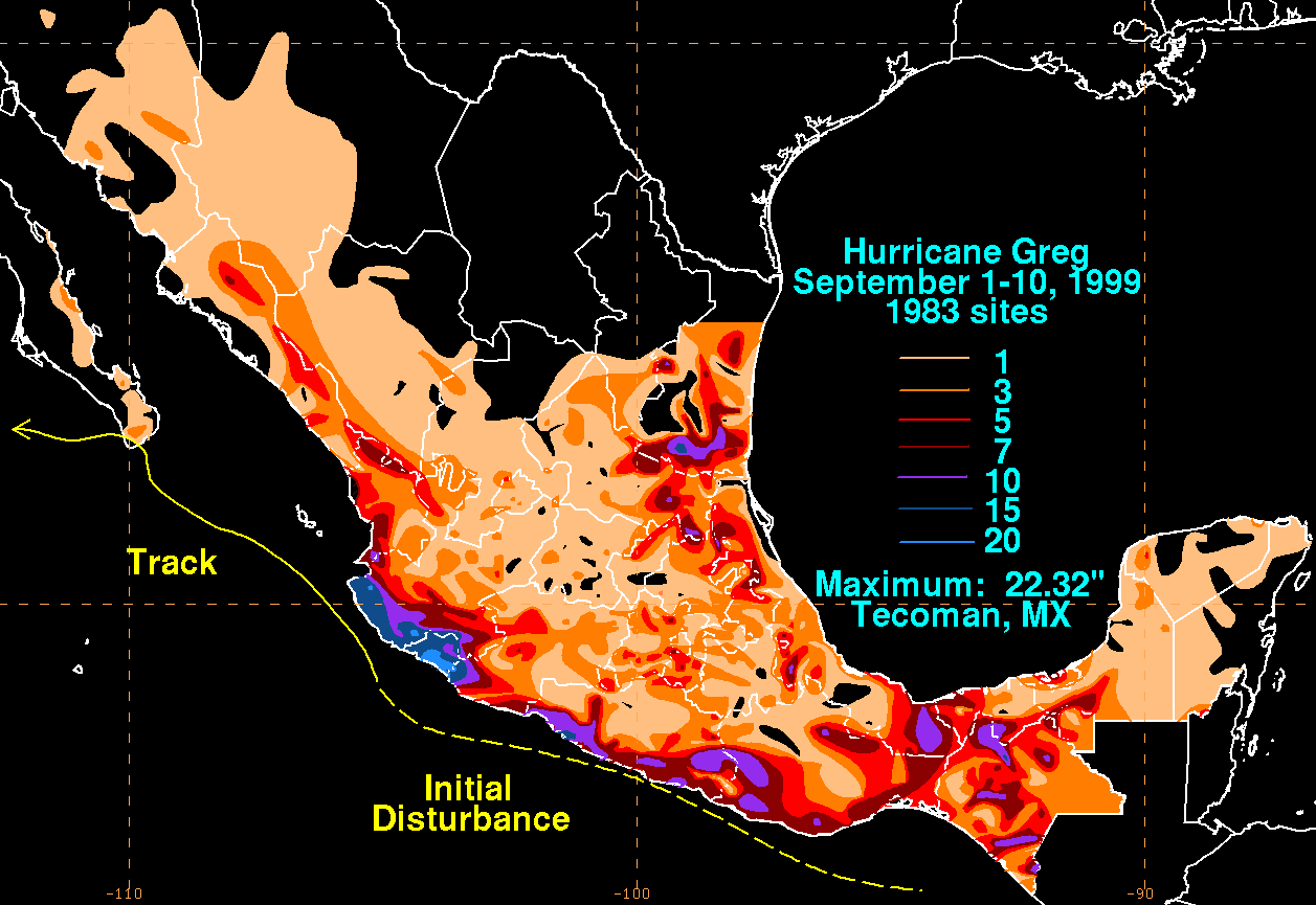
English: Storm total rainfall map of Hurricane Greg during September 1999. |
|||
| Date | ||||
| Source | WPC tropical cyclone rainfall data | |||
| Author | David Roth, Weather Prediction Center, Camp Springs, Maryland | |||
| Permission (Reusing this file) |
|
File history
Click on a date/time to view the file as it appeared at that time.
| Date/Time | Thumbnail | Dimensions | User | Comment | |
|---|---|---|---|---|---|
| current | 03:31, 9 January 2008 | | 1,257 × 865 (52 KB) | Miss Madeline~commonswiki | {{Information |Description=A map of the rainfall from 1999's Hurricane Greg |Source=[http://www.hpc.ncep.noaa.gov/tropical/rain/greg1999.html Hydrometeorological Prediction Center page on Hurricane Greg (1999)], more specifically [http://www.hpc.ncep.noaa |
File usage
The following page uses this file: