


File:Dumbarton Rock, the Magazine - geograph.org.uk - 1381466.jpg
Summary
| Description |
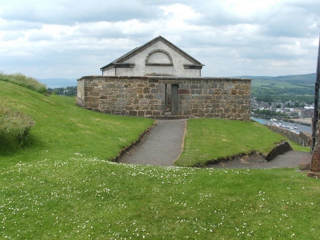
English: Dumbarton Rock: the Magazine [This is one of a linked series of articles about Dumbarton Rock. See the end of 1380091 for a list of the reference works that are cited here in abbreviated form.]
This powder magazine was built in 1748; it could hold 150 barrels of gunpowder. It replaced an earlier magazine that stood against a nearby section of the curtain wall of the castle [OSG07, p5]. (The site of the earlier building is shown in the next article in this series.) The building is surrounded by a blast wall; an information panel located on the inside of that wall shows a plan of the building, and describes the care that was taken to prevent accidental ignition of the gunpowder; for example, to reduce the risk of sparks, those entering the magazine had to exchange their hobnailed boots for wooden clogs. On the night of May 5-6, 1941, this building received a direct hit from a high-explosive bomb, one of four that hit the Rock, although they were presumably intended for the nearby Blackburn aircraft factory or for Denny's shipyards. The north-east corner of the outer wall of the magazine was demolished by the blast (fortunately, the building had long ago ceased to be used in its original role) [MacPhail, p165-6]. Previous: 1381450. Next: 1381489. |
| Date | |
| Source | From geograph.org.uk |
| Author | Lairich Rig |
| Attribution (required by the license) | Lairich Rig / Dumbarton Rock: the Magazine / |
| Camera location | | View this and other nearby images on: OpenStreetMap |
|---|
_heading:292.00&language=en)
| Object location | | View this and other nearby images on: OpenStreetMap |
|---|
_heading:292.00&language=en)
Licensing

|
This image was taken from the Geograph project collection. See this photograph's page on the Geograph website for the photographer's contact details. The copyright on this image is owned by Lairich Rig and is licensed for reuse under the Creative Commons Attribution-ShareAlike 2.0 license.
|
- You are free:
- to share – to copy, distribute and transmit the work
- to remix – to adapt the work
- Under the following conditions:
- attribution – You must give appropriate credit, provide a link to the license, and indicate if changes were made. You may do so in any reasonable manner, but not in any way that suggests the licensor endorses you or your use.
- share alike – If you remix, transform, or build upon the material, you must distribute your contributions under the same or compatible license as the original.
File history
Click on a date/time to view the file as it appeared at that time.
| Date/Time | Thumbnail | Dimensions | User | Comment | |
|---|---|---|---|---|---|
| current | 18:14, 28 February 2011 | | 640 × 480 (82 KB) | GeographBot | == {{int:filedesc}} == {{Information |description={{en|1=Dumbarton Rock: the Magazine [This is one of a linked series of articles about Dumbarton Rock. See the end of http://www.geograph.org.uk/photo/1380091 for a list of the reference works that are cite |
File usage
The following page uses this file: